Berezanka
Berezanka
Березанка | |
|---|---|
Urban-type settlement | |
 Flag  Coat of arms | |
 Berezanka | |
| Coordinates: 46°51′18″N 31°23′15″E / 46.85500°N 31.38750°ECoordinates: 46°51′18″N 31°23′15″E / 46.85500°N 31.38750°E | |
| Country | Ukraine |
| Oblast | Mykolaiv Oblast |
| Raion | Berezanka Raion |
| Population (2021)[1] | |
| • Total | 4,063 |
| Time zone | UTC+2 (EET) |
| • Summer (DST) | UTC+3 (EEST) |

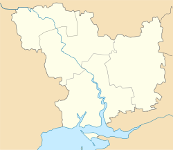
Berezanka (Ukrainian: Березанка, Russian: Береза́нка) is an urban-type settlement in the south of Mykolaiv Oblast, Ukraine. It serves as the administrative center of Berezanka Raion. Population: 4,063 (2021 est.)[1]
Berezanka is located on the banks of the , a tributary of the Black Sea.
History[]
The settlement was founded in 1866 by German settlers as Alexanderfeld. It belonged to Odessky Uyezd of Kherson Governorate and was the administrative center of . In 1914, after the start of World War I, it was renamed Suvorovo, to commemorate Alexander Suvorov, in a wave of eliminating German names.[2] On 16 April 1920, Odessa Governorate split off, and Odessky Uyezd was moved to Odessa Governorate. In 1923, uyezds in Ukrainian Soviet Socialist Republic were abolished, and the governorates were divided into okruhas. In 1923, Suvorovo was renamed Tylihulo-Berezanka, and in 1966 Berezanka.[2][3]
In 1923, Tylihulo-Berezanka became part of Anatolivka Raion of , with the administrative center in . In the same year, the center of the raion was moved to Tylihulo-Berezanka, and later raion was renamed Tylihulo-Berezanka.[3] In 1925, the governorates were abolished, and okruhas were directly subordinated to Ukrainian SSR. In 1926, Tylihulo-Berezanka was renamed Berezanka.[2] In 1930, okruhas were abolished, and on 27 February 1932, Odessa Oblast was established, and Tylihulo-Berezanka Raion was included into Odessa Oblast. On 22 September 1937, Mykolaiv Oblast split off Odessa Oblast, and Tylihulo-Berezanka Raion became part of newly created Mykolaiv Oblast. In January 1963, during the abortive Khrushchyov administrative reform, Tylihulo-Berezanka Raion was abolished, and Berezanka was included into Mykolaiv Raion. In 1966, Berezanka Raion was re-established in the area previously occupied by Tylihulo-Berezanka Raion.[4] Simultaneously, Berezanka was granted urban-type settlement status.[5]
Economy[]
Transportation[]
The M14 highway, which connects Odessa and Mykolaiv, runs immediately south of Berezanka. This stretch of the highway coincides with the European route E58.
References[]
- ^ a b "Чисельність наявного населення України (Actual population of Ukraine)" (PDF) (in Ukrainian). State Statistics Service of Ukraine. Retrieved 11 July 2021.
- ^ a b c Дизендорф, В.Ф. (2011). Немцы России, населённые пункты и места поселения: Энциклопедический словарь (in Russian). Moscow: ЭРН. p. 24.
- ^ a b "История района" (in Russian). Berezanka Deanery. Retrieved 5 March 2016.
- ^ "Районы Николаевской области" (in Russian). Николаевская область. Электронная историческая энциклопедия. Retrieved 6 March 2016.
- ^ Украинская ССР - Административно-территориальное деление на 1 января 1979 года. Kiev: Ukrainian Soviet Encyclopedia. 1979.
| Authority control: National libraries |
|---|
- Urban-type settlements in Mykolaiv Oblast
- Yelisavetgradsky Uyezd