Bereznehuvate
Bereznehuvate
Березнегувате | |
|---|---|
Urban-type settlement | |
 Bereznehuvate | |
| Coordinates: 47°18′41″N 32°50′52″E / 47.31139°N 32.84778°ECoordinates: 47°18′41″N 32°50′52″E / 47.31139°N 32.84778°E | |
| Country | Ukraine |
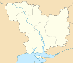
| Oblast | Mykolaiv Oblast |
| Raion | Bereznehuvate Raion |
| Population (2021)[1] | |
| • Total | 7,364 |
| Time zone | UTC+2 (EET) |
| • Summer (DST) | UTC+3 (EEST) |

Bereznehuvate (Ukrainian: Березнегувате, Russian: Березнегова́тое) is an urban-type settlement in the east of Mykolaiv Oblast, Ukraine. It serves as the administrative center of Bereznehuvate Raion. Population: 7,364 (2021 est.)[1]
The settlement is located on the right bank of the Vysun, a right tributary of the Inhulets, in the basin of the Dnieper.[2]
History[]
Bereznehuvate was founded in the 1780s by Zaporozhian Cossacks. It is first mentioned in 1787 and was used as a place to banish and resettle people from central Ukrainian lands. In 1820, Bereznehuvate became a military settlement subordinate to the Black Sea Navy.[2] Administratively, it belonged to Khersonsky Uyezd, which belonged to different governorates of the Russian Empire: Yekaterinoslav Viceroyalty until 1795, until 1796, Novorossiya Governorate until 1803, Kherson Governorate until 1920, Nikolayev Governorate until 1921, and Odessa Governorate until 1923, when uyezds were abolished in the Ukrainian Soviet Socialist Republic, and governorates were divided into okruhas. In 1923, Bereznehuvate Raion of , with the administrative center in Bereznehuvate, was established.[3] In 1925, the governorates were abolished, and okruhas were directly subordinated to Ukrainian SSR. In 1930, okruhas were abolished. In 1935, Bereznehuvate Raion was transferred into Odessa Oblast.[4] On 22 September 1937, Mykolaiv Oblast was established on lands which previously belonged to Dnipropetrovsk and Odessa Oblasts, and Bereznehuvate Raion became part of newly created Mykolaiv Oblast.[5]
In March and April 1944, Bereznegovatoye–Snigirevka Offensive, a part of major Dnieper–Carpathian Offensive of the Soviet army during the last phase of World War II, took place around Bereznehuvate. In 1956, Bereznehuvate was granted urban-type settlement status.[6]
Economy[]
Transportation[]
, on the railway connecting Snihurivka and Apostolove, is approximately 12 kilometres (7.5 mi) southeast of Bereznehuvate.[6]
References[]
- ^ a b "Чисельність наявного населення України (Actual population of Ukraine)" (PDF) (in Ukrainian). State Statistics Service of Ukraine. Retrieved 11 July 2021.
- ^ a b "Березнеговатое в XVIII-XX веках: история Николаевщины" (in Russian). Николаевские Известия. 12 December 2015. Retrieved 5 March 2016.
- ^ Вся Одещина. Odessa: . 1926. p. 410.
- ^ "Становление и развитие" (in Russian). Одесские известия. Archived from the original on 13 March 2016. Retrieved 12 March 2016.
- ^ "Районы Николаевской области" (in Russian). Николаевская область. Электронная историческая энциклопедия. Retrieved 6 March 2016.
- ^ a b Украинская ССР - Административно-территориальное деление на 1 января 1979 года. Kiev: Ukrainian Soviet Encyclopedia. 1979.
| Authority control: National libraries |
|---|
- Urban-type settlements in Mykolaiv Oblast
- Khersonsky Uyezd
- Former Jewish agricultural colonies of Kherson Governorate