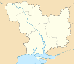
Yelanets
Yelanets
Єланець | |
|---|---|
Urban-type settlement | |
 Yelanets | |
| Coordinates: 47°41′45″N 31°51′14″E / 47.69583°N 31.85389°ECoordinates: 47°41′45″N 31°51′14″E / 47.69583°N 31.85389°E | |
| Country | Ukraine |
| Oblast | Mykolaiv Oblast |
| Raion | Yelanets Raion |
| Population (2021)[1] | |
| • Total | 4,711 |
| Time zone | UTC+2 (EET) |
| • Summer (DST) | UTC+3 (EEST) |
Yelanets (Ukrainian: Єланець, Russian: Ела́нец) is an urban-type settlement in the north of Mykolaiv Oblast, Ukraine. It serves as the administrative center of Yelanets Raion. Population: 4,711 (2021 est.)[1]
The settlement is located at the left bank of the , a right tributary of the Southern Bug.
History[]
Yelanets was founded in the 1800s as Hnylyi Yelanets. In 1810, it was renamed Novomoskovsk, and in 1818 has become a military settlement which belonged to Yelisavetgradsky Uyezd of Kherson Governorate. In 1828, Yelisavetgradsky Uyezd was merged with into . In 1857, military settlements were abolished. In 1858, Novomoskovsk was renamed Yelanets. In 1865, the administrative center of Bobrinetsky Uyezd was moved to Yelisavetgrad, and the uyezd was renamed Yelisavetgradsky. Yelanets was a selo and the center of of Yelisavetgradsky Uyezd.[2]
On 16 April 1920, Kherson Governorate was renamed Nikolayev Governorate, and on 21 October 1922, it was merged into Odessa Governorate. In 1923, uyezds were abolished, and Yelanets was included in the newly established Voznesensk Raion of .[2] In 1925, the governorates were abolished, and okruhas were directly subordinated to Ukrainian Soviet Socialist Republic. In 1926, Yelanets Raion of Mykolaiv Okruha, with the administrative center in Yelanets, was established.[2] In 1930, okruhas were abolished. In 1935, Yelanets Raion was transferred to Odessa Oblast.[3] On 22 September 1937, Mykolaiv Oblast was established on lands which previously belonged to Dnipropetrovsk and Odessa Oblasts, and Yelanets Raion has become a part of newly created Mykolaiv Oblast. In 1968, Yelanets was granted an urban-type settlement status.[4]
Economy[]
Transportation[]
The closest railway station is in Voznesensk, 45 kilometres (28 mi) west of the settlement.[5]
References[]
- ^ a b "Чисельність наявного населення України (Actual population of Ukraine)" (PDF) (in Ukrainian). State Statistics Service of Ukraine. Retrieved 11 July 2021.
- ^ a b c "Еланецкий район" (in Russian). Информация о городах и селах Украины. Retrieved 12 March 2016.
- ^ "Становление и развитие" (in Russian). Одесские известия. Retrieved 12 March 2016.
- ^ "Районы Николаевской области" (in Russian). Николаевская область. Электронная историческая энциклопедия. Retrieved 6 March 2016.
- ^ Украинская ССР - Административно-территориальное деление на 1 января 1979 года. Kiev: Ukrainian Soviet Encyclopedia. 1979.
- Urban-type settlements in Mykolaiv Oblast
- Yelisavetgradsky Uyezd
