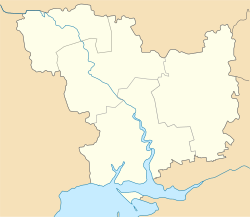
Pervomaiske, Mykolaiv Oblast
Pervomaiske
Первомайське | |
|---|---|
Urban-type settlement | |
 Pervomaiske | |
| Coordinates: 47°2′36″N 32°26′10″E / 47.04333°N 32.43611°ECoordinates: 47°2′36″N 32°26′10″E / 47.04333°N 32.43611°E | |
| Country | Ukraine |
| Oblast | Mykolaiv Oblast |
| Raion | Vitovka Raion |
| Population (2021)[1] | |
| • Total | 2,698 |
| Time zone | UTC+2 (EET) |
| • Summer (DST) | UTC+3 (EEST) |
Pervomaiske (Ukrainian: Первомайське, Russian: Первомайское) is an urban-type settlement in Vitovka Raion in the southeast of Mykolaiv Oblast, Ukraine. Population: 2,698 (2021 est.)[1]
The settlement is located on the right bank of the Bilozerka River. The passes just south of the settlement.
History[]
The settlement was founded in the beginning of the 20th century as the selo of Zasillia to serve the railway station of the same name.
In 1939, Mykolaiv Rural Raion (sometimes referred to as Mykolaiv Raion) was established in Mykolaiv Oblast with the center in the city of Mykolaiv.[2] On 12 September 1944, Mykolaiv Raion was renamed Zhovtneve Raion, and the administrative center of the raion was transferred from Mykolaiv to the town of .[3] In 1965, Pervomaiske was given urban-type settlement status.[4] On 19 May 2016, Zhovtneve Raion was renamed Vitovka Raion conform to the law prohibiting names of Communist origin.[5]
Economy[]
Transportation[]
The closest railway station is in , 2 kilometres (1.2 mi) southwest of the settlement, on the railway line connecting Mykolaiv and Snihurivka.[4]
References[]
- ^ a b "Чисельність наявного населення України (Actual population of Ukraine)" (PDF) (in Ukrainian). State Statistics Service of Ukraine. Retrieved 11 July 2021.
- ^ "Районы Николаевской области" (in Russian). Николаевская область. Электронная историческая энциклопедия. Retrieved 10 March 2016.
- ^ "Николаевская область" (in Russian). Николаевская область. Электронная историческая энциклопедия. Retrieved 10 March 2016.
- ^ a b Украинская ССР - Административно-территориальное деление на 1 января 1979 года. Kiev: Ukrainian Soviet Encyclopedia. 1979.
- ^ "На Николаевщине Жовтневый район переименовали в Витовский" (in Russian). Николаевские новости. 19 May 2016. Retrieved 20 May 2016.
- Urban-type settlements in Mykolaiv Oblast
