Bladen County, North Carolina
Bladen County | |
|---|---|
U.S. county | |
 Bladen County Courthouse, Elizabethtown | |
 Seal | |
 Location within the U.S. state of North Carolina | |
 North Carolina's location within the U.S. | |
| Coordinates: 34°37′N 78°34′W / 34.62°N 78.56°W | |
| Country | |
| State | |
| Founded | 1739 |
| Named for | Martin Bladen |
| Seat | Elizabethtown |
| Largest town | Elizabethtown |
| Area | |
| • Total | 887 sq mi (2,300 km2) |
| • Land | 874 sq mi (2,260 km2) |
| • Water | 13 sq mi (30 km2) 1.4% |
| Population | |
| • Estimate (2018) | 33,190 |
| • Density | 40/sq mi (20/km2) |
| Time zone | UTC−5 (Eastern) |
| • Summer (DST) | UTC−4 (EDT) |
| Congressional districts | 7th, 9th |
| Website | www |

Bladen County (/ˈbleɪdən/)[1] is a county located in the U.S. state of North Carolina. As of the 2010 Census, the population was 35,190.[2] Its county seat is Elizabethtown.[3] The county was created in 1734 as Bladen Precinct and gained county status in 1739.[4]
History[]
Bladen County was formed in 1734 as Bladen Precinct of Bath County, from New Hanover Precinct.[5] It was named for Martin Bladen, a member of the Board of Trade.[6] With the abolition of Bath County in 1739, all of its constituent precincts became counties.
Bladen's original residents included the Waccamaw people.[7][5]
Bladen County began as a vast territory, with indefinite northern and western boundaries. Reductions in its extent began in 1750, when its western part became Anson County. In 1752 the northern part of Bladen County was combined with parts of Granville County and Johnston County to form Orange County. In 1754 the northern part of what was left of Bladen County became Cumberland County. In 1764 the southern part of what remained of Bladen County was combined with part of New Hanover County to form Brunswick County. In 1787 the western part of the now much smaller county became Robeson County. Finally, in 1808 the southern part of Bladen County was combined with part of Brunswick County to form Columbus County. Bladen County is considered the "mother county" of North Carolina because of the 100 counties in North Carolina, 55 of them at one point belonged to Bladen County. It is also the fourth largest county in North Carolina.
Geography[]
According to the U.S. Census Bureau, the county has a total area of 887 square miles (2,300 km2), of which 874 square miles (2,260 km2) is land and 13 square miles (34 km2) (1.4%) is water.[8] It is the fourth-largest county in North Carolina by land area.
Adjacent counties[]
- Cumberland County - north
- Sampson County - northeast
- Pender County - east
- Columbus County - south
- Robeson County - west
Major highways[]
Demographics[]
| Historical population | |||
|---|---|---|---|
| Census | Pop. | %± | |
| 1790 | 5,100 | — | |
| 1800 | 7,028 | 37.8% | |
| 1810 | 5,671 | −19.3% | |
| 1820 | 7,276 | 28.3% | |
| 1830 | 7,811 | 7.4% | |
| 1840 | 8,022 | 2.7% | |
| 1850 | 9,767 | 21.8% | |
| 1860 | 11,995 | 22.8% | |
| 1870 | 12,831 | 7.0% | |
| 1880 | 16,158 | 25.9% | |
| 1890 | 16,763 | 3.7% | |
| 1900 | 17,677 | 5.5% | |
| 1910 | 18,006 | 1.9% | |
| 1920 | 19,761 | 9.7% | |
| 1930 | 22,389 | 13.3% | |
| 1940 | 27,156 | 21.3% | |
| 1950 | 29,703 | 9.4% | |
| 1960 | 28,881 | −2.8% | |
| 1970 | 26,477 | −8.3% | |
| 1980 | 30,491 | 15.2% | |
| 1990 | 28,663 | −6.0% | |
| 2000 | 32,278 | 12.6% | |
| 2010 | 35,190 | 9.0% | |
| 2018 (est.) | 33,190 | [9] | −5.7% |
| U.S. Decennial Census[10] 1790-1960[11] 1900-1990[12] 1990-2000[13] 2010-2013[2] | |||
As of the census[14] of 2000, there were 32,278 people, 12,897 households, and 8,937 families residing in the county. The population density was 37 people per square mile (14/km2). There were 15,316 housing units at an average density of 18 per square mile (7/km2). The racial makeup of the county was 57.22% White, 37.91% Black or African American, 2.04% Native American, 0.10% Asian, 0.04% Pacific Islander, 1.97% from other races, and 0.73% from two or more races. 3.71% of the population were Hispanic or Latino of any race.
By 2005 55.8% of the population of Bladen County was non-Hispanic whites. 36.8% of the population was African-American. 5.0% of the population of was Latino. 2.3% of the population was Native American.
There were 12,897 households, out of which 30.40% had children under the age of 18 living with them, 48.90% were married couples living together, 15.70% had a female householder with no husband present, and 30.70% were non-families. 27.70% of all households were made up of individuals, and 11.50% had someone living alone who was 65 years of age or older. The average household size was 2.45 and the average family size was 2.97.
In the county, the population was spread out, with 24.60% under the age of 18, 8.70% from 18 to 24, 27.20% from 25 to 44, 25.20% from 45 to 64, and 14.20% who were 65 years of age or older. The median age was 38 years. For every 100 females there were 92.60 males. For every 100 females age 18 and over, there were 88.70 males.
The median income for a household in the county was $26,877, and the median income for a family was $33,974. Males had a median income of $27,799 versus $21,973 for females. The per capita income for the county was $14,735. About 16.60% of families and 21.00% of the population were below the poverty line, including 28.70% of those under age 18 and 24.20% of those age 65 or over.
Law and government[]
Bladen County is a member of the regional .
Following the 2018 United States Midterm Elections, an investigation was opened into accusations of an absentee ballot fraud scheme directed by McCrae Dowless in Bladen County, within North Carolina's 9th Congressional District. Accusations were based around the Republican Primary election, in which Mark Harris defeated incumbent Robert Pittenger, and around the general election, in which Harris initially appeared to defeat Democrat Dan McCready. As of December 2018, the investigation is currently ongoing.[15][16] Wake County District Attorney Lorrin Freeman, Democrat, said it was possible over 1,000 ballots had been destroyed.[17] According to District Attorney Jon David, Republican, the county has a "troubled history of political groups exploiting the use of absentee ballots."[18]
Communities[]

Towns[]
- Bladenboro
- Clarkton
- Dublin
- East Arcadia
- Elizabethtown (county seat)
- Tar Heel
- White Lake
Census-designated places[]
Unincorporated communities[]
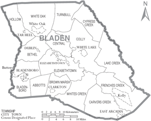
Townships[]
- Abbottsburg
- Bethel
- Bladenboro
- Brown Marsh
- Carvers Creek
- Central
- Clarkton
- Colly
- Cypress Creek
- Elizabethtown
- East Arcadia
- Frenches Creek
- Hollow
- Lake Creek
- Tarheel
- Turnbull
- White Oak
- Dublin
- Whites Creek
Population ranking[]
The population ranking of the following table is based on the 2010 census of Bladen County.[20]
† county seat
| Rank | City/Town/etc. | Municipal type | Population (2010 Census) |
|---|---|---|---|
| 1 | † Elizabethtown | Town | 3,583 |
| 2 | Bladenboro | Town | 1,750 |
| 3 | Clarkton | Town | 837 |
| 4 | White Lake | Town | 802 |
| 5 | Kelly | CDP | 544 |
| 6 | East Arcadia | Town | 487 |
| t-7 | Dublin | Town | 338 |
| t-7 | White Oak | CDP | 338 |
| 8 | Butters | CDP | 294 |
| 9 | Tar Heel | Town | 117 |
Other notable information[]
Bladen County is also the home of the oldest documented Taxodium distichum (bald cypress) at 1622 years old.[21]
Smithfield Foods, which is an anchor employer for Bladen County and two nearby counties, employed about 5,000 people in 2018.[22]
See also[]
References[]
- ^ Talk Like A Tarheel Archived 2013-06-22 at the Wayback Machine, from the North Carolina Collection's website at the University of North Carolina at Chapel Hill. Retrieved 2013-02-08.
- ^ Jump up to: a b "State & County QuickFacts". United States Census Bureau. Archived from the original on July 7, 2011. Retrieved October 17, 2013.
- ^ "Find a County". National Association of Counties. Archived from the original on 2011-05-31. Retrieved 2011-06-07.
- ^ "North Carolina: Individual County Chronologies". North Carolina Atlas of Historical County Boundaries. The Newberry Library. 2009. Archived from the original on March 4, 2016. Retrieved January 20, 2015.
- ^ Jump up to: a b Jason, Bordeaux (2010). "Bladen County in the 1700s". NCpedia. Retrieved 2018-07-17.
- ^ Proffitt, Martie (Apr 17, 1983). "Local history offers tasty tidbits". Star-News. pp. 1C. Retrieved 1 November 2015.
- ^ Martin, Jonathan (2016). "Bladen County (1734)". North Carolina History Project. Retrieved 2018-07-17.
- ^ "2010 Census Gazetteer Files". United States Census Bureau. August 22, 2012. Archived from the original on January 12, 2015. Retrieved January 12, 2015.
- ^ "Population and Housing Unit Estimates". Retrieved July 22, 2019.
- ^ "U.S. Decennial Census". United States Census Bureau. Retrieved January 12, 2015.
- ^ "Historical Census Browser". University of Virginia Library. Retrieved January 12, 2015.
- ^ Forstall, Richard L., ed. (March 27, 1995). "Population of Counties by Decennial Census: 1900 to 1990". United States Census Bureau. Retrieved January 12, 2015.
- ^ "Census 2000 PHC-T-4. Ranking Tables for Counties: 1990 and 2000" (PDF). United States Census Bureau. April 2, 2001. Retrieved January 12, 2015.
- ^ "U.S. Census website". United States Census Bureau. Retrieved 2008-01-31.
- ^ Morrill, Jim (November 29, 2018). "'Tangled web' in Bladen County has questions swirling about votes in the 9th District". The Charlotte Observer. Charlotte, North Carolina. Retrieved November 30, 2018.
- ^ Gardner, Amy; Ross, Kirk (November 29, 2018). "Certification in limbo in N.C. House race as fraud investigation continues". The Washington Post. Washington, D.C. Retrieved November 30, 2018.
- ^ Casiano, Louis (6 December 2018). "Over 1,000 ballots may have been destroyed in NC congressional race, DA says". Fox News. Retrieved 6 December 2018.
- ^ Henderson, Bruce; Doran, Will (December 7, 2018). "In 2 NC counties with 'rough politics,' election fraud claims are nothing new". The Charlotte Observer. Retrieved December 9, 2018.
- ^ Leip, David. "Dave Leip's Atlas of U.S. Presidential Elections". uselectionatlas.org. Retrieved 2018-03-14.
- ^ "2010 U.S. Census website". United States Census Bureau. Retrieved 2016-02-13.
- ^ "Oldest Taxodium disticum". Eastern OLDLIST. Rocky Mountain Tree-Ring Research, Inc. & Eastern Kentucky University. Retrieved 3 November 2013.
- ^ Tracy, Kailey (July 12, 2018). "Trump's trade war with China could affect local jobs". WECT, Channel 6. Retrieved 2018-07-17.
External links[]
- Official website
- Bladen Journal, Google news archive. —PDFs of 2,696 issues, dating from 1929 to 1985.
| show Places adjacent to Bladen County, North Carolina |
|---|
| show Municipalities and communities of Bladen County, North Carolina, United States |
|---|


Coordinates: 34°37′N 78°34′W / 34.62°N 78.56°W
| show Authority control |
|---|
- North Carolina counties
- Bladen County, North Carolina
- 1739 establishments in North Carolina
- Populated places established in 1739