Burakin, Western Australia
| Burakin Western Australia | |
|---|---|
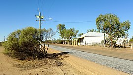 Dowerin-Kalannie Road, Burakin, 2014 | |
 Burakin | |
| Coordinates | 30°31′26″S 117°10′23″E / 30.524°S 117.173°ECoordinates: 30°31′26″S 117°10′23″E / 30.524°S 117.173°E |
| Established | 1928 |
| Postcode(s) | 6467 |
| Elevation | 359 m (1,178 ft) |
| Location | |
| LGA(s) | Shire of Wongan-Ballidu |
| State electorate(s) | Moore |
| Federal division(s) | Durack |

Burakin is a small town near Kalannie in the eastern Wheatbelt region of Western Australia.
The townsite was gazetted in 1928. The name is an Aboriginal word of unknown meaning, and was suggested by the Wongan Hills Road Board in 1927. The original spelling was to have been Borrikin.[1]
Burakin is the junction for the branch railway line to Bonnie Rock. The line was completed on 27 April 1931, but services beyond Beacon were withdrawn from late 1997.[2]
In 2000 and 2001 Burakin was the epicentre of a series of earthquakes now known as the Burakin Swarm – a significant series of seismographic events that are considered important in understanding the South West Seismic Zone.[3]
References[]
- ^ "History of country town names – B". Western Australian Land Information Authority. Retrieved 8 June 2007.
- ^ Rails through the Wodjil Milne, Rod Australian Railway Historical Society Bulletin, January, 1999 pp3-9
- ^ "UWA Seismic Events in WA – Burakin Swarm". 2005. Archived from the original on 11 July 2008. Retrieved 20 April 2011.
External links[]
![]() Media related to Burakin, Western Australia at Wikimedia Commons
Media related to Burakin, Western Australia at Wikimedia Commons
This article about a location in Western Australia is a stub. You can help Wikipedia by . |
- Towns in Western Australia
- Wheatbelt (Western Australia)
- Western Australia geography stubs