Watheroo, Western Australia
| Watheroo Western Australia | |
|---|---|
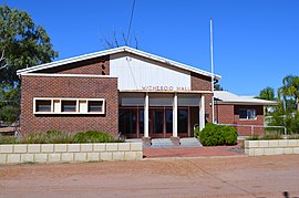 Watheroo Hall, 2013. | |
 Watheroo | |
| Coordinates | 30°17′52.4702″S 116°03′31.4046″E / 30.297908389°S 116.058723500°ECoordinates: 30°17′52.4702″S 116°03′31.4046″E / 30.297908389°S 116.058723500°E |
| Population | 181 (2016 census)[1] |
| Established | 1907 |
| Postcode(s) | 6513 |
| Elevation | 263 m (863 ft) |
| Location |
|
| LGA(s) | Shire of Moora |
| State electorate(s) | Moore |
| Federal Division(s) | Durack |

Watheroo is a small town in the Wheatbelt region of Western Australia. There are 181 residents, according to the 2016 census.
History[]
Land in the area was settled by James Oliver in 1851, the area was surveyed in 1871 and the name Watheroo was charted for the first time. Watheroo is a thriving farming Wheatbelt town, farming livestock and grain. The town was an original station on the Midland Railway Company railway line to Walkaway. The townsite was gazetted in 1907.[2]
Railway[]
Following flooding along the Moore River in 1907, the railway lines between Watheroo and Moora were closed for some time when parts of the track were washed away.[3] Rail services were again affected in 1917 when 1.7 inches (43 mm) of rain fell in three hours causing more flooding, washways and the railyard in town to be submerged.[4]
Etymology[]
The name is Indigenous Australian in origin and was the name of a nearby spring. The word Watheroo is derived from the word wardo which means little bird or more specifically the willy wagtail or from the word wardoro which means water.[5]
Climate[]
| hideClimate data for Watheroo (1918-1959) | |||||||||||||
|---|---|---|---|---|---|---|---|---|---|---|---|---|---|
| Month | Jan | Feb | Mar | Apr | May | Jun | Jul | Aug | Sep | Oct | Nov | Dec | Year |
| Average high °C (°F) | 33.9 (93.0) |
33.8 (92.8) |
31.0 (87.8) |
26.5 (79.7) |
21.3 (70.3) |
18.1 (64.6) |
17.2 (63.0) |
18.3 (64.9) |
21.1 (70.0) |
23.7 (74.7) |
28.1 (82.6) |
31.5 (88.7) |
25.4 (77.7) |
| Average low °C (°F) | 15.9 (60.6) |
16.3 (61.3) |
14.8 (58.6) |
11.4 (52.5) |
8.0 (46.4) |
6.2 (43.2) |
5.0 (41.0) |
5.4 (41.7) |
6.5 (43.7) |
8.0 (46.4) |
11.2 (52.2) |
13.8 (56.8) |
10.2 (50.4) |
| Average precipitation mm (inches) | 9.4 (0.37) |
16.9 (0.67) |
22.1 (0.87) |
23.4 (0.92) |
58.8 (2.31) |
84.6 (3.33) |
78.4 (3.09) |
54.6 (2.15) |
30.1 (1.19) |
20.8 (0.82) |
9.4 (0.37) |
9.3 (0.37) |
417.2 (16.43) |
| Source: [6] | |||||||||||||
References[]
- ^ Australian Bureau of Statistics (27 June 2017). "Watheroo (State Suburb)". 2016 Census QuickStats. Retrieved 22 December 2019.

- ^ Western Australian Land Information Authority. "History of country town names – W". Retrieved 17 October 2008.
- ^ "A town under water". The Advertiser. Adelaide: National Library of Australia. 3 August 1907. p. 10. Retrieved 8 April 2013.
- ^ "The Midland Line". The West Australian. Perth: National Library of Australia. 6 August 1917. p. 6. Retrieved 8 April 2013.
- ^ "Shire of Moora – Watheroo". 2006. Archived from the original on 19 July 2008. Retrieved 17 October 2008.
- ^ "Climate statistics for Watheroo". Bureau of Meteorology. Retrieved 13 July 2014.
External links[]
![]() Media related to Watheroo, Western Australia at Wikimedia Commons
Media related to Watheroo, Western Australia at Wikimedia Commons
| Authority control |
|
|---|
- Towns in Western Australia
- Wheatbelt (Western Australia)
- Grain receival points of Western Australia