Doodlakine, Western Australia
| Doodlakine Western Australia | |
|---|---|
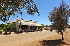 Doodlakine Store, 2014 | |
 Doodlakine | |
| Coordinates | 31°37′S 117°53′E / 31.61°S 117.88°ECoordinates: 31°37′S 117°53′E / 31.61°S 117.88°E |
| Population | 75 (2016 census)[1] |
| Established | 1891 |
| Postcode(s) | 6411 |
| Elevation | 263 m (863 ft) |
| Location |
|
| LGA(s) | Shire of Kellerberrin |
| State electorate(s) | Central Wheatbelt |
| Federal division(s) | Durack |

Doodlakine is a town 220 km (140 mi) east of Perth, Western Australia. It is within the Shire of Kellerberrin along the Great Eastern Highway. The town has a crossing loop for trains on the Perth-to-Kalgoorlie railway and serves as a stop on the MerredinLink rural train service.
History[]
The area was first visited by Europeans in 1864 when explorers came and charted the area. The word Doodlakine is Aboriginal word for a particular rock formation north of the townsite.
An area close to the townsite, along the road to the Yilgarn goldfields and near a reliable water supply, was set aside in 1891 for a town to be established. This was gazetted as the Doodlakine townsite in the same year. Later a railway line was constructed through the area about 3 km (1.9 mi) south of the town, and the government soon subdivided area along the line. This area was gazetted as a second part of the townsite in 1899.[2]
In 1932 the Wheat Pool of Western Australia announced that the town would have two grain elevators, each fitted with an engine, installed at the railway siding.[3]
The town overflows with people each year during a music concert held at the pub. Hundreds of people come from around the state and camp behind the pub.[4]
Doodlakine is affectionately known by the locals as "Doodlie".[5]
Economy[]
The surrounding areas produce wheat and other cereal crops. The town is a receival site for Cooperative Bulk Handling.[6]
Rail services[]
Transwa's MerredinLink and Prospector services stop at Doodlakine, at least one service each day.[7][8]
| Preceding station | Following station | |||
|---|---|---|---|---|
| Kellerberrin towards East Perth
|
MerredinLink | Hines Hill towards Merredin
| ||
| Prospector | Hines Hill towards Kalgoorlie
| |||
References[]
- ^ Australian Bureau of Statistics (27 June 2017). "Doodlakine (State Suburb)". 2016 Census QuickStats. Retrieved 28 June 2021.

- ^ "History of country town names – D". Western Australian Land Information Authority. Retrieved 26 September 2008.
- ^ "Country elevators". The West Australian. Perth: National Library of Australia. 6 July 1932. p. 10. Retrieved 6 April 2013.
- ^ "Wheatbelt Tourism – Doodlakine". 2005. Archived from the original on 22 July 2008. Retrieved 26 September 2008.
- ^ Hough, Frank. "Inaugural Speech: Hon Frank Hough, MLC" (PDF). Parliament of Western Australia. Retrieved 13 April 2015.
- ^ "CBH receival sites" (PDF). 2011. Archived from the original (PDF) on 18 March 2012. Retrieved 1 April 2013.
- ^ "AvonLink and MerredinLink Timetable" (PDF). Transwa. Public Transport Authority. Archived (PDF) from the original on 13 March 2020. Retrieved 28 June 2020.
- ^ "Prospector Timetable" (PDF). Transwa. Public Transport Authority. Archived (PDF) from the original on 18 June 2020. Retrieved 28 June 2020.
External links[]
![]() Media related to Doodlakine, Western Australia at Wikimedia Commons
Media related to Doodlakine, Western Australia at Wikimedia Commons
- Towns in Western Australia
- Wheatbelt (Western Australia)
- Grain receival points of Western Australia