Burton Road tram stop
Burton Road | |||||||||||||||||||||||||||||||||||||||||||||||||||||||||||||||||||||||||||||||||||||||||||||||||||||||||||||||||||||||||||||||||||||||||||||
|---|---|---|---|---|---|---|---|---|---|---|---|---|---|---|---|---|---|---|---|---|---|---|---|---|---|---|---|---|---|---|---|---|---|---|---|---|---|---|---|---|---|---|---|---|---|---|---|---|---|---|---|---|---|---|---|---|---|---|---|---|---|---|---|---|---|---|---|---|---|---|---|---|---|---|---|---|---|---|---|---|---|---|---|---|---|---|---|---|---|---|---|---|---|---|---|---|---|---|---|---|---|---|---|---|---|---|---|---|---|---|---|---|---|---|---|---|---|---|---|---|---|---|---|---|---|---|---|---|---|---|---|---|---|---|---|---|---|---|---|---|---|
| Metrolink station | |||||||||||||||||||||||||||||||||||||||||||||||||||||||||||||||||||||||||||||||||||||||||||||||||||||||||||||||||||||||||||||||||||||||||||||
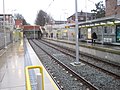
 Burton Road Metrolink station, looking towards Withington | |||||||||||||||||||||||||||||||||||||||||||||||||||||||||||||||||||||||||||||||||||||||||||||||||||||||||||||||||||||||||||||||||||||||||||||
| Location | Withington, Manchester England | ||||||||||||||||||||||||||||||||||||||||||||||||||||||||||||||||||||||||||||||||||||||||||||||||||||||||||||||||||||||||||||||||||||||||||||
| Coordinates | 53°25′43″N 2°14′24″W / 53.4286°N 2.240°WCoordinates: 53°25′43″N 2°14′24″W / 53.4286°N 2.240°W | ||||||||||||||||||||||||||||||||||||||||||||||||||||||||||||||||||||||||||||||||||||||||||||||||||||||||||||||||||||||||||||||||||||||||||||
| Grid reference | SJ840924 | ||||||||||||||||||||||||||||||||||||||||||||||||||||||||||||||||||||||||||||||||||||||||||||||||||||||||||||||||||||||||||||||||||||||||||||
| Line(s) | South Manchester Line | ||||||||||||||||||||||||||||||||||||||||||||||||||||||||||||||||||||||||||||||||||||||||||||||||||||||||||||||||||||||||||||||||||||||||||||
| Platforms | 2 | ||||||||||||||||||||||||||||||||||||||||||||||||||||||||||||||||||||||||||||||||||||||||||||||||||||||||||||||||||||||||||||||||||||||||||||
| Other information | |||||||||||||||||||||||||||||||||||||||||||||||||||||||||||||||||||||||||||||||||||||||||||||||||||||||||||||||||||||||||||||||||||||||||||||
| Status | In operation | ||||||||||||||||||||||||||||||||||||||||||||||||||||||||||||||||||||||||||||||||||||||||||||||||||||||||||||||||||||||||||||||||||||||||||||
| Fare zone | 3 | ||||||||||||||||||||||||||||||||||||||||||||||||||||||||||||||||||||||||||||||||||||||||||||||||||||||||||||||||||||||||||||||||||||||||||||
| History | |||||||||||||||||||||||||||||||||||||||||||||||||||||||||||||||||||||||||||||||||||||||||||||||||||||||||||||||||||||||||||||||||||||||||||||
| Opened | 23 May 2013[1] | ||||||||||||||||||||||||||||||||||||||||||||||||||||||||||||||||||||||||||||||||||||||||||||||||||||||||||||||||||||||||||||||||||||||||||||
| |||||||||||||||||||||||||||||||||||||||||||||||||||||||||||||||||||||||||||||||||||||||||||||||||||||||||||||||||||||||||||||||||||||||||||||
| Location | |||||||||||||||||||||||||||||||||||||||||||||||||||||||||||||||||||||||||||||||||||||||||||||||||||||||||||||||||||||||||||||||||||||||||||||
 Burton Road Location within Manchester_Metrolink | |||||||||||||||||||||||||||||||||||||||||||||||||||||||||||||||||||||||||||||||||||||||||||||||||||||||||||||||||||||||||||||||||||||||||||||

Burton Road is a stop on the South Manchester Line (SML) of Greater Manchester's light rail Metrolink system, on Burton Road in West Didsbury, Manchester, England. The stop was built as part of Phase 3b of the network's expansion and opened on 23 May 2013 on a section of the former Midland Railway.[1][2][3] It is the closest stop to Withington Community Hospital.
Service pattern[]
- 12 minute service to Shaw and Crompton with double trams in the peak
- 12 minute service to Rochdale Town Centre with double trams in the peak
- 6 minute service to East Didsbury with double trams in the peak
History[]
In 1880 the Midland Railway opened the new Manchester South District line which ran from Heaton Mersey to Throstle Nest Junction, Old Trafford.[4] The line north of Chorlton Junction (with the Manchester, Sheffield and Lincolnshire Railway's line to Fallowfield) was later operated by the Cheshire Lines Committee from 1891 when the Fallowfield line opened.[5] Under British Rail operation, the line closed in 1967 as part of the Beeching Axe.
Plans to re-open the line for light rail use have been proposed since the early 1980s,[6] but these proposals failed several times due to problems securing funding.[7] Revised plans put forward in 2006 only allowed for the line to be opened as far as St Werburgh's Road in Chorlton.[8]
In 2009, following the failure of the Greater Manchester Transport Innovation Fund, revised transport funding was announced by the Government which would facilitate a major expansion of the Metrolink network, including the re-opening of the former Midland line and stations as far as East Didsbury.[3][9]
Gallery[]
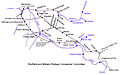
Midland Railway lines in Manchester

The station, on its opening day
The station, looking towards West Didsbury


References[]
- ^ a b "Early doors for East Didsbury's new Metrolink line". Transport for Greater Manchester. Archived from the original on 20 July 2015. Retrieved 14 May 2013.
- ^ Linton, Deborah (13 May 2009). "£1.4bn transport deal unveiled". Manchester Evening News. Retrieved 17 May 2009.
- ^ a b "Metrolink: back on track?". BBC Manchester. 13 May 2009. Retrieved 17 May 2009.
- ^ J. Gough. The Midland Railway - A Chronology. Railway and Canal Historical Society, 1989, p. 198.
- ^ Gough,Midland Railway, p.198.
- ^ Greater Manchester Passenger Transport Executive (1984), Light Rapid Transit in Greater Manchester, GMPTE - publicity brochure
- ^ "Government scraps trams extension". BBC News. 20 July 2004. Retrieved 28 December 2008.
- ^ "Metrolink - the little Bang?". BBC Manchester. 7 July 2006. Archived from the original on 21 June 2010. Retrieved 28 December 2008.
- ^ "Tram line extension is approved". BBC News. 13 May 2009. Retrieved 17 May 2009.
External links[]
- https://web.archive.org/web/20130226053951/http://www.lrta.org/Manchester/city_south.html
- Metrolink Future Network - map of the planned extensions (GMPTE, 2009)
- Metrolink stop information
- Burton Road area map
- Burton Road Metrolink station plans
- Last tram times for Burton Road stop
| Tram stops |   | ||||||||
|---|---|---|---|---|---|---|---|---|---|
| Operations |
| ||||||||
| History (Timeline) |
| ||||||||
| Proposed developments |
| ||||||||
| |||||||||
This article on a railway station in Greater Manchester is a stub. You can help Wikipedia by . |
This United Kingdom rapid transit article is a stub. You can help Wikipedia by . |
- Tram stops in Manchester
- Railway stations in Great Britain opened in 2013
- Tram stops on the East Didsbury to Rochdale line
- Greater Manchester railway station stubs
- United Kingdom rapid transit stubs