Cachen
Cachen | |
|---|---|
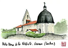 Watercolor of the church in Cachen | |
show Location of Cachen | |
 Cachen | |
| Coordinates: 44°04′15″N 0°25′43″W / 44.0708°N 0.4286°WCoordinates: 44°04′15″N 0°25′43″W / 44.0708°N 0.4286°W | |
| Country | France |
| Region | Nouvelle-Aquitaine |
| Department | Landes |
| Arrondissement | Mont-de-Marsan |
| Canton | Haute Lande Armagnac |
| Government | |
| • Mayor (2020–2026) | Marie-Rose Langlade[1] |
| Area 1 | 35.66 km2 (13.77 sq mi) |
| Population (Jan. 2018)[2] | 227 |
| • Density | 6.4/km2 (16/sq mi) |
| Time zone | UTC+01:00 (CET) |
| • Summer (DST) | UTC+02:00 (CEST) |
| INSEE/Postal code | 40058 /40120 |
| Elevation | 62–114 m (203–374 ft) (avg. 88 m or 289 ft) |
| 1 French Land Register data, which excludes lakes, ponds, glaciers > 1 km2 (0.386 sq mi or 247 acres) and river estuaries. | |


Cachen is a commune in the Landes department in Nouvelle-Aquitaine in southwestern France.
Population[]
|
|
See also[]
References[]
- ^ "Répertoire national des élus: les maires". data.gouv.fr, Plateforme ouverte des données publiques françaises (in French). 2 December 2020.
- ^ "Populations légales 2018". INSEE. 28 December 2020.
| Wikimedia Commons has media related to Cachen. |
This Landes geographical article is a stub. You can help Wikipedia by . |
Categories:
- Communes of Landes (department)
- Landes (department) geography stubs