Cagnotte
Cagnotte | |
|---|---|
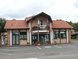 Town hall | |
show Location of Cagnotte | |
 Cagnotte | |
| Coordinates: 43°35′47″N 1°04′00″W / 43.5964°N 1.0667°WCoordinates: 43°35′47″N 1°04′00″W / 43.5964°N 1.0667°W | |
| Country | France |
| Region | Nouvelle-Aquitaine |
| Department | Landes |
| Arrondissement | Dax |
| Canton | Orthe et Arrigans |
| Government | |
| • Mayor (2020–2026) | Robert Bachere[1] |
| Area 1 | 14.68 km2 (5.67 sq mi) |
| Population (Jan. 2018)[2] | 762 |
| • Density | 52/km2 (130/sq mi) |
| Time zone | UTC+01:00 (CET) |
| • Summer (DST) | UTC+02:00 (CEST) |
| INSEE/Postal code | 40059 /40300 |
| Elevation | 12–135 m (39–443 ft) (avg. 44 m or 144 ft) |
| 1 French Land Register data, which excludes lakes, ponds, glaciers > 1 km2 (0.386 sq mi or 247 acres) and river estuaries. | |


Cagnotte (French pronunciation: [kaɲɔt]; Occitan: Canhòta) is a commune in the Landes department in Nouvelle-Aquitaine in southwestern France.
Population[]
|
|
See also[]
References[]
- ^ "Répertoire national des élus: les maires". data.gouv.fr, Plateforme ouverte des données publiques françaises (in French). 2 December 2020.
- ^ "Populations légales 2018". INSEE. 28 December 2020.
| Wikimedia Commons has media related to Cagnotte (Landes). |
| show Authority control |
|---|
This Landes geographical article is a stub. You can help Wikipedia by . |
Categories:
- Communes of Landes (department)
- Landes (department) geography stubs