Cellieu
Cellieu | |
|---|---|
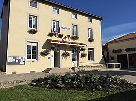 Town hall | |
 Coat of arms | |
show Location of Cellieu | |
 Cellieu | |
| Coordinates: 45°31′25″N 4°32′30″E / 45.5236°N 4.5417°ECoordinates: 45°31′25″N 4°32′30″E / 45.5236°N 4.5417°E | |
| Country | France |
| Region | Auvergne-Rhône-Alpes |
| Department | Loire |
| Arrondissement | Saint-Étienne |
| Canton | Sorbiers |
| Intercommunality | Saint-Étienne Métropole |
| Government | |
| • Mayor (2020–2026) | Marc Tardieu |
| Area 1 | 12.11 km2 (4.68 sq mi) |
| Population (Jan. 2018)[1] | 1,695 |
| • Density | 140/km2 (360/sq mi) |
| Time zone | UTC+01:00 (CET) |
| • Summer (DST) | UTC+02:00 (CEST) |
| INSEE/Postal code | 42032 /42320 |
| Elevation | 352–817 m (1,155–2,680 ft) (avg. 520 m or 1,710 ft) |
| 1 French Land Register data, which excludes lakes, ponds, glaciers > 1 km2 (0.386 sq mi or 247 acres) and river estuaries. | |


Cellieu (French pronunciation: [sɛljø]) is a commune in the Loire department in central France.
Since the 2016 reform of the administrative regions, it is located in the exact center of the new region Auvergne-Rhône-Alpes.
Population[]
|
|
See also[]
References[]
- ^ "Populations légales 2018". INSEE. 28 December 2020.
| Wikimedia Commons has media related to Cellieu. |
| show Authority control |
|---|
This Loire geographical article is a stub. You can help Wikipedia by . |
Categories:
- Communes of Loire (department)
- Loire geography stubs