Central Stickney, Illinois
Central Stickney, Illinois | |
|---|---|
Unincorporated community | |
 Boundary of Central Stickney, Illinois, just southwest of Chicago | |
 Central Stickney, Illinois | |
| Coordinates: 41°48′26″N 87°45′45″W / 41.8073°N 87.7626°WCoordinates: 41°48′26″N 87°45′45″W / 41.8073°N 87.7626°W | |
| Country | United States |
| State | Illinois |
| County | Cook |
| Township | Stickney |
| Elevation | 722 ft (220 m) |
| Time zone | UTC-6 (Central (CST)) |
| • Summer (DST) | UTC-5 (CDT) |
| ZIP code | 60638 |
| Area code(s) | 708 |

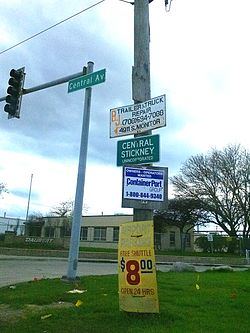
Central Stickney is an unincorporated community in Stickney Township, Cook County, Illinois, a half mile north of Midway International Airport. It consists of the areas around Central Avenue, between I-55 to the north and 51st Street, its southern boundary; east of Central, the northern boundary is roughly drawn between 47th and 48th Streets. It is bordered by the village of Forest View to the north and the Chicago community of Garfield Ridge to the south and east. The area consists of a residential neighborhood of approximately 150 acres to the east of Central Avenue and a business park to the west, as well as several small businesses along Central. Central Stickney has a post office, with the zip code 60638. It is served by the Central Stickney Fire Protection District and the Central Stickney Park District. Central Stickney has been trying to incorporate for many years, but faces possible annexation to the City of Chicago.
Education[]
Central Stickney has one public school, Charles J. Sahs Elementary School, which serves grades K-8; it is the only school in . Students then attend Reavis High School in Burbank, four miles to the south, for grades 9-12.
Central Stickney is also in the Moraine Valley Community College District 524.
References[]
Chicago metropolitan area | ||
|---|---|---|
| Major city |
|  |
| Cities (over 30,000 in 2010) |
| |
| Towns and villages (over 30,000 in 2010) |
| |
| Counties | ||
| Regions |
| |
| Sub-regions | ||
Illinois, United States | ||
- Unincorporated communities in Illinois
- Unincorporated communities in Cook County, Illinois
- Chicago metropolitan area