Norwood Park Township, Cook County, Illinois
Norwood Park Township | |
|---|---|
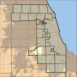 Location in Cook County | |
 Cook County's location in Illinois | |
| Coordinates: 41°58′06″N 87°49′04″W / 41.96833°N 87.81778°WCoordinates: 41°58′06″N 87°49′04″W / 41.96833°N 87.81778°W | |
| Country | United States |
| State | Illinois |
| County | Cook |
| Area | |
| • Total | 3.67 sq mi (9.51 km2) |
| • Land | 3.67 sq mi (9.51 km2) |
| • Water | 0 sq mi (0 km2) 0% |
| Elevation | 650 ft (198 m) |
| Population (2010) | |
| • Estimate (2016)[1] | 26,236 |
| • Density | 7,186/sq mi (2,774.4/km2) |
| Time zone | UTC-6 (CST) |
| • Summer (DST) | UTC-5 (CDT) |
| ZIP codes | 60068, 60631, 60656, 60706 |
| FIPS code | 17-031-54430 |

Norwood Park Township is one of 29 townships in Cook County, Illinois, USA. As of the 2010 census, its population was 26,385.[2]
Geography[]
According to the United States Census Bureau, Norwood Park Township covers an area of 3.67 square miles (9.5 km2). Its ZIP Code is 60631.
Cities, towns, villages[]
- Chicago (small portion of Norwood Park)
- Harwood Heights
- Norridge
- Park Ridge (southeast edge)
Adjacent townships[]
- Leyden Township (southwest)
- Maine Township (northwest)
Cemeteries[]
The township contains these two cemeteries: Acacia Park and Westlawn Jewish.
Major highways[]
History[]
Serial killer John Wayne Gacy lived in the township, killing his 33 victims at his home and burying most of the bodies in its crawlspace.[3]
Demographics[]
| Historical population | |||
|---|---|---|---|
| Census | Pop. | %± | |
| 2016 (est.) | 26,236 | [1] | |
| U.S. Decennial Census[4] | |||
Political districts[]
- Illinois's 5th congressional district
- Illinois's 9th congressional district
- State House District 19
- State House District 20
- State House District 65
- State Senate District 10
- State Senate District 33
References[]
- "Norwood Park Township, Cook County, Illinois". Geographic Names Information System. United States Geological Survey. Retrieved 2010-01-10.
- United States Census Bureau 2007 TIGER/Line Shapefiles
- United States National Atlas
- ^ Jump up to: a b "Population and Housing Unit Estimates". Retrieved June 9, 2017.
- ^ "Geographic Identifiers: 2010 Demographic Profile Data (DP-1): Norwood Park township, Cook County, Illinois". U.S. Census Bureau, American Factfinder. Archived from the original on February 10, 2020. Retrieved March 21, 2013.
- ^ https://www.fox13news.com/news/john-wayne-gacy-property-where-33-were-murdered-up-for-sale
- ^ "Census of Population and Housing". Census.gov. Retrieved June 4, 2016.
External links[]
| show Municipalities and communities of Cook County, Illinois, United States |
|---|
| show Authority control |
|---|
Categories:
- Townships in Cook County, Illinois
- Townships in Illinois