McCook, Illinois
McCook, Illinois | |
|---|---|
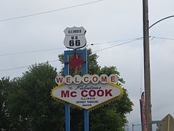 McCook welcome sign, inspired by the Welcome to Fabulous Las Vegas sign | |
 Location of McCook in Cook County, Illinois. | |
 Location of Illinois in the United States | |
| Coordinates: 41°47′55″N 87°49′57″W / 41.79861°N 87.83250°WCoordinates: 41°47′55″N 87°49′57″W / 41.79861°N 87.83250°W | |
| Country | United States |
| State | Illinois |
| County | Cook |
| Government | |
| • Mayor | Terrance M. Carr, Jr. (acting mayor) |
| Area | |
| • Total | 2.63 sq mi (6.83 km2) |
| • Land | 2.61 sq mi (6.77 km2) |
| • Water | 0.02 sq mi (0.05 km2) |
| Population (2010) | |
| • Total | 228 |
| • Estimate (2019)[2] | 220 |
| • Density | 84.16/sq mi (32.49/km2) |
| Time zone | UTC-6 (CST) |
| • Summer (DST) | UTC-5 (CDT) |
| ZIP Code(s) | 60525 |
| Area code(s) | 708 |
| FIPS code | 17-45564 |
| Wikimedia Commons | McCook, Illinois |
| Website | www |

McCook is a village in Cook County, Illinois, United States, and is an industrial suburb of Chicago. As of the 2010 census, the village population was 228,[3] which is the lowest population of all municipalities in the county.
History[]
McCook was named for John J. McCook, a late 19th-century director of the Santa Fe Railroad and a former Civil War officer. The railway stopped at a small station in town. The Outlaws Motorcycle Club was established in McCook in 1935 when Old Route 66 passed through the town. In 1958, six people were killed in an explosion at a Reynolds Metals plant. In 1995, the former Universal Oil Products Riverside Laboratory in McCook was awarded with National Historic Chemical Landmark status.
Geography[]
McCook is located at 41°47′55″N 87°49′57″W / 41.79861°N 87.83250°W (41.798542, -87.832432).[4]
According to the 2010 census, McCook has a total area of 2.631 square miles (6.81 km2), of which 2.61 square miles (6.76 km2) (or 99.2%) is land and 0.021 square miles (0.05 km2) (or 0.8%) is water.[5]
McCook is home to a small population but a large amount of heavy industry, resulting in a large tax base.
Demographics[]
| Historical population | |||
|---|---|---|---|
| Census | Pop. | %± | |
| 1930 | 367 | — | |
| 1940 | 315 | −14.2% | |
| 1950 | 361 | 14.6% | |
| 1960 | 441 | 22.2% | |
| 1970 | 333 | −24.5% | |
| 1980 | 303 | −9.0% | |
| 1990 | 235 | −22.4% | |
| 2000 | 254 | 8.1% | |
| 2010 | 228 | −10.2% | |
| 2019 (est.) | 220 | [2] | −3.5% |
| U.S. Decennial Census[6] | |||
At the 2000 census there were 254 people, 119 households, and 69 families in the village. The population density was 97.6 people per square mile (37.7/km2). There were 125 housing units at an average density of 48.0 per square mile (18.6/km2). The racial makeup of the village was 95.28% White, 4.72% from other races. Hispanic or Latino of any race were 7.87%.[7]
The top three ancestries reported in McCook as of the 2000 census were Polish (18.9%), Irish (16.3%) and Italian (16.3%).[8]
Of the 119 households 19.3% had children under the age of 18 living with them, 39.5% were married couples living together, 11.8% had a female householder with no husband present, and 42.0% were non-families. 39.5% of households were one person and 15.1% were one person aged 65 or older. The average household size was 2.13 and the average family size was 2.86.
The age distribution was 16.5% under the age of 18, 8.7% from 18 to 24, 28.3% from 25 to 44, 25.2% from 45 to 64, and 21.3% 65 or older. The median age was 43 years. For every 100 females, there were 91.0 males. For every 100 females age 18 and over, there were 91.0 males.
The median household income was $43,125 and the median family income was $58,333. Males had a median income of $40,625 versus $26,429 for females. The per capita income for the village was $24,996. None of the families and 1.8% of the population were living below the poverty line, including no under eighteens and 4.1% of those over 64.
Government[]
McCook is in Illinois' 3rd congressional district.
Business[]
McCook is home to a large amount of heavy industry, including portions of Vulcan Materials Company McCook Quarry, UOP, and the Electro-Motive Diesel (EMD) railroad locomotive plant. Known as the LaGrange plant for its mailing address (McCook does not have its own post office), EMD produced most of their locomotives there from 1935 to 1991, when parent company General Motors moved all final-assembly operations to London, Ontario. The LaGrange plant continues to manufacture locomotive parts and engines, and also serves as the EMD U.S. headquarters.
Education[]
A part of McCook is served by the Lyons School District 103 and J. Sterling Morton High School District 201's Morton West High School located in Berwyn.
A part of McCook is served by Lyons Township High School in Western Springs/LaGrange.
References[]
- ^ "2019 U.S. Gazetteer Files". United States Census Bureau. Retrieved July 14, 2020.
- ^ Jump up to: a b "Population and Housing Unit Estimates". United States Census Bureau. May 24, 2020. Retrieved May 27, 2020.
- ^ "Profile of General Population and Housing Characteristics: 2010 Demographic Profile Data (DP-1): McCook village, Illinois". U.S. Census Bureau, American Factfinder. Archived from the original on February 12, 2020. Retrieved March 14, 2013.
- ^ "US Gazetteer files: 2010, 2000, and 1990". United States Census Bureau. 2011-02-12. Retrieved 2011-04-23.
- ^ "G001 - Geographic Identifiers - 2010 Census Summary File 1". United States Census Bureau. Archived from the original on 2020-02-13. Retrieved 2015-10-26.
- ^ "Census of Population and Housing". Census.gov. Retrieved June 4, 2015.
- ^ "U.S. Census website". United States Census Bureau. Retrieved 2008-01-31.
- ^ "Profile of General Demographic Characteristics, McCook, Illinois" (PDF). Archived from the original (PDF) on 2007-12-03. Retrieved 2007-04-04. (37.9 KiB). U.S. Census Bureau. Accessed 2007-04-03.
| show Municipalities and communities of Cook County, Illinois, United States |
|---|
| show Authority control |
|---|
- McCook, Illinois
- Villages in Illinois
- Villages in Cook County, Illinois
- Chicago metropolitan area