Rolling Meadows, Illinois
Rolling Meadows, Illinois | |
|---|---|
City | |
| City of Rolling Meadows | |
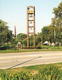 Bell tower in Rolling Meadows | |
 Seal | |
| Motto(s): "Progress Thru Participation" | |
 Location of Rolling Meadows in Cook County, Illinois. | |
 Location of Illinois in the United States | |
| Coordinates: 42°4′34″N 88°1′33″W / 42.07611°N 88.02583°WCoordinates: 42°4′34″N 88°1′33″W / 42.07611°N 88.02583°W | |
| Country | |
| State | Illinois |
| County | Cook |
| Township | Palatine, Elk Grove |
| Incorporated | 1955 |
| Government | |
| • Mayor | Joe Gallo[1](2019-2023) |
| Area | |
| • Total | 5.62 sq mi (14.56 km2) |
| • Land | 5.62 sq mi (14.54 km2) |
| • Water | 0.01 sq mi (0.02 km2) 0% |
| Population (2010) | |
| • Total | 24,099 |
| • Estimate (2019)[3] | 23,532 |
| • Density | 4,190.17/sq mi (1,617.88/km2) |
| Standard of living (2009-11) | |
| • Per capita income | $29,099 |
| • Median home value | $251,900 |
| ZIP code(s) | 60008 |
| Area code(s) | 847 and 224 |
| FIPS code | 17-65338 |
| Website | www |

Rolling Meadows is a city in Cook County, Illinois, United States. The population was 24,099 at the 2010 census.[4]
History[]
This section does not cite any sources. (March 2010) |
In 1836, Orrin Ford became the first landowner in the area that is now Rolling Meadows, staking his claim of 160 acres (0.65 km2) in an area known as Plum Grove. Other farm families followed, many traveling from Vermont. By the early 1840s, settlers had built a dam across Salt Creek and had laid claim to the entire Plum Grove area.
The community became part of the newly formed Palatine Township in 1850 as German immigrants arrived. In 1862, the Salem Evangelical Church was built, and the church's 40-foot-square (12 m) cemetery still exists at the corner of Kirchoff and Plum Grove roads.
In 1927, H.D. "Curly" Brown bought 1,000 acres (4.0 km2) of land in the area with the intention of building a golf course, along with land adjacent to it for a racetrack. In the early 1950s, Kimball Hill purchased the land intended for the golf course, and began home sales by advertising a floor plan of his basic house in the Chicago Tribune. Although the response was positive, officials in neighboring Arlington Heights protested, hoping to buy the land themselves for estate homes. However, prospective buyers of the Kimball Hill homes persuaded the Cook County Board for zoning changes to allow Hill to proceed.
In 1953, the first families moved into the development, which Hill named Rolling Meadows, and 700 houses were sold by 1955, mostly to blue-collar workers. Hill donated $200 per home for a school system, and then built and equipped the first elementary school. He also founded the Rolling Meadows Homeowners' Association and donated land for parks, as well as funded the Clearbrook Center, which is a home for individuals with cognitive disabilities that opened in 1955.
Rolling Meadows incorporated as a city in 1955 and soon began annexing land for future development. The town boomed during the 1950s and 1960s as businesses moved into the area. Crawford's department store opened in 1957 and was the largest in the northwest suburbs, although it closed in 1994. An industrial park opened on North Hicks Road in 1958, and Western Electric opened a facility in the 1960s, employing 1,500 workers. Developers saturated the area with apartment buildings, and by 1970, multifamily dwellings made up 35 percent of the total structures in Rolling Meadows. Rolling Meadows complexes, however, suffered from a series of fires in the decade, prompting the city to become more stringent in their building codes, which had allowed for frame multifamily structures.
By 2000, the city had begun revamping commercial areas along Kirchoff Road. In the south end of the city on Golf Road, corporations such as 3Com, Helene Curtis, and Charles Industries established bases in what has become known as the Golden Corridor.
Geography[]
Rolling Meadows is located 24 miles (39 km) northwest of the Chicago Loop. According to the 2010 census, Rolling Meadows has a total area of 5.635 square miles (14.59 km2), of which 5.63 square miles (14.58 km2) (or 99.91%) is land and 0.005 square miles (0.01 km2) (or 0.09%) is water.[5]
Demographics[]
| Historical population | |||
|---|---|---|---|
| Census | Pop. | %± | |
| 1960 | 10,879 | — | |
| 1970 | 19,178 | 76.3% | |
| 1980 | 20,167 | 5.2% | |
| 1990 | 22,591 | 12.0% | |
| 2000 | 24,604 | 8.9% | |
| 2010 | 24,099 | −2.1% | |
| 2020 | 24,200 | 0.4% | |
| U.S. Decennial Census[6] | |||
| Demographics (2010)[4] | |||
|---|---|---|---|
| White | Black | Asian | |
| 77.7% | 2.4% | 8.2% | |
| Islander | Native | Other | Hispanic (any race) |
| 0.02% | 0.3% | 11.3% | 26.3% |
As of the census[7] of 2000, there were 24,607 people, 8,923 households, and 6,174 families residing in the city. The population density was 4,510.4 people per square mile (1,743.1/km2). There were 9,151 housing units at an average density of 1,677.6 per square mile (648.3/km2). The racial makeup of the city was 82.33% White, 2.83% African American, 0.27% Native American, 6.61% Asian, 0.03% Pacific Islander, 5.95% from other races, and 1.98% from two or more races. Hispanic or Latino of any race were 19.20% of the population.
There were 8,923 households, out of which 33.4% had children under the age of 18 living with them, 55.8% were married couples living together, 9.2% had a female householder with no husband present, and 30.8% were non-families. 24.4% of all households were made up of individuals, and 7.0% had someone living alone who was 65 years of age or older. The average household size was 2.72 and the average family size was 3.26.
In the city, the population was spread out, with 25.1% under the age of 18, 9.3% from 18 to 24, 33.9% from 25 to 44, 21.1% from 45 to 64, and 10.6% who were 65 years of age or older. The median age was 34 years. For every 100 females, there were 102.5 males. For every 100 females age 18 and over, there were 101.5 males.
The median income for a household in the city was $59,535, and the median income for a family was $68,571. Males had a median income of $45,101 versus $35,039 for females. The per capita income for the city was $26,178. About 3.5% of families and 5.1% of the population were below the poverty line, including 7.4% of those under age 18 and 2.9% of those age 65 or over.
Economy[]

The Chicago-area office of Huawei is located at 3601 Algonquin Road.[8] The Chicago-area sales office of Asiana Airlines is located at Suite 1010 of Continental Towers # 3.[9]
According to the city's 2018 Comprehensive Annual Financial Report,[10] the top employers in the city are:
| # | Employer | # of Employees |
|---|---|---|
| 1 | Northrop Defense Systems | 2,450 |
| 2 | Arthur J Gallagher | 2,000 |
| 3 | Verizon Wireless | 900 |
| 4 | Capital One | 800 |
| 5 | CareerBuilder Employment Screening | 450 |
| 6 | Komatsu | 300 |
| 7 | A.H. Management Group | 300 |
| 8 | RTC | 235 |
| 9 | Meijer | 230 |
| 10 | Walmart | 200 |
Parks and recreation[]

The Rolling Meadows Park District was formed in 1958, and has been a finalist for the National Gold Medal award for excellence in parks and recreation management four times.[11]
The Salt Creek Rural Park District was formed in 1956, and provides recreation and leisure services to the residents that live within the corporate boundaries of the district, which include parts of the village of Arlington Heights, Palatine, and the city of Rolling Meadows. The district also provides recreation and leisure services to non-residents of the area on a fee basis.[12]
Education[]
Primary and secondary schools[]

Almost all of Rolling Meadows is served by Palatine Community Consolidated School District 15. District 15 schools in Rolling Meadows include Central Road (K-6), Kimball Hill (K-6), Willow Bend (K-6), John G. Conyers Learning Academy (early childhood and multiple needs), Carl Sandburg Jr. High (7-8) which take students from Thomas Jefferson (K-6) in North Hoffman Estates, Central Road, Kimball Hill and Willow Bend, and Plum Grove Jr. High (7-8).
A very small portion is served by Arlington Heights School District 25, which includes Westgate Elementary School and South Middle School, where students then attend RMHS. Another smaller portion is served by Schaumburg Consolidated School District 54 and Fairview Elementary School, Margaret Mead Junior High School and WFHS, and a small portion extends into Community Consolidated School District 59; that portion has no residents.
About half of Rolling Meadows is served by Township High School District 214's Rolling Meadows High School. The other half is served by Township High School District 211 by William Fremd High School in Palatine.
The Roman Catholic Archdiocese of Chicago operates Catholic schools. St. Colette School is a preK-8 Catholic school serving all of Rolling Meadows. St. Colette School was awarded as a 2007 Blue Ribbon School from the U.S. Department of Education.[citation needed] The student population from circa 2017 to 2020 declined by 97. In 2020 its budget deficit was $500,000. Therefore the archdiocese decided to close the school after Spring 2020.[13]
Notable people[]
- Bryan Anderson, Iraqi War veteran and author[14]
- Jay Bennett, guitarist with band Wilco
- Gary Cole, film and television actor[15]
- Carol Marin, television and print journalist
- Tim McIlrath, lead singer to punk-rock band Rise Against;[16] lived in Arlington Heights
- Scott Tolzien, NFL quarterback with Indianapolis Colts, Green Bay Packers
References[]
- ^ https://www.cityrm.org/505/Mayor
- ^ "2019 U.S. Gazetteer Files". United States Census Bureau. Retrieved July 14, 2020.
- ^ Cite error: The named reference
USCensusEst2019CenPopScriptOnlyDirtyFixDoNotUsewas invoked but never defined (see the help page). - ^ Jump up to: a b "Profile of General Population and Housing Characteristics: 2010 Demographic Profile Data (DP-1): Rolling Meadows city, Illinois". U.S. Census Bureau, American Factfinder. Archived from the original on February 12, 2020. Retrieved February 14, 2013.
- ^ "G001 - Geographic Identifiers - 2010 Census Summary File 1". United States Census Bureau. Archived from the original on 2020-02-13. Retrieved 2015-12-27.
- ^ "Census of Population and Housing". Census.gov. Retrieved June 4, 2015.
- ^ "U.S. Census website". United States Census Bureau. Retrieved 2008-01-31.
- ^ "Contact us Archived 2010-11-01 at the Wayback Machine." Huawei. Retrieved on February 4, 2009.
- ^ "Worldwide Offices." Asiana Airlines. Accessed September 20, 2008.
- ^ "City of Rolling Meadows, Illinois Comprehensive Annual Financial Report". 2019-05-23.
- ^ Rolling Meadows Park District
- ^ Salt Creek Rural Park District
- ^ "Five Archdiocese of Chicago Catholic schools will close". Chicago Catholic. 2020-01-22. Retrieved 2020-05-08. - Spanish version
- ^ Silverberg, Melissa (1 November 2011). "From Iraq to Rolling Meadows: A soldier's tale". Daily Herald. Chicago. Retrieved 15 April 2015.
- ^ "Celebrities have roots in local communities". Be Good. Retrieved 2014-09-15.
- ^ Rise Against
External links[]
| show Places adjacent to Rolling Meadows, Illinois |
|---|
| show Municipalities and communities of Cook County, Illinois, United States |
|---|
| show Chicago metropolitan area |
|---|

| show Authority control |
|---|
- Cities in Illinois
- Chicago metropolitan area
- Cities in Cook County, Illinois
- Populated places established in 1953
- 1955 establishments in Illinois