Stickney, Illinois
Stickney, Illinois | |
|---|---|
Village | |
| Village of Stickney, Illinois | |
| Motto(s): A Community That Cares | |
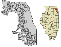 Location of Stickney in Cook County, Illinois. | |
 Location of Illinois in the United States | |
| Coordinates: 41°49′1″N 87°47′12″W / 41.81694°N 87.78667°WCoordinates: 41°49′1″N 87°47′12″W / 41.81694°N 87.78667°W | |
| Country | |
| State | Illinois |
| County | Cook |
| Township | Stickney |
| Incorporated | 1913 |
| Government | |
| • Type | |
| • President | Jeff Walik |
| Area | |
| • Total | 1.96 sq mi (5.08 km2) |
| • Land | 1.92 sq mi (4.98 km2) |
| • Water | 0.04 sq mi (0.09 km2) 2.04% |
| Population (2010) | |
| • Total | 6,786 |
| • Estimate (2019)[2] | 6,566 |
| • Density | 3,412.68/sq mi (1,317.43/km2) |
| Up 10.38% from 2000 | |
| Standard of living (2007-11) | |
| • Per capita income | $21,972 |
| • Median home value | $204,000 |
| ZIP code(s) | 60402 |
| Area code(s) | 708 |
| Geocode | 72676 |
| FIPS code | 17-72676 |
| Website | www |

| Demographics (2010)[3] | |||
|---|---|---|---|
| White | Black | Asian | |
| 67.8% | 2.5% | 1.5% | |
| Islander | Native | Other | Hispanic (any race) |
| 0.1% | 0.5% | 27.7% | 50.9% |
Stickney is a village in Cook County, Illinois, United States. The village is named for Alpheus Beede Stickney, a railroad executive who played a central role in establishing the Clearing Industrial District.[4] The population was 6,786 at the 2010 census.[3] It was well known in the 1920s and early 1930s as the home for several bordellos linked to mobster Al Capone's empire.
The largest wastewater treatment plant in the world, the Stickney Water Reclamation Plant (Stickney WRP), is located within the village.[citation needed] This facility is operated by the Metropolitan Water Reclamation District of Greater Chicago.
Geography[]
Stickney is located at 41°49′1″N 87°47′12″W / 41.81694°N 87.78667°W (41.816982, -87.786755).[5]
According to the 2010 census, Stickney has a total area of 1.966 square miles (5.09 km2), of which 1.93 square miles (5.00 km2) (or 98.17%) is land and 0.036 square miles (0.09 km2) (or 1.83%) is water.[6]
Demographics[]
| Historical population | |||
|---|---|---|---|
| Census | Pop. | %± | |
| 1920 | 550 | — | |
| 1930 | 2,005 | 264.5% | |
| 1940 | 2,446 | 22.0% | |
| 1950 | 3,317 | 35.6% | |
| 1960 | 6,239 | 88.1% | |
| 1970 | 6,601 | 5.8% | |
| 1980 | 5,893 | −10.7% | |
| 1990 | 5,678 | −3.6% | |
| 2000 | 6,148 | 8.3% | |
| 2010 | 6,786 | 10.4% | |
| 2019 (est.) | 6,566 | [2] | −3.2% |
| U.S. Decennial Census[7] | |||
As of the census[8] of 2000, there were 6,148 people, 2,253 households, and 1,516 families residing in the village. The population density was 3,189.5 people per square mile (1,229.9/km2). There were 2,334 housing units at an average density of 1,210.8 per square mile (466.9/km2). The racial makeup of the village was 90.78% White, 0.42% African American, 0.23% Native American, 1.09% Asian, 6.31% from other races, and 1.17% from two or more races. Hispanic or Latino of any race were 21.52% of the population, including 18.7% of Mexican descent.
The top five non-Hispanic ancestries reported in Stickney as of the 2000 census were Polish (19.5%), Czech (16.2%), German (14.0%), Italian (9.2%) and Irish (8.9%).[9]
There were 2,253 households, out of which 27.6% had children under the age of 18 living with them, 49.5% were married couples living together, 12.8% had a female householder with no husband present, and 32.7% were non-families. 28.2% of all households were made up of individuals, and 14.7% had someone living alone who was 65 years of age or older. The average household size was 2.50 and the average family size was 3.10.
In the village, the population was spread out, with 22.8% under the age of 18, 8.7% from 18 to 24, 29.5% from 25 to 44, 20.7% from 45 to 64, and 18.3% who were 65 years of age or older. The median age was 37 years. For every 100 females, there were 98.5 males. For every 100 females age 18 and over, there were 96.4 males.
The median income for a household in the village was $42,772, and the median income for a family was $52,614. Males had a median income of $30,684 versus $29,444 for females. The per capita income for the village was $19,109. About 2.4% of families and 5.8% of the population were below the poverty line, including 2.1% of those under age 18 and 7.0% of those age 65 or over.
Government[]
Stickney is in Illinois' 3rd congressional district.
Education[]
Stickney has two public elementary schools, Home School and Edison School, part of Lyons Elementary School District 103, both serving grades K-5. Students then attend George Washington Middle School in Lyons for grades 6–8.
Residents are zoned Morton West High School in Berwyn for grades 9-12 as all residents are west of Ridgeland Avenue.[10][11]
The village had previously hosted Haley School which was built in 1923[12] and demolished in 1987; its land later being converted into Haley Park in 1989, and MacArthur School (41st and Cuyler) which was closed and later demolished. St Pius X Church had an elementary school which was closed in the 90s.
References[]
- ^ "2019 U.S. Gazetteer Files". United States Census Bureau. Retrieved July 14, 2020.
- ^ Jump up to: a b "Population and Housing Unit Estimates". United States Census Bureau. May 24, 2020. Retrieved May 27, 2020.
- ^ Jump up to: a b "Profile of General Population and Housing Characteristics: 2010 Demographic Profile Data (DP-1): Stickney village, Illinois". U.S. Census Bureau, American Factfinder. Archived from the original on February 12, 2020. Retrieved March 20, 2013.
- ^ "Encyclopedia of Chicago - Stickney, IL". Chicago Historical Society. 2005. Retrieved 2013-11-10.
- ^ "US Gazetteer files: 2010, 2000, and 1990". United States Census Bureau. 2011-02-12. Retrieved 2011-04-23.
- ^ "G001 - Geographic Identifiers - 2010 Census Summary File 1". United States Census Bureau. Archived from the original on 2020-02-13. Retrieved 2015-12-25.
- ^ "Census of Population and Housing". Census.gov. Retrieved June 4, 2015.
- ^ "U.S. Census website". United States Census Bureau. Retrieved 2008-01-31.
- ^ "Profile of General Demographic Characteristics, Stickney, Illinois" (PDF). (38.8 KiB). U.S. Census Bureau. Accessed 2007-04-06.
- ^ "1950s." J. Sterling Morton High School East. Retrieved on December 20, 2016.
- ^ "Polling Locations for March 2012." Stickney Township. Retrieved on December 20, 2016.
- ^ "Pioneers of Progress ... the history of Stickney Township." (Stickney Township Office, 1969), p. 25. Retrieved on December 29, 2018.
External links[]
| show Places adjacent to Stickney, Illinois |
|---|
| show Municipalities and communities of Cook County, Illinois, United States |
|---|
| show Authority control |
|---|
- Villages in Illinois
- Villages in Cook County, Illinois
- Chicago metropolitan area
- Populated places established in 1913
- 1913 establishments in Illinois