Bloom Township, Cook County, Illinois
Bloom Township | |
|---|---|
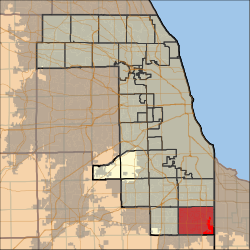 Location in Cook County | |
 Cook County's location in Illinois | |
| Coordinates: 41°31′02″N 87°36′03″W / 41.51722°N 87.60083°WCoordinates: 41°31′02″N 87°36′03″W / 41.51722°N 87.60083°W | |
| Country | United States |
| State | Illinois |
| County | Cook |
| Area | |
| • Total | 46.7 sq mi (121.0 km2) |
| • Land | 46.4 sq mi (120.3 km2) |
| • Water | 0.3 sq mi (0.7 km2) 0.59% |
| Elevation | 630 ft (192 m) |
| Population (2010) | |
| • Estimate (2016)[1] | 90,285 |
| • Density | 1,958/sq mi (755.8/km2) |
| Time zone | UTC-6 (CST) |
| • Summer (DST) | UTC-5 (CDT) |
| ZIP codes | 60411, 60422, 60425, 60430, 60438, 60461, 60466, 60475, 60476 |
| FIPS code | 17-031-06561 |

Bloom Township is one of 29 townships in Cook County, Illinois, USA. As of the 2010 census, its population was 90,923.[2]
Geography[]
According to the United States Census Bureau, Bloom Township covers an area of 46.7 square miles (121.0 km2); of this, 46.4 square miles (120.3 km2) is land and 0.27 square miles (0.7 km2), or 0.59 percent, is water.[2]
Cities, towns, villages[]
- Chicago Heights
- Flossmoor (east quarter)
- Ford Heights
- Glenwood (vast majority)
- Homewood (half)
- Lansing (south quarter)
- Lynwood
- Olympia Fields (small portion)
- Park Forest (small portion)
- Sauk Village (vast majority)
- South Chicago Heights
- Steger (north half)
Adjacent townships[]
- Thornton Township (north)
- North Township, Lake County, Indiana (northeast)
- St. John Township, Lake County, Indiana (east)
- Crete Township, Will County (south)
- Monee Township, Will County (southwest)
- Rich Township (west)
- Bremen Township (northwest)
Cemeteries[]
The township contains these six cemeteries: Assumption, Bloom Presbyterian, Calvary, Mount Glenwood Memory Gardens, Saint James Catholic and Saint Pauls Evangelical Lutheran.
Major highways[]
Airports and landing strips[]
- Lansing Municipal Airport
- Mulderink Heliport
- Raeco Heliport
- Saint James Hospital and Health Centers Heliport
Lakes[]
- Sauk Lake
Landmarks[]
- Cook County Forest Preserves
Demographics[]
| Historical population | |||
|---|---|---|---|
| Census | Pop. | %± | |
| 2016 (est.) | 90,285 | [1] | |
| U.S. Decennial Census[3] | |||
Political districts[]
- Illinois' 2nd congressional district
- State House District 29
- State House District 30
- State House District 80
- State Senate District 15
- State Senate District 40
References[]
- "Bloom Township, Cook County, Illinois". Geographic Names Information System. United States Geological Survey. Retrieved 2010-01-10.
- United States Census Bureau 2007 TIGER/Line Shapefiles
- United States National Atlas
- ^ a b "Population and Housing Unit Estimates". Retrieved June 9, 2017.
- ^ a b "Geographic Identifiers: 2010 Demographic Profile Data (DP-1): Bloom township, Cook County, Illinois". U.S. Census Bureau, American Factfinder. Archived from the original on February 12, 2020. Retrieved March 20, 2013.
- ^ "Census of Population and Housing". Census.gov. Retrieved June 4, 2016.
External links[]
- Bloom Township official site
- City-Data.com
- Illinois State Archives
- Township Officials of Illinois
- Cook County official site
Categories:
- Townships in Cook County, Illinois
- Townships in Illinois