Westchester, Illinois
Westchester, Illinois
Village of Westchester | |
|---|---|
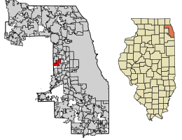 Location of Westchester in Cook County, Illinois. | |
 Location of Illinois in the United States | |
| Coordinates: 41°51′14″N 87°53′1″W / 41.85389°N 87.88361°WCoordinates: 41°51′14″N 87°53′1″W / 41.85389°N 87.88361°W | |
| Country | United States |
| State | Illinois |
| County | Cook |
| Founded | 1926 |
| Government | |
| • Type | Village |
| Area | |
| • Total | 3.69 sq mi (9.55 km2) |
| • Land | 3.69 sq mi (9.55 km2) |
| • Water | 0.00 sq mi (0.00 km2) |
| Population (2010) | |
| • Total | 16,718 |
| • Estimate (2019)[2] | 16,117 |
| • Density | 4,372.49/sq mi (1,688.32/km2) |
| Time zone | UTC-6 (CST) |
| • Summer (DST) | UTC-5 (CDT) |
| ZIP Code(s) | 60154 |
| Area code(s) | 708 |
| FIPS code | 17-80047 |
| Wikimedia Commons | Westchester, Illinois |
| Website | www |

Westchester is a village in Cook County, Illinois, United States. It is a western suburb of Chicago. The population was 16,718 at the 2010 census.[3] The current Village President is Frank Perry.[4]
History[]
The area now known as Westchester was occupied by German farmers beginning in the mid-19th century. Samuel Insull purchased the land in 1924 with plans to develop it for residential use and create an English-style town. As a result, the town's name and the majority of its street names are of English origin.
The Great Depression slowed development during the 1930s, although the population continued to grow. The town's suburban development was stimulated by its being the western terminal of Chicago's rapid transit line. The extension of the line was removed in 1951. But in 1956 the federal government began postwar construction of the Interstate Highway System, resulting in the construction of nearby expressways I-290 and I-294. These have provided residents with convenient travel in the region.
Residential and retail development has consumed nearly all open land within the village, save for the protected 85-acre (340,000 m2) of Wolf Road Prairie.[5] It is the largest black-soil prairie remnant east of the Mississippi River.[6]
Geography[]
Westchester is located at 41°51′14″N 87°53′1″W / 41.85389°N 87.88361°W (41.853890, -87.883712).[7]
According to the 2010 census, Westchester has a total area of 3.69 square miles (9.56 km2), all land. It shares its western border with Du Page County.[8]
Demographics[]
| Historical population | |||
|---|---|---|---|
| Census | Pop. | %± | |
| 1930 | 358 | — | |
| 1940 | 621 | 73.5% | |
| 1950 | 4,308 | 593.7% | |
| 1960 | 18,092 | 320.0% | |
| 1970 | 20,033 | 10.7% | |
| 1980 | 17,730 | −11.5% | |
| 1990 | 17,301 | −2.4% | |
| 2000 | 16,824 | −2.8% | |
| 2010 | 16,718 | −0.6% | |
| 2019 (est.) | 16,117 | [2] | −3.6% |
| U.S. Decennial Census[9] | |||
As of the census[10] of 2010, there were 16,718 people living in the village. The racial makeup of the village was 65.9% White, 14.1% African American, 0.1% Native American, 3.9% Asian, 0.1% from other races, and 1.0% from two or more races. Hispanic or Latino of any race were 14.9% of the population.
Government[]
Westchester is divided among three congressional districts. The areas south of Cermak Road or west of Haase and Burns avenues are in Illinois' 3rd congressional district; nearly all of the areas east of Mannheim Road and east of Mayfair Avenue, between Canterbury Street and Dorchester Avenue, are in the 7th district; and the area in between (primarily Oak Ridge and Glen Oak cemeteries) is in the state's 4th district.
Economy[]
Westchester is home to Westbrook Corporate Center, located at Wolf Road and Cermak Road. Constructed in 1986 and renovated in 1996, the complex consists of five 10-story towers encompassing more than 1 million square feet (90,000 m²) of office space. Westbrook Corporate Center has won the 2000/2001 BOMA- International Office Building of the Year Award, 2000/2001 BOMA- North Central Region Office Building of the Year Award, and 1998/1999, 1999/2000, 2000/2001 BOMA- Suburban Chicago Office Building of the Year Award.
Top employers[]
According to the Village's 2012 Comprehensive Annual Financial Report,[11] the top employers in the city are:
| # | Employer |
|---|---|
| 1 | G4S Secure Solutions Inc |
| 2 | Corn Products International (Ingredion) |
| 3 | Sogeti |
| 4 | Chicago Laborers Pension & Welfare Funds |
| 5 | CommScope Corp (Andrew Solutions) |
| 6 | |
| 7 | Yellow Book USA, Inc |
| 8 | |
| 9 | |
| 10 | Healthcare Financial Management Association |
Education[]
Public schools[]
Westchester School District 92.5 serves most of the city.[12] There are four schools in this district:
- Westchester Primary School (Preschool – 2nd grade)
- Westchester Intermediate School (3rd grade – 5th grade)
- Westchester Middle School (6th grade – 8th grade)
- Brittain School (Special Needs)[13]
In addition Hillside School District 93, which operates a single K-8 school in Hillside, serves a section of Westchester.[14] In 1968 the school district proposed a bond for a junior high school,[15] on a 12.5-acre (5.1 ha) parcel of land in Westchester.[16] The voters rejected the referendum and the plans were scrapped. The president of Concord Homes, Roger Mankedick, stated in a Chicago Sun-Times stated that the student population that was supposed to surround the school never came.[17] The Chicago Tribune stated there was a decline in students in the area surrounding the school site. In 1998 the district instead sold the land to Concord Homes for $2.6 million.[16]
Proviso Township High Schools district serves high school residents. Zoned students attend Proviso West High School in Hillside.[13] Westchester residents may apply to Proviso Math & Science Academy in Forest Park.
Private schools[]
The following private Catholic school of the Roman Catholic Archdiocese of Chicago is located in the village:
- Divine Providence School (PS–8)[18]
Other private schools are located in the village:
- Immanuel Christian Academy (K–8, Lutheran)
- Westchester Christian School (K-12, Non-Denominational)
- PAEC Academy (K-8, Special Needs)[19]
Notable people[]
- Philip Caputo, author and journalist (A Rumor of War); born in Westchester
- Marco D'Amico, mafia member of the Chicago Outfit
- Mario Anthony DeStefano, member of the Chicago Outfit
- Jim Durkin, state legislator representing Illinois' 82nd District
- Kathryn Hahn, actress (Crossing Jordan); born in Westchester
- Michael Sarno, member of the Chicago Outfit
- Saba, Rapper
- Daniel P. Ward, Chief Justice of the Illinois Supreme Court; lived in Westchester
- Cameron Meredith, Professional Football Player for the New Orleans Saints, born in Westchester
- , Lead singer for the band Kansas, born in Westchester
- Julian Love, NFL player (New York Giants)
See also[]
 Chicago portal
 Illinois portal
References[]
- ^ "2019 U.S. Gazetteer Files". United States Census Bureau. Retrieved July 14, 2020.
- ^ Jump up to: a b "Population and Housing Unit Estimates". United States Census Bureau. May 24, 2020. Retrieved May 27, 2020.
- ^ "Profile of General Population and Housing Characteristics: 2010 Demographic Profile Data (DP-1): Westchester village, Illinois". U.S. Census Bureau, American Factfinder. Archived from the original on February 12, 2020. Retrieved March 20, 2013.
- ^ http://westchester-il.org/Directory.aspx?DID=4
- ^ Encyclopedia of Chicago. Accessed 2007-04-23
- ^ "Wolf Road Prairie - Into the Wild", Chicago Wilderness Magazine], Spring, 2004. Accessed 2007-04-23
- ^ "US Gazetteer files: 2010, 2000, and 1990". United States Census Bureau. 2011-02-12. Retrieved 2011-04-23.
- ^ "G001 - Geographic Identifiers - 2010 Census Summary File 1". United States Census Bureau. Archived from the original on 2020-02-13. Retrieved 2015-12-25.
- ^ "Census of Population and Housing". Census.gov. Retrieved June 4, 2015.
- ^ "U.S. Census website". United States Census Bureau. Retrieved 2008-01-31.
- ^ Village of Westchester Comprehensive Annual Financial Report
- ^ http://www.sd925.w-cook.k12.il.us/
- ^ Jump up to: a b "Links & Contacts". Village of Westchester, Illinois.
- ^ Home. Hillside School District 93. Retrieved on March 18, 2017. "About Since 1918 Hillside School District 93[...]" - See also U.S. Census Bureau School District Map page 4 of Cook County
- ^ "District 93 to Discuss Need for New School". Chicago Tribune. 1968-02-25. p. W2.
- ^ Jump up to: a b "School Site Turns Residential". Chicago Tribune. 1999-07-18. Retrieved 2017-03-18. "Concord purchased the land in an auction in 1998. Hillside School District 93 had [...]"
- ^ Cunniff, Bill (1999-07-30). "Westchester site of 76 town houses". Chicago Sun-Times. p. 8 New Homes.
- ^ https://marymotherofdivinegrace.org/school
- ^ https://www.paec803.org/vnews/display.v/SEC/PAEC%20Academy%7CPAEC%20Academy%20Program
External links[]
| show Places adjacent to Westchester, Illinois |
|---|
| show Municipalities and communities of Cook County, Illinois, United States |
|---|
| show Authority control |
|---|
- Chicago metropolitan area
- Populated places established in 1926
- Villages in Cook County, Illinois
- Villages in Illinois
- 1926 establishments in Illinois