Chameyrat
Chameyrat | |
|---|---|
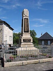 War memorial | |
 Coat of arms | |
show Location of Chameyrat | |
 Chameyrat | |
| Coordinates: 45°14′06″N 1°41′56″E / 45.235°N 1.6989°ECoordinates: 45°14′06″N 1°41′56″E / 45.235°N 1.6989°E | |
| Country | France |
| Region | Nouvelle-Aquitaine |
| Department | Corrèze |
| Arrondissement | Tulle |
| Canton | Naves |
| Government | |
| • Mayor (2014–2020) | Alain Vaux |
| Area 1 | 18.95 km2 (7.32 sq mi) |
| Population (Jan. 2018)[1] | 1,529 |
| • Density | 81/km2 (210/sq mi) |
| Time zone | UTC+01:00 (CET) |
| • Summer (DST) | UTC+02:00 (CEST) |
| INSEE/Postal code | 19038 /19330 |
| Elevation | 160–471 m (525–1,545 ft) |
| 1 French Land Register data, which excludes lakes, ponds, glaciers > 1 km2 (0.386 sq mi or 247 acres) and river estuaries. | |


show This article may be expanded with text translated from the corresponding article in French. (January 2009) Click [show] for important translation instructions. |
Chameyrat is a commune in the Corrèze department in central France.
Population[]
| Year | Pop. | ±% |
|---|---|---|
| 1962 | 1,137 | — |
| 1968 | 1,185 | +4.2% |
| 1975 | 1,196 | +0.9% |
| 1982 | 1,436 | +20.1% |
| 1990 | 1,569 | +9.3% |
| 1999 | 1,540 | −1.8% |
| 2008 | 1,585 | +2.9% |
See also[]
References[]
- ^ "Populations légales 2018". INSEE. 28 December 2020.
| Wikimedia Commons has media related to Chameyrat. |
This Corrèze geographical article is a stub. You can help Wikipedia by . |
Categories:
- Communes of Corrèze
- Corrèze geography stubs