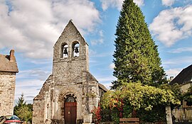
Latronche
Latronche | |
|---|---|
 of Latronche | |
 Coat of arms | |
show Location of Latronche | |
 Latronche | |
| Coordinates: 45°17′45″N 2°13′43″E / 45.2958°N 2.2286°ECoordinates: 45°17′45″N 2°13′43″E / 45.2958°N 2.2286°E | |
| Country | France |
| Region | Nouvelle-Aquitaine |
| Department | Corrèze |
| Arrondissement | Ussel |
| Canton | Haute-Dordogne |
| Intercommunality | Haute-Corrèze Communauté |
| Government | |
| • Mayor (2020–2026) | Marie Christine Soulefour[1] |
| Area 1 | 19.79 km2 (7.64 sq mi) |
| Population (Jan. 2018)[2] | 133 |
| • Density | 6.7/km2 (17/sq mi) |
| Time zone | UTC+01:00 (CET) |
| • Summer (DST) | UTC+02:00 (CEST) |
| INSEE/Postal code | 19110 /19160 |
| Elevation | 321–606 m (1,053–1,988 ft) (avg. 570 m or 1,870 ft) |
| 1 French Land Register data, which excludes lakes, ponds, glaciers > 1 km2 (0.386 sq mi or 247 acres) and river estuaries. | |


show This article may be expanded with text translated from the corresponding article in French. (January 2009) Click [show] for important translation instructions. |
Latronche (French pronunciation: [latʁɔ̃ʃ]; Occitan: La Troncha) is a commune in the Corrèze department in central France.
Population[]
| Year | Pop. | ±% |
|---|---|---|
| 1962 | 157 | — |
| 1968 | 187 | +19.1% |
| 1975 | 167 | −10.7% |
| 1982 | 140 | −16.2% |
| 1990 | 123 | −12.1% |
| 1999 | 154 | +25.2% |
| 2008 | 132 | −14.3% |
See also[]
References[]
- ^ "Répertoire national des élus: les maires". data.gouv.fr, Plateforme ouverte des données publiques françaises (in French). 2 December 2020.
- ^ "Populations légales 2018". INSEE. 28 December 2020.
External links[]
 Media related to Latronche at Wikimedia Commons
This Corrèze geographical article is a stub. You can help Wikipedia by . |
Categories:
- Communes of Corrèze
- Corrèze geography stubs