Valiergues
Valiergues | |
|---|---|
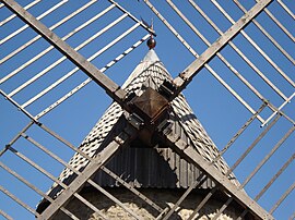 Windmill | |
 Coat of arms | |
show Location of Valiergues | |
 Valiergues | |
| Coordinates: 45°28′47″N 2°17′36″E / 45.4797°N 2.2933°ECoordinates: 45°28′47″N 2°17′36″E / 45.4797°N 2.2933°E | |
| Country | France |
| Region | Nouvelle-Aquitaine |
| Department | Corrèze |
| Arrondissement | Ussel |
| Canton | Haute-Dordogne |
| Intercommunality | Haute-Corrèze Communauté |
| Government | |
| • Mayor (2020–2026) | Daniel Delpy |
| Area 1 | 13.13 km2 (5.07 sq mi) |
| Population (Jan. 2018)[1] | 144 |
| • Density | 11/km2 (28/sq mi) |
| Time zone | UTC+01:00 (CET) |
| • Summer (DST) | UTC+02:00 (CEST) |
| INSEE/Postal code | 19277 /19200 |
| Elevation | 612–720 m (2,008–2,362 ft) |
| 1 French Land Register data, which excludes lakes, ponds, glaciers > 1 km2 (0.386 sq mi or 247 acres) and river estuaries. | |


show This article may be expanded with text translated from the corresponding article in French. (January 2009) Click [show] for important translation instructions. |
Valiergues (French pronunciation: [valjɛʁɡ]; Occitan: Valhergas) is a commune in the Corrèze department in central France.
Geography[]
The Triouzoune forms part of the commune's southwestern boundary.
Population[]
| Year | Pop. | ±% |
|---|---|---|
| 1962 | 83 | — |
| 1968 | 106 | +27.7% |
| 1975 | 109 | +2.8% |
| 1982 | 120 | +10.1% |
| 1990 | 124 | +3.3% |
| 1999 | 121 | −2.4% |
| 2008 | 143 | +18.2% |
See also[]
References[]
- ^ "Populations légales 2018". INSEE. 28 December 2020.
| Wikimedia Commons has media related to Valiergues. |
This Corrèze geographical article is a stub. You can help Wikipedia by . |
Categories:
- Communes of Corrèze
- Corrèze geography stubs