Forgès
Forgès | |
|---|---|
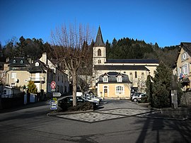 The church and square in Forgès | |
 Coat of arms | |
show Location of Forgès | |
 Forgès | |
| Coordinates: 45°09′23″N 1°52′15″E / 45.1564°N 1.8708°ECoordinates: 45°09′23″N 1°52′15″E / 45.1564°N 1.8708°E | |
| Country | France |
| Region | Nouvelle-Aquitaine |
| Department | Corrèze |
| Arrondissement | Tulle |
| Canton | Argentat-sur-Dordogne |
| Government | |
| • Mayor (2020–2026) | Christiane Cure[1] |
| Area 1 | 10.43 km2 (4.03 sq mi) |
| Population (Jan. 2018)[2] | 270 |
| • Density | 26/km2 (67/sq mi) |
| Time zone | UTC+01:00 (CET) |
| • Summer (DST) | UTC+02:00 (CEST) |
| INSEE/Postal code | 19084 /19380 |
| Elevation | 207–455 m (679–1,493 ft) (avg. 228 m or 748 ft) |
| 1 French Land Register data, which excludes lakes, ponds, glaciers > 1 km2 (0.386 sq mi or 247 acres) and river estuaries. | |


show This article may be expanded with text translated from the corresponding article in French. (January 2009) Click [show] for important translation instructions. |
Forgès is a commune in the Corrèze department in central France.
Population[]
| Year | Pop. | ±% |
|---|---|---|
| 1962 | 403 | — |
| 1968 | 461 | +14.4% |
| 1975 | 375 | −18.7% |
| 1982 | 356 | −5.1% |
| 1990 | 344 | −3.4% |
| 1999 | 319 | −7.3% |
| 2008 | 315 | −1.3% |
See also[]
References[]
- ^ "Répertoire national des élus: les maires". data.gouv.fr, Plateforme ouverte des données publiques françaises (in French). 2 December 2020.
- ^ "Populations légales 2018". INSEE. 28 December 2020.
| Wikimedia Commons has media related to Forgès. |
This Corrèze geographical article is a stub. You can help Wikipedia by . |
Categories:
- Communes of Corrèze
- Corrèze geography stubs