Espartignac
Espartignac | |
|---|---|
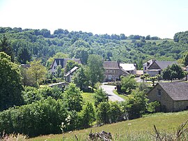 A general view of Espartignac | |
show Location of Espartignac | |
 Espartignac | |
| Coordinates: 45°24′56″N 1°35′47″E / 45.4156°N 1.5964°ECoordinates: 45°24′56″N 1°35′47″E / 45.4156°N 1.5964°E | |
| Country | France |
| Region | Nouvelle-Aquitaine |
| Department | Corrèze |
| Arrondissement | Tulle |
| Canton | Uzerche |
| Intercommunality | Pays d'Uzerche |
| Government | |
| • Mayor (2014–2020) | Françoise Chatégnier |
| Area 1 | 14.03 km2 (5.42 sq mi) |
| Population (Jan. 2018)[1] | 428 |
| • Density | 31/km2 (79/sq mi) |
| Time zone | UTC+01:00 (CET) |
| • Summer (DST) | UTC+02:00 (CEST) |
| INSEE/Postal code | 19076 /19140 |
| Elevation | 292–472 m (958–1,549 ft) (avg. 350 m or 1,150 ft) |
| 1 French Land Register data, which excludes lakes, ponds, glaciers > 1 km2 (0.386 sq mi or 247 acres) and river estuaries. | |


show This article may be expanded with text translated from the corresponding article in French. (January 2009) Click [show] for important translation instructions. |
Espartignac is a commune in the Corrèze department in central France.
Population[]
| Year | Pop. | ±% |
|---|---|---|
| 1962 | 299 | — |
| 1968 | 326 | +9.0% |
| 1975 | 321 | −1.5% |
| 1982 | 344 | +7.2% |
| 1990 | 342 | −0.6% |
| 1999 | 385 | +12.6% |
| 2008 | 381 | −1.0% |
See also[]
References[]
- ^ "Populations légales 2018". INSEE. 28 December 2020.
| Wikimedia Commons has media related to Espartignac. |
This Corrèze geographical article is a stub. You can help Wikipedia by . |
Categories:
- Communes of Corrèze
- Corrèze geography stubs