Chipman Parish, New Brunswick
Chipman | |
|---|---|
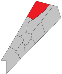 Location within Queens County, New Brunswick. | |
| Country | |
| Province | |
| County | Queens County |
| Erected | 1835 |
| Area | |
| • Land | 483.44 km2 (186.66 sq mi) |
| Population (2016)[1] | |
| • Total | 913 |
| • Density | 1.9/km2 (5/sq mi) |
| • Change 2011-2016 | |
| • Dwellings | 541 |
| Time zone | UTC-4 (AST) |
| • Summer (DST) | UTC-3 (ADT) |
Chipman is a civil parish in Queens County, New Brunswick, Canada.[2]
For governance purposes it is divided between the village of Chipman and the local service district of the parish of Chipman,[3] both of which are members of Regional Service Commission 11 (RSC11).[4]
Origin of name[]
The parish was named for Ward Chipman Jr., Chief Justice of New Brunswick at the time of its erection.[5]
History[]
Chipman was erected in 1835 from Brunswick and Canning Parishes.[6]
In 1855 all of Chipman southeast of Coal Creek was transferred to Waterborough Parish.[7]
In 1896 the boundary with Waterborough was altered, parallelling the Brunswick line from the mouth of North Branch Coal Creek to the county line;[8] the lost territory became part of Waterborough.
Boundaries[]
Chipman Parish is bounded:[2][9][10]
- on the northeast by the Kent County line;
- on the southeast by a line beginning on the county line at a point about 5.5 kilometres southeasterly of Route 116, then running southwesterly along a line parallel to the northwestern line of Brunswick Parish, which is a line running north 54º east[a] from a point on the Saint John River about 1.8 kilometres southwest of the Route 715 bridge over McAlpines Brook, until striking Coal Creek at the southeast angle of a grant to Malcolm Carmichael upstream of the mouth of the South Branch Coal Creek, then down Coal Creek to the Northeast Arm of Grand Lake;
- on the southwest by a line running northwesterly from the Northeast Arm to Indian Point, then across Salmon Bay to strike land northeast of Newcastle Centre, then north 45º west[b] past the Post Road and the old CPR line before turning nearly west and running about 400 metres to the Sunbury County line;
- on the northwest by the Sunbury County line.
Communities[]
Communities at least partly within the parish.[9][10][15] bold indicates an incorporated municipality
- Briggs Corner
- Bronson
- Bronson Settlement
- Camp Wegesegum
- Castaway
- Chipman
- Coal Creek
- Dufferin
- Fowlers Corner
- Gaspereau Forks
- Harley Road
- Iron Bound Cove
- Kings Mines
- Midland
- Redbank
- Salmon Creek
- The Ridge
- Upper Gaspereau
Bodies of water[]
Bodies of water[c] at least partly within the parish.[9][10][15]
- Gaspereau River
- Salmon River
- Castaway Stream
- Iron Bound Cove Stream
- North Forks Stream
- Coal Creek
- Long Creek
- Redbank Creek
- Salmon Creek
- Grand Lake
- Northeast Arm
- Salmon Bay
Islands[]
Islands at least partly within the parish.[9][10][15]
- Curley Island
- Long Island
Other notable places[]
Parks, historic sites, and other noteworthy places at least partly within the parish.[9][10][15]
Demographics[]
Parish population total does not include village of Chipman
Population[]Population trend[16][17][18][1]
|
Language[]Mother tongue (2016)[1]
|
Access Routes[]
Highways and numbered routes that run through the parish, including external routes that start or finish at the parish limits:[19]
See also[]
Notes[]
- ^ By the magnet of 1786, when declination at the starting point was a bit more than 14º west of north.[11]
- ^ By the magnet of 1835,[12] when declination in the area was about 17º west of north.[13] The Territorial Division Act clause referring to magnetic direction bearings was omitted in the 1952[14]
- ^ Not including brooks, ponds or coves.
References[]
- ^ a b c d "Census Profile, 2016 Census: Chipman, Parish [Census subdivision], New Brunswick". Statistics Canada. Retrieved 27 September 2019.
- ^ a b "Chapter T-3 Territorial Division Act". Government of New Brunswick. Retrieved 13 November 2020.
- ^ "New Brunswick Regulation 84-168 under the Municipalities Act (O.C. 84-582)". Government of New Brunswick. Retrieved 19 July 2020.
- ^ "Communities in each of the 12 Regional Service Commissions (RSC) / Les communautés dans chacune des 12 Commissions de services régionaux (CSR)" (PDF), Government of New Brunswick, July 2017, retrieved 2 February 2021
- ^ Ganong, William F. (1896). A Monograph of the Place-Nomenclature of the Province of New Brunswick. Royal Society of Canada. p. 226. Retrieved 17 March 2021.
- ^ "5 Wm. IV c. 23 An Act for erecting parts of the Towns or Parishes of Brunswick and Canning in Queen's County into a separate Town or Parish.". Acts of the General Assembly of His Majesty's Province of New-Brunswick, Passed in the Year 1835. Fredericton: Government of New Brunswick. 1835. p. 31. Retrieved 27 March 2021.
- ^ "18 Vic. c. 50 An Act to alter the division line between the Parishes of Chipman and Waterborough, in Queen's County.". Acts of the General Assembly of Her Majesty's Province of New Brunswick, Passed in the Month of November, 1854, and in the Months of February, March, and April, 1855. Fredericton: Government of New Brunswick. 1855. p. 179. Available as a free ebook from Google Books.
- ^ "59 Vic. c. 8 An Act to Revise and Codify an Act to Provide for the Division of the Province into Counties, Towns and Parishes.". Acts of the General Assembly of Her Majesty's Province of New Brunswick. Passed in the Month of March, 1896. Fredericton: Government of New Brunswick. 1896. pp. 86–123. Available as a free ebook from Google Books.
- ^ a b c d e "No. 96". Provincial Archives of New Brunswick. Department of Natural Resources and Energy Development. Retrieved 19 June 2021. Remainder of parish on maps 106, 107, 116, and 117 at same site.
- ^ a b c d e "296" (PDF). Transportation and Infrastructure. Government of New Brunswick. Retrieved 19 June 2021. Remainder of parish on mapbooks 297, 313–315, 331–333, and 353 at same site.
- ^ "Historical Magnetic Declination". National Oceanic and Atmospheric Administration. Retrieved 26 April 2021.
- ^ "5 Wm. IV c. 23 An Act for erecting parts of the Towns or Parishes of Brunswick and Canning in Queen's County into a separate Town or Parish.". Acts of the General Assembly of His Majesty's Province of New-Brunswick, Passed in the Year 1835. Fredericton: Government of New Brunswick. 1835. p. 31. Retrieved 27 March 2021.
- ^ "Historical Magnetic Declination". National Oceanic and Atmospheric Administration. Retrieved 25 April 2021.
- ^ "Chapter 227 Territorial Division Act". The Revised Statutes of New Brunswick 1952 Volume III. Fredericton: Government of New Brunswick. 1952. pp. 3725–3771.
- ^ a b c d "Search the Canadian Geographical Names Database (CGNDB)". Government of Canada. Retrieved 6 July 2021.
- ^ Statistics Canada: 2001, 2006 census
- ^ Profile: Chipman Parish, New Brunswick
- ^ 2011 Statistics Canada Census Profile: Chipman Parish, New Brunswick
- ^ Atlantic Canada Back Road Atlas ISBN 978-1-55368-618-7
Places adjacent to Chipman Parish, New Brunswick | |
|---|---|
| Subdivisions |
|
|---|---|
| Cities | |
| Counties | |
| |

- Parishes of Queens County, New Brunswick
- Local service districts of Queens County, New Brunswick