Canning Parish, New Brunswick
Canning | |
|---|---|
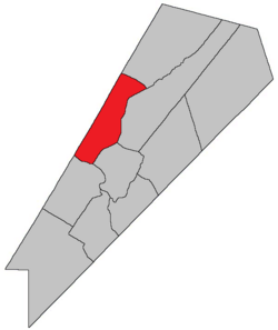 Location within Queens County, New Brunswick. | |
| Country | |
| Province | |
| County | Queens County |
| Erected | 1827 |
| Area | |
| • Land | 174.38 km2 (67.33 sq mi) |
| Population (2016)[1] | |
| • Total | 924 |
| • Density | 5.3/km2 (14/sq mi) |
| • Change 2011-2016 | |
| • Dwellings | 755 |
| Time zone | UTC-4 (AST) |
| • Summer (DST) | UTC-3 (ADT) |
Canning is a civil parish in Queens County, New Brunswick, Canada.[2]
For governance purposes it is divided between the village of Minto and the local service district of the parish of Canning,[3] both of which are members of Regional Service Commission 11 (RSC11).[4]
Origin of name[]
The parish was probably named in honour of George Canning, British Secretary of State for Foreign Affairs and Leader of the House of Commons at the time.[5] Shortly after the parish's erection Canning became Prime Minister of the United Kingdom.
History[]
Canning was erected in 1827 from Waterborough Parish.[6]
In 1835 the northwestern part of Canning was included in the newly erected Chipman Parish.[7]
Boundaries[]
Canning is bounded:[2][8][9][10]
- on the northeast by a line beginning on the Sunbury County line about 400 metres north-northeasterly of Minto, then running east-southeasterly for about 1.2 km before turning to run south 45º east[a] to Salmon Bay, then in a direct line to Indian Point, then into the Northeast Arm of Grand Lake;
- on the southeast by a line through Grand Lake, passing through Northeast Arm and west of Goat Island, then through the isthmus to the Saint John River, passing east of the Route 2 interchange with Route 105 and Conservation Road;
- on the southwest by the Saint John River;
- on the northwest by the Sunbury County line.
Communities[]
Communities at least partly within the parish.[8][9][10] bold indicates an incorporated municipality
- Clarks Corners
- Douglas Harbour
- Flowers Cove
- Maquapit Lake
- Newcastle Centre
- Newcastle Creek
- Princess Park
- Scotchtown
- Minto
- Newcastle Bridge
- Rothwell
- South Minto
Bodies of water[]
Bodies of water[b] at least partly within the parish.[8][9][10]
- Grand Lake Little River
- Saint John River
- Baltimore Stream
- Main Thoroughfare
- Newcastle Creek
- Otter Creek
- Coys Gut
- Back Lake
- Lower Timber Lake
- Maquapit Lake
- The Keyhole
- Grand Lake
- Douglas Harbour
- Newcastle Bay
- Northeast Arm
- Salmon Bay
Islands[]
Islands at least partly within the parish.[8][9][10]
- Hunters Island
- Marshalls Island
- Thatch Island
- Grand Point Bar
Other notable places[]
Parks, historic sites, and other noteworthy places at least partly within the parish.[8][9][10][14]
- Grand Lake Protected Natural Area
- Pickerel Pond Nature Preserve
Demographics[]
Parish population total does not portion within Minto
Population[]Population trend[15][16][17][1]
|
Language[]Mother tongue (2016)[1]
|
Access Routes[]
Highways and numbered routes that run through the parish, including external routes that start or finish at the parish limits:[18]
|
|
|
|
See also[]
Notes[]
References[]
- ^ a b c d "Census Profile, 2016 Census Canning, Parish [Census subdivision], New Brunswick". Statistics Canada. Retrieved September 27, 2019.
- ^ a b c "Chapter T-3 Territorial Division Act". Government of New Brunswick. Retrieved 13 November 2020.
- ^ "New Brunswick Regulation 84-168 under the Municipalities Act (O.C. 84-582)". Government of New Brunswick. Retrieved 19 July 2020.
- ^ "Communities in each of the 12 Regional Service Commissions (RSC) / Les communautés dans chacune des 12 Commissions de services régionaux (CSR)" (PDF), Government of New Brunswick, July 2017, retrieved 2 February 2021
- ^ Ganong, William F. (1896). A Monograph of the Place-Nomenclature of the Province of New Brunswick. Royal Society of Canada. p. 224. Retrieved 17 March 2021.
- ^ "8 Geo. IV c. 12 An Act for erecting the North-western part of the Town or Parish of Waterborough, in Queens County, into a separate Town or Parish.". Acts of the General Assembly of His Majesty's Province of New-Brunswick, Passed in the Year 1827. Fredericton: Government of New Brunswick. 1827. pp. 26–27. Retrieved 27 March 2021.
- ^ "5 Wm. IV c. 23 An Act for erecting parts of the Towns or Parishes of Brunswick and Canning in Queen's County into a separate Town or Parish.". Acts of the General Assembly of His Majesty's Province of New-Brunswick, Passed in the Year 1835. Fredericton: Government of New Brunswick. 1835. p. 31. Retrieved 27 March 2021.
- ^ a b c d e "No. 116". Provincial Archives of New Brunswick. Department of Natural Resources and Energy Development. Retrieved 19 June 2021. Remainder of parish on maps 127 and 128 at same site.
- ^ a b c d e "331" (PDF). Transportation and Infrastructure. Government of New Brunswick. Retrieved 19 June 2021. Remainder of parish on mapbooks 332, 352, 353, 372, 373, 392, and 393 at same site.
- ^ a b c d e "Search the Canadian Geographical Names Database (CGNDB)". Government of Canada. Retrieved 19 June 2021.
- ^ "5 Wm. IV c. 23 An Act for erecting parts of the Towns or Parishes of Brunswick and Canning in Queen's County into a separate Town or Parish.". Acts of the General Assembly of His Majesty's Province of New-Brunswick, Passed in the Year 1835. Fredericton: Government of New Brunswick. 1835. p. 31. Retrieved 27 March 2021.
- ^ "Historical Magnetic Declination". National Oceanic and Atmospheric Administration. Retrieved 25 April 2021.
- ^ "Chapter 227 Territorial Division Act". The Revised Statutes of New Brunswick 1952 Volume III. Fredericton: Government of New Brunswick. 1952. pp. 3725–3771.
- ^ "Explore New Brunswick's Protected Natural Areas". GeoNB. Retrieved 2 July 2021.
- ^ Statistics Canada: 2001, 2006 census
- ^ Profile: Canning Parish, New Brunswick
- ^ 2011 Statistics Canada Census Profile: Canning Parish, New Brunswick
- ^ Atlantic Canada Back Road Atlas ISBN 978-1-55368-618-7
Places adjacent to Canning Parish, New Brunswick | |
|---|---|
| Subdivisions |
|
|---|---|
| Cities | |
| Counties | |
| |

- Parishes of Queens County, New Brunswick
- Local service districts of Queens County, New Brunswick