Culberson, North Carolina
Culberson, North Carolina | |
|---|---|
Unincorporated community | |
 Houses in Culberson | |
 Culberson | |
| Coordinates: 34°59′30″N 84°10′04″W / 34.99167°N 84.16778°WCoordinates: 34°59′30″N 84°10′04″W / 34.99167°N 84.16778°W | |
| Country | United States |
| State | North Carolina |
| County | Cherokee |
| Elevation | 1,627 ft (496 m) |
| Time zone | UTC-5 (Eastern (EST)) |
| • Summer (DST) | UTC-4 (EDT) |
| ZIP code | 28903 |
| Area code(s) | 828 |
| GNIS feature ID | 1010605[1] |


Culberson is an unincorporated community in Cherokee County, North Carolina, United States. Culberson is located on North Carolina Highway 60 near the Georgia state line, 10 miles (16 km) southwest of Murphy. Culberson has a post office with ZIP code 28903.[2][3] Culberson is also home to a store, a few churches, a flea market, a local winery, several family-owned businesses, and a gas station on the NC/GA state line.
History[]
Culberson once had a railroad depot and a train that ran from Atlanta to Murphy. The railroad company also operated a hotel in Culberson in the early 1900s. Logging and farming were early forms of employment to the area.
Education[]
Students K-8 attend Ranger Elementary/Middle School.
Religion[]
Places of worship[]
- Cornerstone Baptist Church
- Culberson Baptist Church
- Mt. Pleasant Baptist Church
Nearby communities[]
- Murphy, North Carolina (10 miles (16 km) northeast)
- Mineral Bluff, Georgia (8 miles (13 km) southwest}
References[]
- ^ "Culberson". Geographic Names Information System. United States Geological Survey.
- ^ United States Postal Service (2012). "USPS - Look Up a ZIP Code". Retrieved 2012-02-15.
- ^ "Postmaster Finder - Post Offices by ZIP Code". United States Postal Service. Retrieved March 16, 2013.
Municipalities and communities of Cherokee County, North Carolina, United States | ||
|---|---|---|
| Towns | 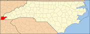 | |
| CDP | ||
| Other communities | ||
| Indian reservation | ||
| Footnotes | ‡This populated place also has portions in an adjacent county or counties | |
| ||
Categories:
- Unincorporated communities in Cherokee County, North Carolina
- Unincorporated communities in North Carolina
- Western North Carolina geography stubs