Unaka, North Carolina
Unaka, North Carolina | |
|---|---|
Unincorporated community | |
 Unaka | |
| Coordinates: 35°11′43″N 84°08′30″W / 35.19528°N 84.14167°WCoordinates: 35°11′43″N 84°08′30″W / 35.19528°N 84.14167°W | |
| Country | United States |
| State | North Carolina |
| County | Cherokee |
| Elevation | 1,644 ft (501 m) |
| Time zone | UTC-5 (Eastern (EST)) |
| • Summer (DST) | UTC-4 (EDT) |
| Area code(s) | 828 |
| GNIS feature ID | 1023032[1] |


Unaka is an unincorporated community in Cherokee County, North Carolina, United States. Unaka is located in the Nantahala National Forest 9.6 miles (15.4 km) northwest of Murphy. Unaka had a post office until it closed on February 15, 1986.[2][3] Unaka is a name derived from a Cherokee word meaning "white", which referred to the appearance of low-lying clouds and fog over the Unicoi Mountains.[4]
References[]
- ^ "Unaka". Geographic Names Information System. United States Geological Survey.
- ^ United States Postal Service (2012). "USPS - Look Up a ZIP Code". Retrieved 2012-02-15.
- ^ "Postmaster Finder - Post Offices by ZIP Code". United States Postal Service. Retrieved March 16, 2013.
- ^ "Community Backstory". Cherokee County Chamber of Commerce. Archived from the original on 3 July 2019. Retrieved 3 July 2019.
Municipalities and communities of Cherokee County, North Carolina, United States | ||
|---|---|---|
| Towns | 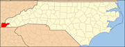 | |
| CDP | ||
| Other communities | ||
| Indian reservation | ||
| Footnotes | ‡This populated place also has portions in an adjacent county or counties | |
| ||
Categories:
- Unincorporated communities in Cherokee County, North Carolina
- Unincorporated communities in North Carolina
- Western North Carolina geography stubs