Hiwassee, North Carolina
| Hiwassee Reservoir | |
|---|---|
 Reservoir from atop the Hiwassee dam | |
 Hiwassee Reservoir | |
| Location | Cherokee County, North Carolina, United States |
| Coordinates | 35°09′10″N 084°10′41″W / 35.15278°N 84.17806°W |
| Type | reservoir |
| Primary inflows | Hiwassee River |
| Primary outflows | Hiwassee River |
| Basin countries | United States |
| Average depth | 142 ft (44 m) |
| Max. depth | 309 ft (94 m) |
| Water volume | 205,590 acre⋅ft (0.25359 km3) |
| Surface elevation | 1,521 ft (464 m) [1] |


Hiwassee is a small village in Cherokee County, North Carolina, which sits next to the Hiwassee Dam and the artificially created Hiwassee Reservoir, on Hiwassee River.
Hiwassee Dam[]
The Dam itself was constructed between 1936 and 1940 by the Tennessee Valley Authority as part of Roosevelt's New Deal policy. Hiwassee Dam is still maintained by the TVA. It has a height of 307 feet, spans a distance of 1,376 across the Hiwassee River and produce 185,000 kilowatts of electricity.
Hiwassee Dam was the world's tallest "overflow" dam until the completion of the Aswan High Dam on the Nile River in Egypt in the early 1970s. The depth from the top of the spillgates to the bedrock at the face of the dam is 285 feet.
Hiwassee Reservoir[]
The reservoir serves recreational, power generation and flood control purposes. It is beautifully situated surrounded by the Nantahala and Cherokee National Forests and almost right next to the . Both reservoirs are important for local wildlife such as deer. The reservoir is relatively shallow with an average depth of 142 ft (44 m) and can exceed depths of 200 ft in places.[2]
References[]
- ^ https://www.weather.gov/ffc/rrm
- ^ "Lake Hiwassee in Cherokee County - Western North Carolina Mountains". theblueridgehighlander.com. Retrieved 2017-06-20.
External links[]
- Hiwassee Reservoir - TVA
- [1]
Coordinates: 35°09′51″N 84°15′15″W / 35.16417°N 84.25417°W
| hide Municipalities and communities of Cherokee County, North Carolina, United States | ||
|---|---|---|
| Towns | 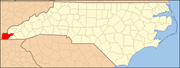 | |
| CDP | ||
| Other communities | ||
| Indian reservation | ||
| Footnotes | ‡This populated place also has portions in an adjacent county or counties | |
| ||
| Authority control |
|---|
- Hiwassee River
- Populated places on the Hiwassee River
- Protected areas of Cherokee County, North Carolina
- Tennessee Valley Authority
- Reservoirs in North Carolina
- Nantahala National Forest
- Cherokee National Forest
- Landforms of Cherokee County, North Carolina