Dracy
Dracy | |
|---|---|
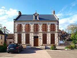 The town hall in Dracy | |
show Location of Dracy | |
 Dracy | |
| Coordinates: 47°45′31″N 3°15′05″E / 47.7586°N 3.2514°ECoordinates: 47°45′31″N 3°15′05″E / 47.7586°N 3.2514°E | |
| Country | France |
| Region | Bourgogne-Franche-Comté |
| Department | Yonne |
| Arrondissement | Auxerre |
| Canton | Cœur de Puisaye |
| Area 1 | 21.86 km2 (8.44 sq mi) |
| Population (Jan. 2018)[1] | 225 |
| • Density | 10/km2 (27/sq mi) |
| Time zone | UTC+01:00 (CET) |
| • Summer (DST) | UTC+02:00 (CEST) |
| INSEE/Postal code | 89147 /89130 |
| Elevation | 168–264 m (551–866 ft) |
| 1 French Land Register data, which excludes lakes, ponds, glaciers > 1 km2 (0.386 sq mi or 247 acres) and river estuaries. | |


Dracy is a commune in the Yonne department in Bourgogne-Franche-Comté in north-central France.
Geography[]
The Ouanne River forms part of the commune's eastern border, flows north-westward through the north-eastern part of the commune, crosses the village and forms part of its northern border.
See also[]
References[]
- ^ "Populations légales 2018". INSEE. 28 December 2020.
| Wikimedia Commons has media related to Dracy. |
This Yonne geographical article is a stub. You can help Wikipedia by . |
Categories:
- Communes of Yonne
- Yonne geography stubs