Dumfries Parish, New Brunswick
Dumfries | |
|---|---|
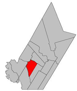 Location within York County, New Brunswick. | |
| Coordinates: 45°57′54″N 67°09′00″W / 45.965°N 67.15°W | |
| Country | |
| Province | |
| County | York |
| Erected | 1833 |
| Area | |
| • Land | 302.72 km2 (116.88 sq mi) |
| Population (2016)[1] | |
| • Total | 356 |
| • Density | 1.2/km2 (3/sq mi) |
| • Change 2011-2016 | |
| • Dwellings | 334 |
| Time zone | UTC-4 (AST) |
| • Summer (DST) | UTC-3 (ADT) |

Dumfries is a civil parish in York County, New Brunswick, Canada.[2]
For governance purposes it forms the local service district of the parish of Dumfries,[3] which is a member of Regional Service Commission 11 (RSC11).[4]
Origin of name[]
The parish may have been named in honour of Capt. Adam Allen, a Loyalist born in Dumfries, Scotland, who settled at the mouth of the Pokiok River.[5]
History[]
Dumfries was erected in 1833 from Prince William Parish. and that part of Woodstock Parish south of the Carleton County line.[6]
In 1834 the county line was altered to follow grant lines when it neared the Saint John River, transferring several small areas between Dumfries and Woodstock.[7]
In 1836 the Saint John River islands in front of Dumfries were formally added to the parish,[8] correcting an oversight in the legislation erecting Dumfries.
In 1850 Big and Little Coac Islands were removed from Dumfries.[9]
In 1855 the western part of Dumfries was erected as Canterbury Parish.[10]
In 1895 the rear of Dumfries was included in the newly erected McAdam Parish.[11]
In 1973 the islands in the Saint John River were removed from the parish.[12] The islands were flooded by the Mactaquac Dam.
Boundaries[]
Dumfries Parish is bounded:[2][13][14]
- on the northeast by the Saint John River;
- on the southeast by the southeastern line of a lot within a six-lot grant to St. Clement's Church in Dumfries on the Saint John River, about 300 metres upriver of Rosborough Settlement Road, then along the prolongation of the grant line to the southern line of a grant to Arthur Henry on the western side of Duck Brook, west of Magaguadavic Lake, then westerly to the southwestern corner of the Henry grant;
- on the southwest by a large grant to the New Brunswick and Canada Railway and Land Company northeast of McAdam, then northerly along the railway grant and the prolongation of its eastern line to Shogomoc Lake, then running north-northwesterly along grant lines to a point about 825 metres east of Moon Pond;
- on the northwest by a line paralleling the southeastern line of the parish from east of Moon Pond to the southwestern corner of a grant to John Benn, which straddles Allandale Road, then along the Benn grant to the Saint John River.
Governance[]
The entire parish forms the local service district of the parish of Dumfries, established in 1966 to assess for fire protection. Community services were added to the assessment in 1967 and first aid and ambulance services in 1978.
Communities[]
Communities at least partly within the parish.[13][14][15] italics indicate a name no longer in official use
Bodies of water[]
Bodies of water[a] at least partly within the parish.[13][14][15]
- Saint John River
- Coac Reach
- Nackawic Bend
- Pokiok Reach
- Little Pokiok Stream
- Pokiok Stream
- Big Deadwater
- Little Magaguadavic Throughway
- Little Magaguadavic Lake
- Magaguadavic Lake
- more than ten other officially named lakes
Other notable places[]
Parks, historic sites, and other noteworthy places at least partly within the parish.[13][14][15][16]
- Pokiok Stream Protected Natural Area
Demographics[]
Population[]Population trend[17][18][19][1]
|
Language[]Mother tongue (2016)[1]
|
See also[]
Notes[]
- ^ Not including brooks, ponds or coves.
References[]
- ^ a b c d "Census Profile, 2016 Census Dumfries, Parish [Census subdivision], New Brunswick". Statistics Canada. Retrieved October 7, 2019.
- ^ a b "Chapter T-3 Territorial Division Act". Government of New Brunswick. Retrieved 13 November 2020.
- ^ "New Brunswick Regulation 84-168 under the Municipalities Act (O.C. 84-582)". Government of New Brunswick. Retrieved 25 July 2020.
- ^ "Communities in each of the 12 Regional Service Commissions (RSC) / Les communautés dans chacune des 12 Commissions de services régionaux (CSR)" (PDF), Government of New Brunswick, July 2017, retrieved 2 February 2021
- ^ Ganong, William F. (1896). A Monograph of the Place-Nomenclature of the Province of New Brunswick. Royal Society of Canada. p. 231. Retrieved 17 March 2021.
- ^ "3 Wm. IV c. 38 An Act to alter the Names of certain Parts of Three Parishes in the County of York, and to erect Two separate Parishes therein.". Acts of the General Assembly of His Majesty's Province of New Brunswick, Passed in the Year 1833. Fredericton: Government of New Brunswick. 1833. pp. 181–182. Retrieved 27 March 2021.
- ^ "4 Wm. IV c. 28 An Act to alter the Division Line between the Counties of York and Carleton.". Acts of the General Assembly of His Majesty's Province of New Brunswick, Passed in the Year 1834. Fredericton: Government of New Brunswick. 1834. pp. 71–72. Retrieved 27 March 2021.
- ^ "6 Wm. IV c. 45 An Act to amend and explain an Act, intituled An Act to alter the names of certain parts of three Parishes in the County of York, and to erect two separate Parishes therein.". Acts of the General Assembly of His Majesty's Province of New Brunswick, Passed in the Year 1836. Fredericton: Government of New Brunswick. 1836. p. 118. Retrieved 27 March 2021.
- ^ "13 Vic. c. 51 An Act to consolidate all the Laws now in force for the division of the Province into Counties, Towns and Parishes.". Acts of the General Assembly of Her Mjaesty's Province of New Brunswick, Passed in the Year 1850. Fredericton: Government of New Brunswick. 1850. pp. 142–152, 145–149. Retrieved 27 March 2021. Book was poorly proofread, resulting in title typo and reuse of page numbers 145–152.
- ^ "18 Vic. c. 45 An Act to erect a part of the Parish of Dumfries, in the County of York, into a separate Town or Parish.". Acts of the General Assembly of Her Majesty's Province of New Brunswick, Passed in the Month of November, 1854, and in the Months of February, March, and April, 1855. Fredericton: Government of New Brunswick. 1855. pp. 174–175. Available as a free ebook from Google Books.
- ^ "57 Vic. c. 34 An Act to erect part of the Parishes of Prince William and Dumfries, in the County of York, into a separate Parish.". Acts of the General Assembly of Her Majesty's Province of New Brunswick. Passed in the Month of April, 1894. Fredericton: Government of New Brunswick. 1894. pp. 157–160. Available as a free ebook from Google Books.
- ^ "Chapter T-3 Territorial Division Act". Revised Statutes of New Brunswick 1973 Volume IV. Fredericton: Government of New Brunswick. 1973. pp. 1–70. The original printed version is cited separately to distinguish it from the edited version available online.
- ^ a b c d "No. 124". Provincial Archives of New Brunswick. Department of Natural Resources and Energy Development. Retrieved 25 June 2021. Remainder of parish on maps 125, 135, and 136 at same site.
- ^ a b c d "367" (PDF). Transportation and Infrastructure. Government of New Brunswick. Retrieved 25 June 2021. Remainder of parish on mapbooks 368, 387, 388, 406, and 407 at same site.
- ^ a b c "Search the Canadian Geographical Names Database (CGNDB)". Government of Canada. Retrieved 3 July 2021.
- ^ "Explore New Brunswick's Protected Natural Areas". GeoNB. Retrieved 3 July 2021.
- ^ Statistics Canada: 1996, 2001, 2006 census
- ^ 2006 Statistics Canada Community Profile: Dumfries Parish, New Brunswick
- ^ 2011 Statistics Canada Census Profile: Dumfries Parish, New Brunswick
Places adjacent to Dumfries Parish, New Brunswick | |
|---|---|
| Subdivisions |
|
|---|---|
| Cities | |
| Counties | |
| |
Coordinates: 45°57′54″N 67°09′00″W / 45.96500°N 67.15000°W
- Parishes of York County, New Brunswick
- Local service districts of York County, New Brunswick