Southampton Parish, New Brunswick
Southampton | |
|---|---|
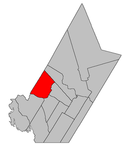 Location within York County, New Brunswick. | |
| Coordinates: 45°58′03″N 67°15′00″W / 45.9675°N 67.25°W | |
| Country | |
| Province | |
| County | York |
| Erected | 1833 |
| Area | |
| • Land | 450.04 km2 (173.76 sq mi) |
| Population (2016)[1] | |
| • Total | 1,484 |
| • Density | 3.3/km2 (9/sq mi) |
| • Change 2011-2016 | |
| • Dwellings | 719 |
| Time zone | UTC-4 (AST) |
| • Summer (DST) | UTC-3 (ADT) |

Southampton is a civil parish in York County, New Brunswick, Canada.[2]
For governance purposes it is divided between the town of Nackawic, the village of Millville, and the local service district of the parish of Southampton,[3] all of which are members of Regional Service Commission 11 (RSC11).[4]
Origin of name[]
When Carleton County was erected in 1832 the new county line went through Northampton Parish. The next year the part of Northampton south of the line was erected as Southampton.[5]
History[]
Southampton was erected in 1833 from the part of Northampton Parish that was southeast of the Carleton County line.[5]
In 1834 the county line was altered to run along grant lines, adding territory to Southampton.[6]
In 1865 the boundary with Queensbury Parish was altered, removing territory east of the East Branch Nackawic Stream.[7]
Boundaries[]
Southampton Parish is bounded:[2][8][9]
- on the northeast beginning on the Carleton County line about 600 metres northeasterly of Route 104, on the prolongation the central line of a two-lot grant to Jonathan Williams on the Saint John River, then running southeasterly along the prolongation to the Burnt Lake Branch;
- on the southeast by a line running down the Burnt Lake Branch and the East Branch Nackawic Stream to the northeastern line of a grant to John Morehouse, about 2.4 kilometres easterly of the junction of Caverhill Siding Road with Route 605, then southeasterly about 1.2 kilometres and southwesterly about 275 metres along the Morehouse grant to the prolongation of the southeastern line of a grant to William Dobie, then southeasterly about 675 metres along the Dobie grant to the prolongation of the southeastern line of a large grant to Captain Joseph Cunliffe, then southwesterly along the Cunliffe grant, striking the Saint John River about 150 metres downstream of the mouth of Quigg Brook, then up the Saint John;
- on the south by the Saint John River;
- on the northwest by the Carleton County line.
Communities[]
Communities at least partly within the parish.[8][9][10]
- Bates Settlement
- Bull Lake
- Campbell Settlement
- Caverhill
- Central Waterville
- Clarkville
- County Line
- East Waterville
- Hainesville
- Hartfield
- Hawkins Corner
- Maple Ridge
- Maplewood
- Middle Southampton
- Millville
- Nackawic
- Nortondale
- Pinder
- Ritchie
- Rossville
- South Waterville
- Southampton
- Southampton Junction
- Temperance Vale
- Temple
- Upper Southampton
- West Waterville
- Woodman
- Woodstock Road
Bodies of water[]
Bodies of water[a] at least partly within the parish.[8][9][10]
- Saint John River
- Meductic Reach
- Pokiok Reach
- Burnt Lake Branch
- Nackawic Stream
- Bulls Creek
- Farnhams Creek
- Gibson Creek
- Greer Creek
- Bull Lake
- Mactaquac Lake
- more than a half-dozen other officially named lakes
Other notable places[]
Parks, historic sites, and other noteworthy places at least partly within the parish.[8][9][10][11]
- Ayers Lake Stream Protected Natural Area
- Becaguimec Wildlife Management Area[12]
- Carr Falls Brook Protected Natural Area
- Greer Creek Protected Natural Area
- Woodman Protected Natural Area
Demographics[]
Parish population total does not include Millville and Nackawic
Population[]Population trend[13][14][15][1]
|
Language[]Mother tongue (2016)[1]
|
See also[]
Notes[]
- ^ Not including brooks, ponds or coves.
References[]
- ^ a b c d "Census Profile, 2016 Census: Southampton, Parish [Census subdivision], New Brunswick". Statistics Canada. Retrieved August 28, 2019.
- ^ a b "Chapter T-3 Territorial Division Act". Government of New Brunswick. Retrieved 13 November 2020.
- ^ "New Brunswick Regulation 84-168 under the Municipalities Act (O.C. 84-582)". Government of New Brunswick. Retrieved 25 July 2020.
- ^ "Communities in each of the 12 Regional Service Commissions (RSC) / Les communautés dans chacune des 12 Commissions de services régionaux (CSR)" (PDF), Government of New Brunswick, July 2017, retrieved 2 February 2021
- ^ a b "3 Wm. IV c. 38 An Act to alter the Names of certain Parts of Three Parishes in the County of York, and to erect Two separate Parishes therein.". Acts of the General Assembly of His Majesty's Province of New Brunswick, Passed in the Year 1833. Fredericton: Government of New Brunswick. 1833. pp. 181–182. Retrieved 27 March 2021.
- ^ "4 Wm. IV c. 28 An Act to alter the Division Line between the Counties of York and Carleton.". Acts of the General Assembly of His Majesty's Province of New Brunswick, Passed in the Year 1834. Fredericton: Government of New Brunswick. 1834. pp. 71–72. Retrieved 27 March 2021.
- ^ "28 Vic. c. 52 An Act to alter and the division line between the Parishes of Queensbury and Southampton in the County of York.". Acts of the General Assembly of Her Majesty's Province of New Brunswick, Passed in the Months of May & June 1865. Fredericton: Government of New Brunswick. 1865. pp. 150–151. Retrieved 27 March 2021.
- ^ a b c d "No. 102". Provincial Archives of New Brunswick. Department of Natural Resources and Energy Development. Retrieved 25 June 2021. Remainder of parish on maps 112, 113, and 124 at same site.
- ^ a b c d "306" (PDF). Transportation and Infrastructure. Government of New Brunswick. Retrieved 25 June 2021. Remainder of parish on mapbooks 324–326, 345–347, 366, and 367 at same site.
- ^ a b c "Search the Canadian Geographical Names Database (CGNDB)". Government of Canada. Retrieved 3 July 2021.
- ^ "Explore New Brunswick's Protected Natural Areas". GeoNB. Retrieved 3 July 2021.
- ^ "New Brunswick Regulation 94-43 under the Fish and Wildlife Act (O.C. 94-231)". Government of New Brunswick. 5 June 2006. Retrieved 8 July 2021.
- ^ Statistics Canada: 1996, 2001, 2006, 2011 census
- ^ 2006 Statistics Canada Community Profile: Southampton Parish, New Brunswick
- ^ 2011 Statistics Canada Census Profile: Southampton Parish, New Brunswick
Places adjacent to Southampton Parish, New Brunswick | |
|---|---|
| Subdivisions |
|
|---|---|
| Cities | |
| Counties | |
| |
Coordinates: 45°58′03″N 67°15′00″W / 45.96750°N 67.25000°W
- Parishes of York County, New Brunswick