Fay-sur-Lignon
Fay-sur-Lignon | |
|---|---|
Commune | |
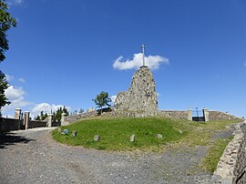 Vocanic dike | |
 Coat of arms | |
show Location of Fay-sur-Lignon | |
 Fay-sur-Lignon | |
| Coordinates: 44°59′14″N 4°13′38″E / 44.9872°N 4.2272°ECoordinates: 44°59′14″N 4°13′38″E / 44.9872°N 4.2272°E | |
| Country | France |
| Region | Auvergne-Rhône-Alpes |
| Department | Haute-Loire |
| Arrondissement | Le Puy-en-Velay |
| Canton | Mézenc |
| Government | |
| • Mayor (2020–2026) | Christian Chorliet |
| Area 1 | 13.24 km2 (5.11 sq mi) |
| Population (Jan. 2018)[1] | 357 |
| • Density | 27/km2 (70/sq mi) |
| Time zone | UTC+01:00 (CET) |
| • Summer (DST) | UTC+02:00 (CEST) |
| INSEE/Postal code | 43092 /43430 |
| Elevation | 1,079–1,380 m (3,540–4,528 ft) |
| 1 French Land Register data, which excludes lakes, ponds, glaciers > 1 km2 (0.386 sq mi or 247 acres) and river estuaries. | |


Fay-sur-Lignon (French pronunciation: [fɛ syʁ liɲɔ̃], literally Fay on Lignon; Occitan: Fai) is a commune in the Haute-Loire department in south-central France.
Geography[]
The river Lignon du Velay flows through the commune.
Population[]
| Year | Pop. | ±% |
|---|---|---|
| 1793 | 702 | — |
| 1806 | 500 | −28.8% |
| 1821 | 834 | +66.8% |
| 1831 | 879 | +5.4% |
| 1841 | 803 | −8.6% |
| 1851 | 924 | +15.1% |
| 1861 | 811 | −12.2% |
| 1872 | 810 | −0.1% |
| 1881 | 1,238 | +52.8% |
| 1891 | 1,219 | −1.5% |
| 1901 | 1,216 | −0.2% |
| 1911 | 1,066 | −12.3% |
| 1921 | 1,021 | −4.2% |
| 1931 | 933 | −8.6% |
| 1946 | 860 | −7.8% |
| 1954 | 756 | −12.1% |
| 1962 | 656 | −13.2% |
| 1968 | 621 | −5.3% |
| 1975 | 527 | −15.1% |
| 1982 | 480 | −8.9% |
| 1990 | 441 | −8.1% |
| 1999 | 399 | −9.5% |
| 2008 | 429 | +7.5% |
| 2017 | 363 | −15.4% |
See also[]
References[]
- ^ "Populations légales 2018". INSEE. 28 December 2020.
| Wikimedia Commons has media related to Fay-sur-Lignon. |
| show Authority control |
|---|
This Haute-Loire geographical article is a stub. You can help Wikipedia by . |
Categories:
- Communes of Haute-Loire
- Haute-Loire geography stubs