Fort Payne, Alabama
Fort Payne | |
|---|---|
 Gault Avenue in downtown Fort Payne | |
| Nickname(s): Official Sock Capital of the World | |
 Location of Fort Payne in DeKalb County, Alabama. | |
| Coordinates: 34°27′13″N 85°42′23″W / 34.45361°N 85.70639°WCoordinates: 34°27′13″N 85°42′23″W / 34.45361°N 85.70639°W | |
| Country | United States |
| State | Alabama |
| County | DeKalb |
| Government | |
| • Type | Mayor-Council (5 members) |
| • Mayor | Brian Baine |
| Area | |
| • Total | 56.54 sq mi (146.43 km2) |
| • Land | 56.18 sq mi (145.51 km2) |
| • Water | 0.36 sq mi (0.92 km2) |
| Elevation | 906 ft (276 m) |
| Population (2020) | |
| • Total | 14,877 |
| • Density | 263.12/sq mi (101.60/km2) |
| Time zone | UTC-6 (Central (CST)) |
| • Summer (DST) | UTC-5 (CDT) |
| ZIP code | 35967-35968 |
| Area code(s) | 256 |
| FIPS code | 01-27616 |
| GNIS feature ID | 0150235 |
| Website | www |

Fort Payne is a city in and county seat of DeKalb County, in northeastern Alabama, United States. At the 2010 census, the population was 14,012.[2]
European-American settlers gradually developed the settlement around the former fort. It grew rapidly in the late 19th century based on industrial resources and manufacturing increasing in the early 20th centuries. At the beginning of the 21st century, it still had 7000 workers in 100 mills producing varieties of socks, nearly half the world production.
History[]
In the late 18th and early 19th centuries, this was the site of Willstown, an important Cherokee town. For a time it was the home of Sequoyah, a silversmith who by 1821 created the Cherokee syllabary, one of the few writing systems created by an individual from a pre-literate culture.[3] In Alabama, his people soon started publishing the first newspaper in Cherokee and English, The Cherokee Phoenix.[3]
This settlement was commonly called Willstown after its headman, Will Weber, who had striking red hair. He was the son of Cherokee and German parents. John Norton, a man born in Scotland about 1770 to Scottish and Cherokee parents, visited this area and other parts of the Cherokee homeland in 1809-1810. He had come to North America as a British soldier and became close to Mohawk people at the Grand River Reserve in Ontario, where he served as an interpreter.[4]
During the 1830s prior to Indian removal, the US Army under command of Major John Payne built a fort near Willstown to intern Cherokee from Alabama until they were forcibly removed to Indian Territory (now Oklahoma). Their forced exile became known as the Trail of Tears. Only a chimney of Fort Payne still stands in the downtown of the city that developed around it.
19th-20th century growth[]

Although European Americans had pressed for Indian removal in the Southeast because they were homesteaders and wanted to settle in the area, by the 1860s, the city of Fort Payne and the surrounding area were sparsely settled. Development of cotton plantations and larger settlements had taken place in the uplands region known as the Black Belt. With no strategic targets nearby, during the Civil War only minor skirmishes between Union and Confederate forces took place here. About the time of the Second Battle of Chattanooga, a large Union force briefly entered the county, but it did not engage substantial Confederate forces.[5][6]
In 1878 the city Fort Payne was designated as the county seat, and in 1889 it was incorporated as a town. The community of had served as the DeKalb county seat since 1850. With the completion of rail lines between Birmingham and Chattanooga that went through Fort Payne, the city's growth was stimulated as it was connected to the new transportation route. County sentiment had supported having the seat in a community served by the railroad, seen as key to the future.[6]
In the late 1880s, Fort Payne's growth was stimulated after the discovery of coal and iron deposits, needed to support industrialization in the region. Investors and especially workers from New England and the North flooded into the region for new jobs. This period is called the "Boom Days", or simply the "Boom".
Many of the notable historic buildings in Fort Payne date from this period of economic growth and prosperity, including the state's oldest standing theater, the Fort Payne Opera House; the former factory of the Hardware Manufacturing Company (today known as the W. B. Davis Mill Building, now the location of the Fort Payne Depot Museum, formerly the passenger station for the present-day Norfolk Southern Railway. Following the decline of passenger traffic as people took to automobiles, today the depot serves as a museum of local history.[7]
The iron and coal deposits were much smaller than expected. Many of the promoters left the region for Birmingham, Alabama, which became the state's major industrial city. Fort Payne suffered a period of economic decline. In 1907, the W.B. Davis Hosiery Mill began operations, processing area cotton to produce socks and hosiery. Hosiery manufacture led the economy in Fort Payne.[8] At the beginning of the 21st century, the hosiery industry in Fort Payne employed over 7,000 people in more than 100 mills. It produced more than half of the socks made in the United States and claimed to be the "Sock Capital of the World."
Beginning in the 1990s, the North American Free Trade Agreement and the Central American Free Trade Agreement lowered tariffs on textile products imported into the United States, resulting in large increases in sock imports. Many businesses in Fort Payne accused foreign manufacturers, particularly those from China, of engaging in dumping of socks below cost to force American companies out of the sock business. By 2005, hosiery mill employment in Fort Payne had declined to around 5,500, and several mills had closed. In late 2005, the federal government gained an agreement with the Chinese government to slow the schedule for the removal of tariffs, delaying their full removal until 2008.[9][10] The hosiery industry continues to have a foothold in the community, diversifying from athletic socks to boutique designs such as like Zkano, and other specialty and medical socks.
In the 1990s, facing the international threat to their manufacturing, business and civic leaders in Fort Payne began to take steps to diversify the city's economy. Several new commercial and industrial projects were developed. The largest was the 2006 construction of a distribution center for The Children's Place stores, a facility that employed 600 people in its first phase of operation.[11]
Other large corporations represented in Fort Payne include Heil Environmental Industries (a division of Dover Industries, manufacturing sanitation trucks); Vulcraft (a division of Nucor Corporation, manufacturing steel roofing systems); and Game Time (a division of Playcore, manufacturing commercial playground equipment).
Geography[]
According to the U.S. Census Bureau, the city has a total area of 55.8 square miles (144.6 km2), of which 55.5 square miles (143.7 km2) is land and 0.35 square miles (0.9 km2), or 0.64%, is water.[2]
The city center lies in a narrow valley on Big Wills Creek in the Cumberland Plateau region immediately west of Lookout Mountain, with Sand Mountain at a distance to the west. The city limits reach to the east and south so that more than half of the city's area is now located on Lookout Mountain. Drainage is through Big Wills Creek to the Coosa River.
A magnitude 4.9 earthquake occurred here in 2003.[12]
Climate[]
Fort Payne is notable for a subtropical climate. Winters usually feature measurable, though infrequent, snow. Cloudmont Ski Resort on Lookout Mountain generates man-made snow as winter temperatures permit. The area is subject to occasional tornadoes. The city's northern side was struck by F3 and F4 tornadoes February 29, 1952 and May 19, 1973 respectfully, both of which caused considerable damage.[13][14][15][16][17] Exactly ten years later, a tornado struck the city again. In the Palm Sunday tornado outbreak of 1994, an F3 tornado passed just west of the city[18] Occasionally, a hurricane that has made landfall in the Gulf of Mexico will reach Fort Payne as a tropical storm or tropical depression. However, in 1995 the eye of Hurricane Opal reached Fort Payne with hurricane-force winds.[19] The 1993 Storm of the Century dumped more than 20 inches (51 cm) of snow on Fort Payne, immobilizing the city and the surrounding area for days. The Köppen Climate Classification subtype for this climate is "Cfa". (Humid Subtropical Climate).[20]
| Month | Jan | Feb | Mar | Apr | May | Jun | Jul | Aug | Sep | Oct | Nov | Dec | Year |
|---|---|---|---|---|---|---|---|---|---|---|---|---|---|
| Average high °F (°C) |
50 (10) | 53 (12) | 60 (16) | 69 (21) | 78 (26) | 86 (30) | 87 (31) | 87 (31) | 82 (28) | 73 (23) | 60 (16) | 51 (11) | 69 (21) |
| Average low °F (°C) |
30 (-1) | 30 (-1) | 35 (2) | 42 (6) | 51 (11) | 60 (16) | 64 (18) | 62 (17) | 57 (14) | 44 (7) | 35 (2) | 30 (-1) | 44 (7) |
| Average rainfall: inches/mm | 5.3 / 134 |
5.3 / 134 |
6.1 155 |
4.9 124 |
4.3 110 |
4.2 108 |
5 128 |
4 102 |
3.5 89 |
3.1 79 |
3.9 99 |
5 127 |
54.6 / 1389 |
Demographics[]
| Historical population | |||
|---|---|---|---|
| Census | Pop. | %± | |
| 1890 | 2,698 | — | |
| 1900 | 1,037 | −61.6% | |
| 1910 | 1,317 | 27.0% | |
| 1920 | 2,025 | 53.8% | |
| 1930 | 3,375 | 66.7% | |
| 1940 | 4,424 | 31.1% | |
| 1950 | 6,226 | 40.7% | |
| 1960 | 7,029 | 12.9% | |
| 1970 | 8,435 | 20.0% | |
| 1980 | 11,485 | 36.2% | |
| 1990 | 11,838 | 3.1% | |
| 2000 | 12,938 | 9.3% | |
| 2010 | 14,012 | 8.3% | |
| 2019 (est.) | 14,074 | [21] | 0.4% |
| U.S. Decennial Census[22] | |||
Fort Payne had at the 2010 census a population of 14,012. There were 5,296 households. The racial makeup of the population was 72.0% non-Hispanic white, 4.2% black or African American, 0.9% Native American, 0.8% Asian, 0.2% Pacific Islander, 0.1% non-Hispanic from some other race, 2.5% reporting two or more races and 20.9% Hispanic or Latino of any race.[23]
As of the census[24] of 2000, there were 12,938 people, 5,046 households, and 3,506 families residing in the city.[25] The population density was 231.5 inhabitants per square mile (89.4/km2). There were 5,585 housing units at an average density of 100.0 per square mile (38.6/km2)[26] The racial makeup of the city was 83.22% White, 4.53% Black or African American, 0.80% Native American, 0.55% Asian, 0.16% Pacific Islander, 8.41% from other races, and 2.33% from two or more races. 12.17% of the population were Hispanic or Latino of any race.[25]
There were 5,046 households, out of which 31.2% had children under the age of 18 living with them, 53.9% were married couples living together, 11.6% had a female householder with no husband present, and 30.5% were non-families. 26.9% of all households were made up of individuals, and 12.1% had someone living alone who was 65 years of age or older. The average household size was 2.49 and the average family size was 2.97.[25]
In the city, the population was spread out, with 23.4% under the age of 18, 10.2% from 18 to 24, 29.3% from 25 to 44, 21.6% from 45 to 64, and 15.6% who were 65 years of age or older. The median age was 36 years. For every 100 females, there were 92.3 males. For every 100 females age 18 and over, there were 88.5 males.[25]
The median income for a household in the city was $33,560, and the median income for a family was $40,200. Males had a median income of $29,731 versus $20,135 for females. The per capita income for the city was $19,690. About 8.3% of families and 12.3% of the population were below the poverty line, including 15.0% of those under age 18 and 17.6% of those age 65 or over.[25]
Arts and culture[]


The ruins of the old Fort Payne are visible in the historic downtown of the city.
Here also are the National Park Service headquarters for the nearby Little River Canyon National Preserve, a 14,000-acre (57 km2) protected area established by Congress in 1992. The canyon is on Lookout Mountain outside the city limits.
Another attraction based on natural resources is DeSoto State Park. While smaller in area, it has a lodge, restaurant, cabins, and river access areas. Manitou Cave is also near Fort Payne.
The country music group Alabama is based in Fort Payne. The city also houses the group's fan club and museum.
Fort Payne is within a 30-minute drive of substantial water recreational areas, notably Guntersville Lake, and Weiss Lake, an artificial lake on the Coosa River. Fort Payne is also near Mentone, a popular mountain resort area known for summer children's camps, rustic hotels, restaurants, and cabins.
Education[]
Fort Payne is served by the Fort Payne City Schools system. Schools in the district include Wills Valley Elementary (K-2), Little Ridge Intermediate (3-5) Fort Payne Middle School (6-8), and Fort Payne High School (9-12).
Brian Jett is the Superintendent of Education.[27]
Media[]
- Radio stations
- WFPA-AM 1400 (News/Talk)
- WZOB-AM 1250 (Country)
- Newspapers
- The Times-Journal
- The Dekalb Advertiser
- Southern Torch[28]
Infrastructure[]
Health care[]
- DeKalb Regional Medical Center- 134-bed facility
Transportation[]
 Interstate 59
 U.S. Highway 11
 Alabama State Route 35
- Norfolk Southern Railway
 Isbell Field (municipal airport)
Notable people[]
- Miles C. Allgood (1878–1977), U.S. congressman
- Mark E. Biddle, Old Testament scholar
- Harry B. Brock, Jr., banker and philanthropist
- Weston Burt, country music singer
- Jeff Cook, Teddy Gentry, and Randy Owen, founders of the country music band Alabama
- Thomas H. Cook, mystery writer
- Lt. Gen. Duward Crow (1919–1997), Assistant Vice Chief of Staff, USAF and Associate Deputy Administrator, NASA
- Jerry Ellis, author
- Howard Finster, religious folk artist and Baptist minister
- Flock Family (NASCAR drivers)
- Bob Flock (1918–1964)
- Fonty Flock (1921–1972)
- Tim Flock (1924–1998)
- Ethel Mobley (1920–1984)
- Milford W. Howard, congressman and author
- Sheila LaBarre, convicted murderer
- Lt. Gen. Forrest S. McCartney, USAF, and director of the John F. Kennedy Space Center
- James McKinney, 5-string banjo player
- Larry Nelson, professional golfer
- Philip Ober, actor
- Lilius Bratton Rainey, congressman
- Ron Sparks, Alabama Commissioner of Agriculture and Industries, 2010 Democratic gubernatorial nominee
- Edward Stinson, aviator and founder of the Stinson Aircraft Company
- Katherine Stinson, pioneer aviator, fourth woman in the U.S. to become a licensed pilot; sister of Edward Stinson
Local facts[]
For a time beginning in 1989, Fort Payne held the world record for "Largest Cake Ever Baked", for a cake of 128,238 pounds (58,168 kg) baked to commemorate the city's centennial.[29]
References[]
- ^ "2019 U.S. Gazetteer Files". United States Census Bureau. Retrieved June 29, 2020.
- ^ Jump up to: a b "Geographic Identifiers: 2010 Demographic Profile Data (G001): Fort Payne city, Alabama". U.S. Census Bureau, American Factfinder. Retrieved October 5, 2015.[dead link]
- ^ Jump up to: a b Wilford, John Noble (22 June 2009). "Carvings From Cherokee Script's Dawn". New York Times. Retrieved 23 June 2009.
- ^ *Taylor, Alan, The Divided Ground, Indians, Settlers, and the Northern Borderland of the American Revolution, 2006, ISBN 0-679-45471-3, pg.6-7
- ^ "Civil War Skirmishes". Landmarks of DeKalb County.
- ^ Jump up to: a b "History of DeKalb County". Landmarks of DeKalb.
- ^ "History of DeKalb County". DeKalb County Tourist Association. Archived from the original on 2008-11-21.
- ^ "Fort Payne". Landmarks of DeKalb Communities.
- ^ "Government Acts to Help Textile Mills". The Gadsden Times. November 9, 2005. p. B1.
- ^ "'Sock Capital of the World' Fights Back". The Huntsville Times. September 1, 2004. p. B2.
- ^ "New Retail Distribution Center in DeKalb Will Employ up to 600 Workers". The Gadsden Times. September 27, 2006. p. A1.
- ^ U.S. Geological Survey: Fort Payne, Alabama Earthquake of 29 April 2003
- ^ "Climatological Data National Summary Publication | IPS | National Climatic Data Center (NCDC)". www.ncdc.noaa.gov. Retrieved 19 August 2020.
- ^ US Department of Commerce, NOAA. "February 29th, 1952 Fayetteville Tornado Weather Setup". www.weather.gov. Retrieved 30 August 2020.
- ^ "Alabama F3". Tornado History Project. Storm Prediction Center. Retrieved 30 August 2020.
- ^ Alabama Event Report: F3 Tornado. National Weather Service (Report). National Centers for Environmental Information. Retrieved 31 August 2020.
- ^ Huntsville Tornado Database, National Weather Service
- ^ "DeKalb Assessing Tornado Damage," The Huntsville Times, March 29, 1994, p. B1
- ^ "Area Escapes Storm's Worst," The Huntsville Times, October 5, 1995, p. A1
- ^ Climate Summary for Fort Payne
- ^ "Population and Housing Unit Estimates". United States Census Bureau. May 24, 2020. Retrieved May 27, 2020.
- ^ "U.S. Decennial Census". Census.gov. Retrieved June 6, 2013.
- ^ 2010 general profile of population and housing characteristics of Fort Payne from the US census
- ^ "U.S. Census website". United States Census Bureau. Retrieved 2008-01-31.
- ^ Jump up to: a b c d e "Fact Sheet". American Fast Facts. United States Census Bureau. Archived from the original on 12 February 2020. Retrieved 2 February 2010.
- ^ "Geographic Comparison Table- Alabama". American Fast Facts. United States Census Bureau. Archived from the original on 12 February 2020. Retrieved 2 February 2010.
- ^ "Fort Payne City Schools". Fort Payne City Schools. Retrieved 2012-03-07.
- ^ "Homepage". Southern Torch. Retrieved 2019-04-15.
- ^ "Biggest and Most and Devoured in the U.S.A.," The New York Times, July 3, 1991
External links[]
| Wikimedia Commons has media related to Fort Payne, Alabama. |
| Wikivoyage has a travel guide for Fort Payne. |
| show Municipalities and communities of DeKalb County, Alabama, United States |
|---|

Largest cities or towns in Alabama
2020 U.S. Census populations | |||||||||
|---|---|---|---|---|---|---|---|---|---|
| Rank | Name | County | Pop. | ||||||
 Huntsville 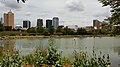 Birmingham |
1 | Huntsville | Limestone, Madison | 215,006 |  Montgomery  Mobile | ||||
| 2 | Birmingham | Jefferson, Shelby | 200,733 | ||||||
| 3 | Montgomery | Elmore, Montgomery | 200,603 | ||||||
| 4 | Mobile | Mobile | 187,041 | ||||||
| 5 | Tuscaloosa | Tuscaloosa | 99,600 | ||||||
| 6 | Hoover | Jefferson, Shelby | 92,606 | ||||||
| 7 | Auburn | Lee | 76,143 | ||||||
| 8 | Dothan | Dale, Henry, Houston | 71,072 | ||||||
| 9 | Decatur | Limestone, Morgan | 57,938 | ||||||
| 10 | Madison | Limestone, Madison | 56,933 | ||||||
| show Authority control |
|---|
- Cities in Alabama
- Populated places established in 1889
- Cities in DeKalb County, Alabama
- Micropolitan areas of Alabama
- County seats in Alabama
- U.S. Route 11