Greenwich Parish, New Brunswick
Greenwich | |
|---|---|
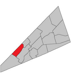 Location within Kings County, New Brunswick. | |
| Country | |
| Province | |
| County | Kings County |
| Erected | 1795 |
| Area | |
| • Land | 114.46 km2 (44.19 sq mi) |
| Population (2016)[1] | |
| • Total | 1,058 |
| • Density | 9.2/km2 (24/sq mi) |
| • Change 2011-2016 | |
| • Dwellings | 560 |
| Time zone | UTC-4 (AST) |
| • Summer (DST) | UTC-3 (ADT) |
Greenwich is a civil parish in Kings County, New Brunswick, Canada.[2]
The local service district is a member of the Fundy Regional Service Commission (FRSC).[3]
Origin of name[]
The origin of the parish's name is uncertain, Greenwich being a placename in several of the Thirteen Colonies. Historian William F. Ganong listed Greenwich, England as a possible source,[4] then later added Greenwich Village in New York and Greenwich Street in Hempstead, New York.[5]
Notable is that the names of Kings County's pre-1800 parishes all occur in both New Jersey and North Carolina.[6]
History[]
Greenwich was erected in 1795 from Kingston Parish.[7]
In 1860 the mainland east of the Saint John River was included in the newly erected parish of Kars.[8]
Boundaries[]
Greenwich Parish is bounded:[2][9][10][11]
- on the northwest by the Queens County line;
- on the northeast by the Saint John River;
- on the southeast by the Long Reach of the Saint John River;
- on the southwest by a line beginning at the mouth of Devils Back Brook where the southwestern line of the grant to George Young strikes, then northwesterly along the grant line and its prolongation to the county line at a point about 300 metres northeasterly of the northern end of Mud Lake;
- including Catons Island, Grassy Island, Isle of Pines, Rocky Island, and Rush Island in Long Reach.
Governance[]
The entire parish forms the local service district of the parish of Greenwich, established in 1976 to assess for fire protection and first aid and ambulance services. Recreational facilities were added to the assessment in 1995, with first aid and ambulance services removed at the same time.
Communities[]
Communities at least partly within the parish;[9][10][11] italics indicate a name no longer in official use
- Browns Corner
- Browns Flat
- Central Greenwich
- Cochrane Corner
- Days Corner
- Evandale
- Glenwood
- Grand View
- Greenwich Hill
- Johnson Croft
- Lynch Corner
- McPherson
- Oak Point
- Upper Greenwich
- Victoria Beach
Bodies of water[]
Bodies of water[a] at least partly in the parish:[9][10][11]
- Saint John River
- Jones Creek
- Marley Creek
- Nutter Creek
- more than fifteen officially named lakes
Islands[]
Islands at least partly in the parish.[9][10][11]
- Catons Island
- Grassy Island
- Isle of Pines
- Rocky Island
- Rush Island
Demographics[]
Population[]
|
Language[]Mother tongue (2016)[1]
|
Access Routes[]
Highways and numbered routes that run through the parish, including external routes that start or finish at the parish limits:[14]
See also[]
Notes[]
- ^ Not including brooks, ponds or coves.
References[]
- ^ a b c d "Census Profile, 2016 Census: Greenwich, Parish [Census subdivision], New Brunswick". Statistics Canada. Retrieved September 20, 2019.
- ^ a b "Chapter T-3 Territorial Division Act". Government of New Brunswick. Retrieved 13 November 2020.
- ^ "Communities in each of the 12 Regional Service Commissions (RSC) / Les communautés dans chacune des 12 Commissions de services régionaux (CSR)" (PDF), Government of New Brunswick, July 2017, retrieved 2 February 2021
- ^ Ganong, William F. (1896). A Monograph of the Place-Nomenclature of the Province of New Brunswick. Royal Society of Canada. p. 238. Retrieved 17 March 2021.
- ^ Ganong, William F. (1906). Additions and Corrections to Monographs on the Place-Nomenclature, Cartography, Historic Sites, Boundaries and Settlement-origins of the Province of New Brunswick. Royal Society of Canada. p. 26. Retrieved 12 April 2021.
- ^ "Domestic Names". U.S. Geological Survey. Retrieved 17 April 2021.
- ^ "35 Geo. III c. 3 An Act in addition to an Act intitled, 'An Act for the better Ascertaining and Confirming the Boundaries of the several Counties within this Province, and for subdividing them into Towns or Parishes.'". Acts of the General Assembly of His Majesty's Province of New-Brunswick, Passed in the Year 1795. Fredericton: Government of New Brunswick. 1795. pp. 338–340. Retrieved 27 March 2021.
- ^ "22 Vic. c. 51 An Act to erect parts of the Parishes of Greenwich and Springfield, in King's County, into a separate Town or Parish.". Acts of the General Assembly of Her Majesty's Province of New Brunswick, Passed in March and April 1859. Fredericton: Government of New Brunswick. 1859. pp. 129–130. Retrieved 27 March 2021.
- ^ a b c d "No. 148". Provincial Archives of New Brunswick. Department of Natural Resources and Energy Development. Retrieved 14 June 2021. Remainder of parish on maps 149, 156, and 157 at same site.
- ^ a b c d "430" (PDF). Transportation and Infrastructure. Government of New Brunswick. Retrieved 14 June 2021. Remainder of parish on mapbooks 445, 459, and 460 at same site.
- ^ a b c d "Search the Canadian Geographical Names Database (CGNDB)". Government of Canada. Retrieved 14 June 2021.
- ^ Statistics Canada: 2001, 2006 census
- ^ 2011 Statistics Canada Census Profile: Greenwich Parish, New Brunswick
- ^ Atlantic Canada Back Road Atlas ISBN 978-1-55368-618-7
Places adjacent to Greenwich Parish, New Brunswick | |
|---|---|
| Subdivisions |
|
|---|---|
| Cities | |
| Counties | |
| |

- Parishes of Kings County, New Brunswick
- Local service districts of Kings County, New Brunswick