Westfield Parish, New Brunswick
Westfield | |
|---|---|
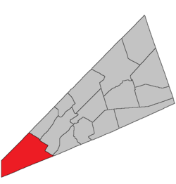 Location within Kings County, New Brunswick. | |
| Country | |
| Province | |
| County | Kings County |
| Erected | 1786 |
| Area | |
| • Land | 295.70 km2 (114.17 sq mi) |
| Population (2016)[1] | |
| • Total | 1,962 |
| • Density | 6.6/km2 (17/sq mi) |
| • Change 2011-2016 | |
| • Dwellings | 952 |
| Time zone | UTC-4 (AST) |
| • Summer (DST) | UTC-3 (ADT) |
Westfield is a civil parish in Kings County, New Brunswick, Canada.[2]
For governance purposes it is divided between the town of Grand Bay-Westfield and the local service district of the parish of Westfield,[3] both of which are members of the Fundy Regional Service Commission (FRSC).[4] Westfield includes the taxing authorities of Westfield East and Westfield West, which are sometimes erroneously described as LSDs in their own right.
Origin of name[]
The parish may have been named for the town of Westfield in Massachusetts.
Notable is that the names of Kings County's pre-1800 parishes all occur in both New Jersey and North Carolina.[5]
History[]
Westfield was erected in 1786 as one of the original parishes of the county.[6]
The 1795 reorganisation of the county[7] affected the boundary on the Kingston Peninsula.
In 1896 the boundary on the Long Reach side of the Kingston Peninsula was altered slightly.[8]
Boundaries[]
Westfield Parish is bounded:[2][9][10]
- on the northwest by the Queens County line;
- on the northeast by a line beginning on the Queens County line at a point about 300 metres northeasterly of the northern end of Mud Lake, then southeasterly along the prolongation of the line dividing two grants at the mouth of Devils Back Brook to the Saint John River, then across the river to the Kingston Peninsula, at a point about 1.2 kilometres north of Williams Lake, then southeasterly along the line between two grants to Robert and Caleb Merrit and its prolongation to the rear line of a tier of grants along the Kennebecasis River, then southwesterly along the rear line of the tier and its prolongation to a point about 375 metres east of Milkish Creek, then southeasterly along the southwestern line of a grant to Stephen Baxter and its prolongation to the Saint John County line;
- on the southeast by the Saint John county line in the Kennebecasis River;
- on the west by Charlotte County line;
- including Kennebecasis Island and nearby small islands.
Communities[]
Communities at least partly within the parish.[9][10][11] bold indicates an incorporated municipality
|
|
|
|
Bodies of water[]
Bodies of water[a] at least partly within the parish.[9][10][11]
|
|
Islands[]
Islands at least partly within the parish.[9][10][11]
- Kennebecasis Island
- Ram Island
Other notable places[]
Parks, historic sites, and other noteworthy places at least partly within the parish.[9][10][11]
Demographics[]
Parish population total does not include Grand Bay-Westfield
Population[]
|
Language[]Mother tongue (2016)[1]
|
Access Routes[]
Highways and numbered routes that run through the parish, including external routes that start or finish at the parish limits:[16]
|
|
See also[]
Notes[]
- ^ Not including brooks, ponds or coves.
References[]
- ^ a b c d "Census Profile, 2016 Census: Westfield, Parish [Census subdivision], New Brunswick". Statistics Canada. Retrieved September 18, 2019.
- ^ a b "Chapter T-3 Territorial Division Act". Government of New Brunswick. Retrieved 13 November 2020.
- ^ "New Brunswick Regulation 84-168 under the Municipalities Act (O.C. 84-582)". Government of New Brunswick. Retrieved 19 July 2020.
- ^ "Communities in each of the 12 Regional Service Commissions (RSC) / Les communautés dans chacune des 12 Commissions de services régionaux (CSR)" (PDF), Government of New Brunswick, July 2017, retrieved 2 February 2021
- ^ "Domestic Names". U.S. Geological Survey. Retrieved 17 April 2021.
- ^ "26 Geo. III Chapter I. An Act for the better ascertaining and confirming the Boundaries of the several Counties within this Province, and for subdividing them into Towns or Parishes.". Acts of the General Assembly of His Majesty's Province of New-Brunswick, passed in the year 1786. Saint John, New Brunswick: Government of New Brunswick. 1786. pp. 3–12. Retrieved 20 March 2021.
- ^ "35 Geo. III c. 3 An Act in addition to an Act intitled, 'An Act for the better Ascertaining and Confirming the Boundaries of the several Counties within this Province, and for subdividing them into Towns or Parishes.'". Acts of the General Assembly of His Majesty's Province of New-Brunswick, Passed in the Year 1795. Fredericton: Government of New Brunswick. 1795. pp. 338–340. Retrieved 27 March 2021.
- ^ "59 Vic. c. 8 An Act to Revise and Codify an Act to Provide for the Division of the Province into Counties, Towns and Parishes.". Acts of the General Assembly of Her Majesty's Province of New Brunswick. Passed in the Month of March, 1896. Fredericton: Government of New Brunswick. 1896. pp. 86–123. Available as a free ebook from Google Books.
- ^ a b c d e "No. 156". Provincial Archives of New Brunswick. Department of Natural Resources and Energy Development. Retrieved 14 June 2021. Remainder of parish on maps 157, 163, 164, and 165 at same site.
- ^ a b c d e "459" (PDF). Transportation and Infrastructure. Government of New Brunswick. Retrieved 14 June 2021. Remainder of parish on mapbooks 460, 471–473, and 482–484 at same site.
- ^ a b c d "Search the Canadian Geographical Names Database (CGNDB)". Government of Canada. Retrieved 7 July 2021.
- ^ "New Brunswick Regulation 94-43 under the Fish and Wildlife Act (O.C. 94-231)". Government of New Brunswick. 5 June 2006. Retrieved 8 July 2021.
- ^ "Explore New Brunswick's Protected Natural Areas". GeoNB. Retrieved 7 July 2021.
- ^ Statistics Canada: 2001, 2006 census
- ^ 2011 Statistics Canada Census Profile: Westfield Parish, New Brunswick
- ^ Atlantic Canada Back Road Atlas ISBN 978-1-55368-618-7
External links[]
Places adjacent to Westfield Parish, New Brunswick | ||||||||||||||||
|---|---|---|---|---|---|---|---|---|---|---|---|---|---|---|---|---|
| ||||||||||||||||
| Subdivisions |
|
|---|---|
| Cities | |
| Counties | |
| |
Coordinates: 45°20′03″N 66°17′56″W / 45.334289°N 66.298885°W

- Local service districts of Kings County, New Brunswick
- Parishes of Kings County, New Brunswick