Lepreau Parish, New Brunswick
Lepreau Parish
Paroisse de Lepreau | |
|---|---|
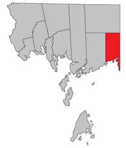 Location within Charlotte County. | |
| Country | |
| Province | |
| County | Charlotte |
| Erected | 1857 |
| Government | |
| • Type | Local service district |
| Area | |
| • Land | 209.62 km2 (80.93 sq mi) |
| Population (2016) | |
| • Total | 707 |
| • Density | 3.4/km2 (9/sq mi) |
| • Change 2011-2016 | |
| • Dwellings | 507 |
| Time zone | UTC-4 (AST) |
| • Summer (DST) | UTC-3 (ADT) |
Lepreau is a civil parish in Charlotte County, New Brunswick, Canada,[2] west of Saint John. It comprises a single local service district (LSD), which is a member of the Southwest New Brunswick Service Commission (SNBSC).[3]
The Point Lepreau Nuclear Generating Station is the parish's most notable feature and is located near its eastern border.
The Census subdivision of Lepreau Parish shares the parish's borders.
Origin of name[]
Historian William Francis Ganong states that the name of the parish comes from Point Lepreau, the name being a corruption of French Pte. aux Napraux.[4]
The parish's official spelling has varied:
- LePreau in 1857,[5]
- Lepreaux in 1868,[6] 1869,[7] 1903,[8] 1927,[9] and 1952[10]
- Le Preaux in 1877[11] and 1896[12]
- Lepreau since 1973[13]
History[]
Lepreau Parish was erected from eastern Pennfield Parish in 1857.[5] It originally included the eastern part of Clarendon Parish.
Boundaries[]
Lepreau is bounded:[2][14][15]
- on the north by a line running due west from the southernmost corner of Queens County;
- on the east by a line running true north from Point Lepreau;
- on the south by Maces Bay and the Bay of Fundy;
- on the west by true north from the mouth of the Pocologan River;
- including any islands within 2 miles (3.2 km) of the shore.
Evolution of boundaries[]
Lepreau's originally extended north to the county line.[5]
In 1868 all of the parish north of the southern point of Queens County was included in the Clarendon District, a polling district that also included the northern part of Pennfield Parish.[6]
In 1869 The Clarendon District was erected as Clarendon Parish[7] and Lepreau's modern boundaries were established.
Local service district[]
The local service district of the parish of Lepreau comprises the entire parish.[16]
The LSD was established in 1970 to assess for fire protection;[17] first aid & ambulance services were added in 1978.[18]
Today the LSD assesses for only the basic LSD services of fire protection, police services, land use planning, emergency measures, and dog control.[19]
Communities[]
Communities at least partly within the parish.[14][15][20] italics indicate a name no longer in official use.
Bodies of water[]
Bodies of water[a] at least partly within the parish.[14][15][20]
- Lepreau River
- North Branch Lepreau River
- West Branch Lepreau River
- Little Lepreau River
- Little New River
- New River
- Pocologan River
- Bay of Fundy
- Maces Bay
- Lepreau Harbour
- New River Harbour
- Pocologan Harbour
- Little Lepreau Basin
- Lake of the Hills
- Ragged Falls Flowage
- more than 25 other officially named lakes
Islands[]
Islands at least partly within the parish.[14][15][20] italics indicates a name no longer in official use
- Head Island
- New River Island (Mole Island)
- Pocologan Island
- Salkeld Islands (Fothergill Islands)
Other notable places[]
Parks, historic sites, and other noteworthy places at least partly within the parish.[14][15][20][21][22]
- Lepreau Falls Provincial Park
- Lepreau River Wildlife Management Area[23]
- McPhersons Point Protected Natural Area
- New River Beach Provincial Park
- New River Protected Natural Area
- Ragged Falls Protected Natural Area
- Salkeld Island Protected Natural Area
Census data[]
Population[]
| Canada census – Lepreau Parish, New Brunswick community profile | |||
|---|---|---|---|
| 2016 | 2011 | 2006 | |
| Population: | 708 (-6.0% from 2011) | 752 (-8.7% from 2006) | 824 (-4.7% from 2001) |
| Land area: | 209.62 km2 (80.93 sq mi) | 209.40 km2 (80.85 sq mi) | 209.40 km2 (80.85 sq mi) |
| Population density: | 3.4/km2 (8.8/sq mi) | 3.6/km2 (9.3/sq mi) | 3.9/km2 (10/sq mi) |
| Median age: | 53.0 (M: 51.3, F: 53.9) | 48.2 (M: 47.8, F: 48.5) | 46.8 (M: 46.1, F: 47.4) |
| Total private dwellings: | 507 | 510 | 490 |
| Median household income: | $57,216 | $42,747 | |
| References: 2016[24] 2011[25] 2006[26] earlier[27] | |||
|
|
| |||||||||||||||||||||||||||
| [28][1] | |||||||||||||||||||||||||||||
Language[]
| Canada Census Mother Tongue - Lepreau Parish, New Brunswick[28] | ||||||||||||||||||
|---|---|---|---|---|---|---|---|---|---|---|---|---|---|---|---|---|---|---|
| Census | Total | English
|
French
|
English & French
|
Other
| |||||||||||||
| Year | Responses | Count | Trend | Pop % | Count | Trend | Pop % | Count | Trend | Pop % | Count | Trend | Pop % | |||||
2011
|
750
|
720 | 96.00% | 20 | 2.67% | 0 | 0.00% | 10 | 1.33% | |||||||||
2006
|
820
|
790 | 96.34% | 20 | 2.44% | 0 | 0.00% | 10 | 1.22% | |||||||||
2001
|
870
|
835 | 95.98% | 25 | 2.87% | 0 | 0.00% | 10 | 1.15% | |||||||||
1996
|
875
|
855 | n/a | 97.71% | 10 | n/a | 1.14% | 0 | n/a | 0.00% | 10 | n/a | 1.14% | |||||
Access Routes[]
Highways and numbered routes that run through the parish, including external routes that start or finish at the parish limits:[29]
Notes[]
- ^ Not including brooks, ponds or coves.
References[]
- ^ a b "Census Profile, 2016 Census Lepreau, Parish [Census subdivision], New Brunswick". Statistics Canada. Retrieved 1 September 2019.
- ^ a b "Chapter T-3 Territorial Division Act". Government of New Brunswick. Retrieved 1 August 2020.
- ^ "Communities in each of the 12 Regional Service Commissions (RSC) / Les communautés dans chacune des 12 Commissions de services régionaux (CSR)" (PDF), Government of New Brunswick, July 2017, retrieved 1 February 2021
- ^ Ganong, William F. (1896–97). "A Monograph of the Place-Nomenclature of the Province of New Brunswick". Transactions of the Royal Society of Canada. II: 244–245. Retrieved 17 March 2021.
- ^ a b c "20 Vic. c. 9 An Act to erect the eastern part of the Parish of Pennfield, in the County of Charlotte, into a separate Town or Parish.". Acts of the General Assembly of Her Majesty's Province of New Brunswick, Passed in July 1856, and March and July 1857. Fredericton: Government of New Brunswick. 1857. pp. 15–16. Retrieved 27 March 2021.
- ^ a b "31 Vic. c. 51 An Act to establish an additional Polling place in the County of Charlotte.". Acts of the General Assembly of Her Majesty's Province of New Brunswick. Passed in the Month of March 1868. Fredericton: Government of New Brunswick. 1868. p. 84. Available as a free ebook from Google Books.
- ^ a b "32 Vic. c. 51 An Act to erect part of the Parishes of Lepreaux and Pennfield, in the County of Charlotte, into a separate Town or Parish.". Acts of the General Assembly of Her Majesty's Province of New Brunswick. Passed in the Month of April 1869. Fredericton: Government of New Brunswick. 1869. pp. 96–97. Available as a free ebook from Google Books.
- ^ "Chapter 2. Respecting the Division of the Province into Counties, Towns, and Parishes.". The Consolidated Statutes of New Brunswick, 1903. Vol. I. Fredericton: Government of New Brunswick. 1903. pp. 17–54.
- ^ "Chapter 2. Respecting the Division of the Province into Counties, Towns and Parishes.". The Revised Statutes of New Brunswick 1927 Volume I. Fredericton: Government of New Brunswick. 1927. pp. 18–64.
- ^ "Chapter 227 Territorial Division Act". The Revised Statutes of New Brunswick 1952 Volume III. Fredericton: Government of New Brunswick. 1952. pp. 3725–3771.
- ^ "Chapter 2 The Division of the Province into Counties, Towns, and Parishes.". The Consolidated Statutes of New Brunswick. Fredericton: Government of New Brunswick. 1877. pp. 56–85. Available as a free ebook from Google Books.
- ^ "59 Vic. c. 8 An Act to Revise and Codify an Act to Provide for the Division of the Province into Counties, Towns and Parishes.". Acts of the General Assembly of Her Majesty's Province of New Brunswick. Passed in the Month of March, 1896. Fredericton: Government of New Brunswick. 1896. pp. 86–123. Available as a free ebook from Google Books.
- ^ "Chapter T-3 Territorial Division Act". Revised Statutes of New Brunswick 1973 Volume IV. Fredericton: Government of New Brunswick. 1973. pp. 1–70.
- ^ a b c d e "No. 163". Provincial Archives of New Brunswick. Department of Natural Resources and Energy Development. Retrieved 3 July 2021.
- ^ a b c d e "471" (PDF). Transportation and Infrastructure. Government of New Brunswick. Retrieved 3 July 2021. Remainder of parish on mapbooks 482, 492, and 499 at same site.
- ^ "New Brunswick Regulation 84-168 under the Municipalities Act (O.C. 84-582)". Government of New Brunswick. Retrieved 6 February 2021.
- ^ "Regulation 70–63 under the Municipalities Act (O. C. 70–385)". The Royal Gazette. Fredericton. 128: 343–344. 17 June 1970.
- ^ "Regulation 78-138 under the Municipalities Act (O. C. 78-975)". The Royal Gazette. Fredericton. 136: 3329. 29 November 1978.
- ^ "2020 Local Government Statistics for New Brunswick" (PDF). Department of Environment and Local Government. p. 55. Retrieved 6 February 2021.
- ^ a b c d "Search the Canadian Geographical Names Database (CGNDB)". Government of Canada. Retrieved 4 July 2021.
- ^ "New Brunswick Regulation 2017-46 under the Parks Act (O.C. 2017-293)" (PDF). The Royal Gazette. Fredericton: Queen's Printer. 175: 1496–1497. 13 December 2017. ISSN 1714-9428. Retrieved 5 July 2021.
- ^ "Explore New Brunswick's Protected Natural Areas". GeoNB. Retrieved 4 July 2021.
- ^ "New Brunswick Regulation 94-43 under the Fish and Wildlife Act (O.C. 94-231)". Government of New Brunswick. 5 June 2006. Retrieved 8 July 2021.
- ^ "2016 Community Profiles". 2016 Canadian Census. Statistics Canada. 21 February 2017. Retrieved 1 September 2019.
- ^ "2011 Community Profiles". 2011 Canadian Census. Statistics Canada. 5 July 2013. Retrieved 15 March 2014.
- ^ "2006 Community Profiles". 2006 Canadian Census. Statistics Canada. 30 March 2011. Retrieved 15 March 2014.
- ^ "2001 Community Profiles". 2001 Canadian Census. Statistics Canada. 17 February 2012.
- ^ a b Statistics Canada: 1996, 2001, 2006, 2011 census
- ^ Atlantic Canada Back Road Atlas ISBN 978-1-55368-618-7 Pages 4, 12
External links[]
Places adjacent to Lepreau Parish, New Brunswick | |
|---|---|
| Subdivisions |
|
|---|---|
| Cities | |
| Counties | |
| |
Coordinates: 45°13′52″N 66°34′36″W / 45.23114°N 66.576805°W

- Parishes of Charlotte County, New Brunswick