Heřmanova Huť
Heřmanova Huť | |
|---|---|
 Municipal office | |
 Flag  Coat of arms | |
 Heřmanova Huť Location in the Czech Republic | |
| Coordinates: 49°42′43″N 13°5′15″E / 49.71194°N 13.08750°ECoordinates: 49°42′43″N 13°5′15″E / 49.71194°N 13.08750°E | |
| Country | |
| Region | Plzeň |
| District | Plzeň-North |
| Established | 1954 |
| Government | |
| • Mayor | Radek Lukáč |
| Area | |
| • Total | 9.88 km2 (3.81 sq mi) |
| Elevation | 380 m (1,250 ft) |
| Population (2021-01-01)[1] | |
| • Total | 1,813 |
| • Density | 180/km2 (480/sq mi) |
| Time zone | UTC+1 (CET) |
| • Summer (DST) | UTC+2 (CEST) |
| Postal code | 330 24 |
| Website | www |

Heřmanova Huť (German: Hermannshütte) is a municipality in Plzeň-North District in the Plzeň Region of the Czech Republic. It has about 1,800 inhabitants.
Administrative parts[]
The municipality is made up of villages of Dolní Sekyřany, Horní Sekyřany, Vlkýš and Vlkýš I.
History[]
The first written mention of Sekyřany is from 1115. The village was later split to Dolní ("Lower") Sekyřany and Horní ("Upper") Sekyřany. Both villages were bought by Chotěšov Abbey in 1253. The first written mention of Vlkýš is from 1457.[2]
The municipality of Heřmanova Huť was founded in 1954 through the merger of three municipalities: Vlkýš, Dolní Sekyřany and Horní Sekyřany.[2]
Demography[]
|
| |||||||||||||||||||||||||||||||||||||||||||||||||||
| Source: Historical lexicon of municipalities of the Czech Republic[3] | ||||||||||||||||||||||||||||||||||||||||||||||||||||
Gallery[]

Train station

Revoluční street

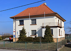
Elementary school


References[]
- ^ "Population of Municipalities – 1 January 2021". Czech Statistical Office. 2021-04-30.
- ^ Jump up to: a b "Historie obce Heřmanova Huť" (in Czech). Obec Heřmanova Huť. Retrieved 2021-06-09.
- ^ "Historický lexikon obcí České republiky 1869–2011 – Okres Plzeň-sever" (in Czech). Czech Statistical Office. 2015-12-21. pp. 3–4.
| Authority control: National libraries |
|---|
This Plzeň Region location article is a stub. You can help Wikipedia by . |
- Villages in Plzeň-North District
- Plzeň Region geography stubs