Hněvnice
Hněvnice | |
|---|---|
Municipality | |
 | |
 Hněvnice | |
| Coordinates: 49°43′52″N 13°6′1″E / 49.73111°N 13.10028°ECoordinates: 49°43′52″N 13°6′1″E / 49.73111°N 13.10028°E | |
| Country | |
| Region | Plzeň |
| District | Plzeň-North |
| Area | |
| • Total | 7.1 km2 (2.7 sq mi) |
| Elevation | 422 m (1,385 ft) |
| Population (2006) | |
| • Total | 108 |
| • Density | 15/km2 (39/sq mi) |
| Postal code | 330 23 to 330 24 |

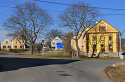
Hněvnice is a village and municipality (obec) in Plzeň-North District in the Plzeň Region of the Czech Republic.
The municipality covers an area of 7.1 square kilometres (2.7 sq mi), and has a population of 108 (as at 3 July 2006).
Hněvnice lies approximately 20 kilometres (12 mi) west of Plzeň and 103 km (64 mi) south-west of Prague.
References[]
| Wikimedia Commons has media related to Hněvnice. |
| Authority control: National libraries |
|---|
This Plzeň Region location article is a stub. You can help Wikipedia by . |
Categories:
- Villages in Plzeň-North District
- Plzeň Region geography stubs