Hlavňovice
Hlavňovice | |
|---|---|
Municipality | |
 Center of the village | |
 Hlavňovice | |
| Coordinates: 49°13′58″N 13°23′46″E / 49.23278°N 13.39611°ECoordinates: 49°13′58″N 13°23′46″E / 49.23278°N 13.39611°E | |
| Country | |
| Region | Plzeň |
| District | Klatovy |
| Area | |
| • Total | 24.1 km2 (9.3 sq mi) |
| Elevation | 687 m (2,254 ft) |
| Population (2006) | |
| • Total | 504 |
| • Density | 21/km2 (54/sq mi) |
| Postal code | 341 42 to 342 01 |
| Website | http://www.hlavnovice.cz/ |

Hlavňovice is a village and municipality (obec) in Klatovy District in the Plzeň Region of the Czech Republic.
The municipality covers an area of 24.1 square kilometres (9.3 sq mi), and has a population of 504 (as at 28 August 2006).
Hlavňovice lies approximately 20 kilometres (12 mi) south-east of Klatovy, 58 km (36 mi) south of Plzeň, and 121 km (75 mi) south-west of Prague.
Gallery[]
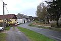
Road

Local store

House in Hlavňovice


References[]
| Wikimedia Commons has media related to Hlavňovice. |
| Authority control: National libraries |
|---|
This Plzeň Region location article is a stub. You can help Wikipedia by . |
Categories:
- Villages in Klatovy District
- Plzeň Region geography stubs