Hrádek (Klatovy District)
Hrádek
Hrádek u Sušice | |
|---|---|
 South-eastern view on Hrádek | |
 Flag  Coat of arms | |
 Hrádek Location in the Czech Republic | |
| Coordinates: 49°15′49″N 13°29′43″E / 49.26361°N 13.49528°ECoordinates: 49°15′49″N 13°29′43″E / 49.26361°N 13.49528°E | |
| Country | |
| Region | Plzeň |
| District | Klatovy |
| First mentioned | 1298 |
| Area | |
| • Total | 36.90 km2 (14.25 sq mi) |
| Elevation | 485 m (1,591 ft) |
| Population (2021-01-01)[1] | |
| • Total | 1,382 |
| • Density | 37/km2 (97/sq mi) |
| Time zone | UTC+1 (CET) |
| • Summer (DST) | UTC+2 (CEST) |
| Postal codes | 342 01 |
| Website | www |

Hrádek is a municipality and village in Klatovy District in the Plzeň Region of the Czech Republic. It has about 1,400 inhabitants.
Hrádek lies approximately 22 kilometres (14 mi) south-east of Klatovy, 55 km (34 mi) south of Plzeň, and 114 km (71 mi) south-west of Prague.
Administrative parts[]
Villages of Čejkovy, Čermná, Kašovice, Odolenov, Tedražice and Zbynice are administrative parts of Hrádek.
Gallery[]
Hrádek Castle

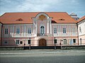
An area in front of the castle

Church of Saint Lawrence


References[]
| Wikimedia Commons has media related to Hrádek (Klatovy District). |
| show Authority control |
|---|
This Plzeň Region location article is a stub. You can help Wikipedia by . |
Categories:
- Villages in Klatovy District
- Prácheňsko
- Plzeň Region geography stubs