Mlýnské Struhadlo
Mlýnské Struhadlo | |
|---|---|
Municipality | |
 | |
 Mlýnské Struhadlo | |
| Coordinates: 49°26′2″N 13°28′18″E / 49.43389°N 13.47167°ECoordinates: 49°26′2″N 13°28′18″E / 49.43389°N 13.47167°E | |
| Country | |
| Region | Plzeň |
| District | Klatovy |
| Area | |
| • Total | 4.03 km2 (1.56 sq mi) |
| Population (1.1.2015) | |
| • Total | 46 |
| • Density | 11/km2 (30/sq mi) |
| Postal code | 339 01 |

Mlýnské Struhadlo is a village and municipality (obec) in Klatovy District in the Plzeň Region of the Czech Republic.
The municipality covers an area of 4.03 square kilometres (1.56 sq mi), and has a population of 50 (as at 3 July 2006).
Mlýnské Struhadlo lies approximately 15 kilometres (9 mi) east of Klatovy, 36 km (22 mi) south of Plzeň, and 100 km (62 mi) south-west of Prague.
Gallery[]

House

Village chapel in detail
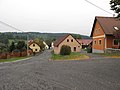
Streets


References[]
| Wikimedia Commons has media related to Mlýnské Struhadlo. |
| Authority control: National libraries |
|---|
This Plzeň Region location article is a stub. You can help Wikipedia by . |
Categories:
- Villages in Klatovy District
- Plzeň Region geography stubs