Hrunamannahreppur
This article needs additional citations for verification. (October 2020) |
Hrunamannahreppur | |
|---|---|
 Coat of arms | |
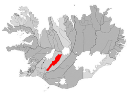 Location of the municipality | |
 Hrunamannahreppur Location of the municipality | |
| Coordinates: 64°07′30″N 20°21′29″W / 64.125°N 20.358°WCoordinates: 64°07′30″N 20°21′29″W / 64.125°N 20.358°W | |
| Country | Iceland |
| Region | Southern Region |
| Constituency | South Constituency |
| Government | |
| • Manager | Jón G. Valgeirsson |
| Area | |
| • Total | 1,375 km2 (531 sq mi) |
| Population | |
| • Total | 785 |
| • Density | 0.57/km2 (1.5/sq mi) |
| Postal code(s) | 845 |
| Municipal number | 8710 |
| Website | fludir |

Hrunamannahreppur (Icelandic pronunciation: [ˈr̥ʏːnaˌmanːaˌr̥ɛhpʏr̥]) is a municipality located in Iceland. Its major settlement is Flúðir.
Part of this district is in the Highlands and includes the Kerlingarfjöll mountain range.[1]
The biting midges (Ceratopogonidae) has been found in this district and is expected to spread throughout Iceland.[2]
References[]
- ^ "Farmers find lost sheep in middle of highlands". Iceland Monitor. Retrieved 2019-02-15.
- ^ "Biting Settlers Seen in Reykjavík". Iceland Monitor. Retrieved 2019-02-15.
| Authority control |
|
|---|
This Iceland location article is a stub. You can help Wikipedia by . |
Categories:
- Municipalities of Iceland
- Iceland geography stubs