Hubynykha
Hubynykha
Губиниха | |
|---|---|
Urban-type settlement | |
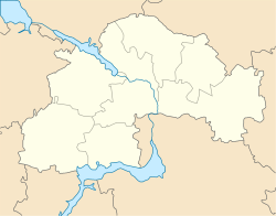 Hubynykha Location in Dnipropetrovsk Oblast | |
| Coordinates: 48°48′19″N 35°15′29″E / 48.80528°N 35.25806°ECoordinates: 48°48′19″N 35°15′29″E / 48.80528°N 35.25806°E | |
| Country | Ukraine |
| Oblast | Dnipropetrovsk Oblast |
| Raion | Novomoskovsk Raion |
| Population (2021)[1] | |
| • Total | 5,389 |
| Time zone | UTC+2 (EET) |
| • Summer (DST) | UTC+3 (EEST) |


Hubynykha (Ukrainian: Губиниха; Russian: Губиниха) is an urban-type settlement in Novomoskovsk Raion of Dnipropetrovsk Oblast in Ukraine. It is located on the , a left tributary of the , in the basin of the Dnieper. Hubynykha hosts the administration of , one of the hromadas of Ukraine.[2] Population: 5,389 (2021 est.)[1]
Climate[]
| Climate data for Hubynykha (1981–2010) | |||||||||||||
|---|---|---|---|---|---|---|---|---|---|---|---|---|---|
| Month | Jan | Feb | Mar | Apr | May | Jun | Jul | Aug | Sep | Oct | Nov | Dec | Year |
| Average high °C (°F) | −1.4 (29.5) |
−0.8 (30.6) |
5.4 (41.7) |
15.0 (59.0) |
21.7 (71.1) |
25.1 (77.2) |
27.4 (81.3) |
27.0 (80.6) |
20.9 (69.6) |
13.3 (55.9) |
4.7 (40.5) |
−0.2 (31.6) |
13.2 (55.8) |
| Daily mean °C (°F) | −4.0 (24.8) |
−3.9 (25.0) |
1.4 (34.5) |
9.5 (49.1) |
15.9 (60.6) |
19.4 (66.9) |
21.5 (70.7) |
20.7 (69.3) |
15.1 (59.2) |
8.5 (47.3) |
1.6 (34.9) |
−2.7 (27.1) |
8.6 (47.5) |
| Average low °C (°F) | −6.7 (19.9) |
−6.9 (19.6) |
−1.9 (28.6) |
4.6 (40.3) |
10.0 (50.0) |
13.9 (57.0) |
16.1 (61.0) |
14.5 (58.1) |
9.9 (49.8) |
4.4 (39.9) |
−1.0 (30.2) |
−5.4 (22.3) |
4.3 (39.7) |
| Average precipitation mm (inches) | 43.0 (1.69) |
36.9 (1.45) |
40.3 (1.59) |
39.4 (1.55) |
47.5 (1.87) |
73.7 (2.90) |
52.9 (2.08) |
46.6 (1.83) |
47.2 (1.86) |
42.1 (1.66) |
45.4 (1.79) |
42.0 (1.65) |
557.0 (21.93) |
| Average precipitation days (≥ 1.0 mm) | 9.1 | 7.4 | 7.9 | 6.9 | 7.0 | 8.3 | 7.1 | 5.2 | 6.1 | 5.9 | 7.6 | 8.3 | 86.8 |
| Average relative humidity (%) | 86.7 | 83.8 | 78.3 | 65.6 | 61.7 | 67.5 | 66.7 | 63.3 | 68.6 | 76.5 | 86.3 | 87.3 | 74.4 |
| Source: World Meteorological Organization[3] | |||||||||||||
Economy[]
Transportation[]
is on the railway connecting Dnipro and Krasnohrad with further connections to Kharkiv and Sloviansk. There is regular passenger traffic.
The settlement has access to Highway M18 connecting Kharkiv with Zaporizhia and Melitopol and to Highway M29 which connects Dnipro and Kharkiv.
References[]
- ^ a b "Чисельність наявного населення України (Actual population of Ukraine)" (PDF) (in Ukrainian). State Statistics Service of Ukraine. Retrieved 11 July 2021.
- ^ "Губинская громада" (in Russian). Портал об'єднаних громад України.
- ^ "World Meteorological Organization Climate Normals for 1981–2010". World Meteorological Organization. Archived from the original on 17 July 2021. Retrieved 18 July 2021.
Categories:
- Urban-type settlements in Dnipropetrovsk Oblast