Petropavlivka, Dnipropetrovsk Oblast
Petropavlivka
Петропавлiвка | |
|---|---|
Urban-type settlement | |
 Petropavlivka | |
| Coordinates: 48°27′15″N 36°26′25″E / 48.45417°N 36.44028°ECoordinates: 48°27′15″N 36°26′25″E / 48.45417°N 36.44028°E | |
| Country | Ukraine |
| Oblast | Dnipropetrovsk Oblast |
| Raion | Synelnykove Raion |
| Population (2021)[1] | |
| • Total | 6,769 |
| Time zone | UTC+2 (EET) |
| • Summer (DST) | UTC+3 (EEST) |

Petropavlivka (Ukrainian: Петропавлiвка; Russian: Петропавловка) is an urban-type settlement in Synelnykove Raion, Dnipropetrovsk Oblast in Ukraine. It hosts the administration of , one of the hromadas of Ukraine.[2] Population: 6,769 (2021 est.)[1]
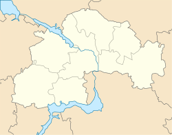
Petropavlivka is located on the left bank of the Samara River, a left tributary of the Dnieper.
Until 18 July 2020, Petropavlivka was the administrative center of Petropavlivka Raion. The raion was abolished in July 2020 as part of the administrative reform of Ukraine, which reduced the number of raions of Dnipropetrovsk Oblast to seven. The area of Petropavlivka Raion was merged into Synelnykove Raion.[3][4]
Economy[]
Transportation[]
Petropavlivka is just north of the Highway M04, connecting Pokrovsk with Dnipro and Kryvyi Rih. A road to Kramatorsk branches off north.
is located southeast of the settlement, in the village of Zaliznychne, on the railway connecting Pokrovsk and Pavlohrad.
References[]
- ^ a b "Чисельність наявного населення України (Actual population of Ukraine)" (PDF) (in Ukrainian). State Statistics Service of Ukraine. Retrieved 11 July 2021.
- ^ "Петропавловская громада" (in Russian). Портал об'єднаних громад України.
- ^ "Про утворення та ліквідацію районів. Постанова Верховної Ради України № 807-ІХ". Голос України (in Ukrainian). 2020-07-18. Retrieved 2020-10-03.
- ^ "Нові райони: карти + склад" (in Ukrainian). Міністерство розвитку громад та територій України.
- Urban-type settlements in Dnipropetrovsk Oblast