Slavhorod
Slavhorod
Славгород | |
|---|---|
Urban-type settlement | |
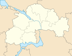 Slavhorod Location in Dnipropetrovsk Oblast | |
| Coordinates: 48°06′07″N 35°31′00″E / 48.10194°N 35.51667°ECoordinates: 48°06′07″N 35°31′00″E / 48.10194°N 35.51667°E | |
| Country | Ukraine |
| Oblast | Dnipropetrovsk Oblast |
| Raion | Synelnykove Raion |
| Population (2021)[1] | |
| • Total | 2,130 |
| Time zone | UTC+2 (EET) |
| • Summer (DST) | UTC+3 (EEST) |


Slavhorod (Ukrainian: Славгород; Russian: Славгород) is an urban-type settlement in Synelnykove Raion of Dnipropetrovsk Oblast in Ukraine. It is located on the , south of the town of Synelnykove. Slavhorod hosts the administration of , one of the hromadas of Ukraine.[2] Population: 2,130 (2021 est.)[1]
Economy[]
Transportation[]
The settlement has access to Highway M18 connecting Kharkiv with Zaporizhzhia and Melitopol.
railway station, in the northern part of the settlement, is on the railway connecting Synelnykove with Zaporizhzhia via Vilniansk. There is infrequent passenger traffic.
References[]
- ^ a b "Чисельність наявного населення України (Actual population of Ukraine)" (PDF) (in Ukrainian). State Statistics Service of Ukraine. Retrieved 11 July 2021.
- ^ "Славгородская громада" (in Russian). Портал об'єднаних громад України.
| Raions | ||
|---|---|---|
| Hromadas |
| |
| Cities | ||
| Urban-type settlements |
| |
Categories:
- Urban-type settlements in Dnipropetrovsk Oblast