Bozhedarivka
Bozhedarivka
Божедарівка | |
|---|---|
Urban-type settlement | |
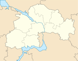 Bozhedarivka Location in Dnipropetrovsk Oblast | |
| Coordinates: 48°21′13″N 34°06′47″E / 48.35361°N 34.11306°ECoordinates: 48°21′13″N 34°06′47″E / 48.35361°N 34.11306°E | |
| Country | Ukraine |
| Oblast | Dnipropetrovsk Oblast |
| Raion | Kamianske Raion |
| Population (2021)[1] | |
| • Total | 2,688 |
| Time zone | UTC+2 (EET) |
| • Summer (DST) | UTC+3 (EEST) |


Bozhedarivka (Ukrainian: Божедарівка; Russian: Божедаровка) is an urban-type settlement in Kamianske Raion of Dnipropetrovsk Oblast in Ukraine. It is located approximately 50 kilometres (31 mi) west of Dnipro. From 1939 until February 2016 it was known as Shchorsk, in honor of Red Army commander Nikolay Shchors, but was renamed to comply with the Ukraine's law prohibiting names of Communist origin.[2] Bozhedarivka hosts the administration of , one of the hromadas of Ukraine.[3] Population: 2,688 (2021 est.)[1]
Until 18 July 2020, Bozhedarivka belonged to Krynychky Raion. The raion was abolished in July 2020 as part of the administrative reform of Ukraine, which reduced the number of raions of Dnipropetrovsk Oblast to seven. The area of Krynychky Raion was merged into Kamianske Raion.[4][5]
Economy[]
Transportation[]
Bozhedarivka railway station is on the railroad connecting Verkhivtseve with Kryvyi Rih. There is regular passenger traffic.
The settlement is on Highway M04 which connects Dnipro and Znamianka with further access to Kropyvnytskyi.
References[]
- ^ a b "Чисельність наявного населення України (Actual population of Ukraine)" (PDF) (in Ukrainian). State Statistics Service of Ukraine. Retrieved 11 July 2021.
- ^ "На Днепропетровщине изменили название 2 населенных пункта". 34.ua (in Russian). 5 February 2016.
- ^ "Божедаровская громада" (in Russian). Портал об'єднаних громад України.
- ^ "Про утворення та ліквідацію районів. Постанова Верховної Ради України № 807-ІХ". Голос України (in Ukrainian). 2020-07-18. Retrieved 2020-10-03.
- ^ "Нові райони: карти + склад" (in Ukrainian). Міністерство розвитку громад та територій України.
- Urban-type settlements in Dnipropetrovsk Oblast