Mahdalynivka
Mahdalynivka
Магдалинiвка | |
|---|---|
Urban-type settlement | |
 Coat of arms | |
 Mahdalynivka | |
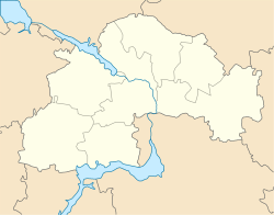
| Coordinates: 48°54′57″N 34°55′06″E / 48.91583°N 34.91833°ECoordinates: 48°54′57″N 34°55′06″E / 48.91583°N 34.91833°E | |
| Country | Ukraine |
| Oblast | Dnipropetrovsk Oblast |
| Raion | Novomoskovsk Raion |
| Population (2021)[1] | |
| • Total | 6,180 |
| Time zone | UTC+2 (EET) |
| • Summer (DST) | UTC+3 (EEST) |

Mahdalynivka (Ukrainian: Магдалинiвка; Russian: Магдалиновка) is an urban-type settlement in Novomoskovsk Raion, Dnipropetrovsk Oblast in Ukraine. It hosts the administration of , one of the hromadas of Ukraine.[2] Population: 6,180 (2021 est.)[1]
Description[]
Mahdalynivka is located on the , a left tributary of the Dnieper. Relief around the settlement is plain with unnoticed change in elevations since it is located in .
Mahdalynivka is first mentioned under its current name in 1783 in connection with delimitation of lands of the former Zaporizhian Sich (Zaporizhia Free Lands).[3] According to "History of cities and villages of the Ukrainian SSR", the start of the settlement was given by 4 families who arrived from Poltava region (at that time Poltava Governorate).[3] Mahdalynivka appeared on territory that during times of Zaporizhian Sich belonged to Provtocha Palanka, a territorial subdivision of Zaporizhian Sich.[3] Researcher of regional studies L.M.Bezuhlyi in his book "Krai Mahdalynivskyi" (Land of Mahdalynivka) and authors of an essay "Mahdalynivshchyna" as the year of establishment of the village consider 1778.[3] Such conclusion was made by them based on information that was provided by notable genealogist Vadym Modzalevskyi (a co-author of Armorial of Little Russia) and a data from "Mezhevaya kniga Azovskoi Gubernii" (Azov Governorate surveying book).[3]
Until the raion was abolished on 18 July 2020,[4][5] Mahdalynivka was the administrative center of Mahdalynivka Raion. After that date, it was transferred to Novomoskovsk Raion.
Economy[]
Transportation[]
Mahdalynivka is connected by roads with Dnipro and Petrykivka (with further access over the bridge to Kamianske). There are local roads as well. Distance between Mahdalynivka and Dnipro is 62.6 kilometres (38.9 mi). [6]
The closest railway station is in Hubynykha, about 20 kilometres (12 mi) east of Mahdalynivka, on the railway line connecting Dnipro and Kharkiv.
Industry[]
- Mahdalynivka butter plant;
- Brick factory;
- Bakery plant;
- Municipal company;
- Private agricultural companies.
References[]
- ^ a b "Чисельність наявного населення України (Actual population of Ukraine)" (PDF) (in Ukrainian). State Statistics Service of Ukraine. Retrieved 11 July 2021.
- ^ "Магдалиновская громада" (in Russian). Портал об'єднаних громад України.
- ^ a b c d e Ihor Kocherhin. Mahdalynivka: establishment and beginning of development (Магдалинівка: заснування і початки розвитку). "DniproKultura" Portal by Dnipropetrovsk Oblast versatile scientific library. 14 January 2019
- ^ "Про утворення та ліквідацію районів. Постанова Верховної Ради України № 807-ІХ". Голос України (in Ukrainian). 2020-07-18. Retrieved 2020-10-03.
- ^ "Нові райони: карти + склад" (in Ukrainian). Міністерство розвитку громад та територій України.
- ^ Suburban 10137 Dnipro - Mahdalynivka
External links[]
- Kulakov, D.T., Kulykovskyi, B.H. Mahdalynivka, Mahdalynivka Raion, Dnipropetrovsk Oblast (Магдалинівка, Магдалинівський район, Дніпропетровська область). History of cities and villages of the Ukrainian SSR
| Authority control: National libraries |
|---|
- Urban-type settlements in Dnipropetrovsk Oblast
- Mahdalynivka Raion