Jianping County
Jianping
建平县 | |
|---|---|
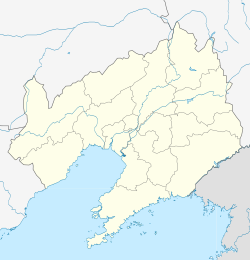
 Location in Chaoyang City | |
 Jianping Location of the county seat in Liaoning | |
| Coordinates: 41°24′N 119°39′E / 41.400°N 119.650°ECoordinates: 41°24′N 119°39′E / 41.400°N 119.650°E | |
| Country | People's Republic of China |
| Province | Liaoning |
| Prefecture-level city | Chaoyang |
| Area | |
| • Total | 4,838 km2 (1,868 sq mi) |
| Elevation | 411 m (1,348 ft) |
| Population | |
| • Total | 580,000 |
| • Density | 120/km2 (310/sq mi) |
| Time zone | UTC+8 (China Standard) |

Jianping (Chinese: 建平; pinyin: Jiànpíng; lit. 'build peace') is a county in the west of Liaoning province, China, bordering Inner Mongolia to the north, west, and northeast. It is under the administration of Chaoyang City, the urban centre of which is more than 65 km (40 mi) to the east. The population
Administrative divisions[]
There are 11 towns, 20 townships, and one ethnic township in the county.[1]
Towns:
- (叶柏寿镇)
- (朱力科镇)
- (建平镇)
- (黑水镇)
- Kalaqin (喀喇沁镇)
- (沙海镇)
- (万寿镇)
- (哈拉道口镇)
- (热水镇)
- (老官地镇)
- (北二十家子回族镇)
Townships:
|
|
|
Climate[]
Jianping has a monsoon-influenced humid continental climate (Köppen Dwa) that barely avoids semi-arid designation (Köppen BSk), with hot and humid summers and rather long, cold, and very dry winters. More than two-thirds of the annual rainfall occurs from June thru August. Monthly 24-hour average temperatures range from −10.0 °C (14.0 °F) in January to 24.1 °C (75.4 °F) in July, for an annual average of 8.37 °C (47.1 °F). The frost-free period lasts 120 to 155 days.
| Climate data for Jianping (1971−2000) | |||||||||||||
|---|---|---|---|---|---|---|---|---|---|---|---|---|---|
| Month | Jan | Feb | Mar | Apr | May | Jun | Jul | Aug | Sep | Oct | Nov | Dec | Year |
| Record high °C (°F) | 10.2 (50.4) |
20.0 (68.0) |
24.3 (75.7) |
33.2 (91.8) |
38.0 (100.4) |
38.2 (100.8) |
42.3 (108.1) |
35.8 (96.4) |
34.2 (93.6) |
28.8 (83.8) |
21.6 (70.9) |
17.5 (63.5) |
42.3 (108.1) |
| Average high °C (°F) | −2.7 (27.1) |
1.1 (34.0) |
8.0 (46.4) |
17.6 (63.7) |
24.1 (75.4) |
28.0 (82.4) |
29.4 (84.9) |
28.2 (82.8) |
23.7 (74.7) |
16.6 (61.9) |
6.8 (44.2) |
−0.1 (31.8) |
15.1 (59.1) |
| Daily mean °C (°F) | −10.0 (14.0) |
−6.3 (20.7) |
1.2 (34.2) |
10.8 (51.4) |
17.5 (63.5) |
22.0 (71.6) |
24.1 (75.4) |
22.5 (72.5) |
16.8 (62.2) |
9.2 (48.6) |
−0.2 (31.6) |
−7.2 (19.0) |
8.4 (47.1) |
| Average low °C (°F) | −15.8 (3.6) |
−12.3 (9.9) |
−5.2 (22.6) |
3.9 (39.0) |
10.8 (51.4) |
16.0 (60.8) |
19.1 (66.4) |
17.2 (63.0) |
10.6 (51.1) |
3.1 (37.6) |
−5.6 (21.9) |
−12.6 (9.3) |
2.4 (36.4) |
| Record low °C (°F) | −27.9 (−18.2) |
−24.6 (−12.3) |
−23.7 (−10.7) |
−10 (14) |
−0.4 (31.3) |
6.1 (43.0) |
12.5 (54.5) |
7.3 (45.1) |
−1.7 (28.9) |
−9.8 (14.4) |
−20 (−4) |
−25.7 (−14.3) |
−27.9 (−18.2) |
| Average precipitation mm (inches) | 1.7 (0.07) |
1.9 (0.07) |
6.8 (0.27) |
17.9 (0.70) |
44.3 (1.74) |
88.0 (3.46) |
130.0 (5.12) |
94.9 (3.74) |
40.8 (1.61) |
18.9 (0.74) |
7.4 (0.29) |
2.9 (0.11) |
455.5 (17.92) |
| Average precipitation days (≥ 0.1 mm) | 1.6 | 1.6 | 2.9 | 4.8 | 7.6 | 11.4 | 12.7 | 11.0 | 7.3 | 4.4 | 2.7 | 1.3 | 69.3 |
| Source: Weather China | |||||||||||||
References[]
- ^ 2011年统计用区划代码和城乡划分代码:建平县 (in Chinese). National Bureau of Statistics of the People's Republic of China. Retrieved 2012-07-15.[permanent dead link]
External links[]
This Liaoning location article is a stub. You can help Wikipedia by . |
- County-level divisions of Liaoning
- Chaoyang, Liaoning
- Liaoning geography stubs