Sujiatun District
Sujiatun
苏家屯区 | ||||
|---|---|---|---|---|
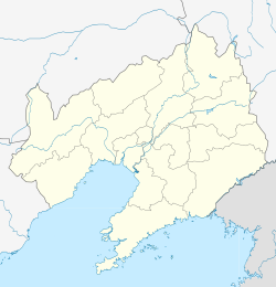
 Sujiatun Location in Liaoning | ||||
| Coordinates: 41°40′13″N 123°20′47″E / 41.6703°N 123.3463°ECoordinates: 41°40′13″N 123°20′47″E / 41.6703°N 123.3463°E[2] | ||||
| Country | People's Republic of China | |||
| Province | Liaoning | |||
| Sub-provincial city | Shenyang | |||
| Area | ||||
| • Total | 782 km2 (302 sq mi) | |||
| Population (2010) | ||||
| • Total | 474,779 | |||
| • Density | 610/km2 (1,600/sq mi) | |||
| Time zone | UTC+8 (China Standard) | |||
| Shenyang district map |
| |||
Sujiatun District (simplified Chinese: 苏家屯区; traditional Chinese: 蘇家屯區; pinyin: Sūjiātún Qū) is one of ten districts of the prefecture-level city of Shenyang, the capital of Liaoning Province, Northeast China, and forms part of the southern suburbs. The current population of Sujiatun is 430,000 and is located 15 km away from central Shenyang. Sujiatun is known mostly for its agricultural and industrial activity. It borders the districts of Yuhong and Heping to the north, Dongling to the northeast, Tiexi to the northwest; it also borders the prefecture-level cities of Fushun to the east, Benxi to the southeast, and Liaoyang to the southwest.
Administrative divisions[]
There are seven subdistricts, seven towns, and five townships within the district.[3]
Subdistricts:
- (解放街道), (铁友街道), (民主街道), (临湖街道), (中兴街道), (湖西街道), (城郊街道)
Towns:
- (陈相屯镇), (十里河镇), (红菱堡镇), (林盛堡镇), (八一镇), (姚千户屯镇), (沙河堡镇)
Townships:
- (王纲堡乡), (永乐乡), (白清寨乡), (佟沟乡), (大沟乡)
References[]
- ^ 分地区土地面积和人口密度 (2012年末) (in Chinese). Shenyang Statistics Bureau. Retrieved 6 July 2014.
- ^ Google (2014-07-02). "Jiefang Sub-district Office" (Map). Google Maps. Google. Retrieved 2014-07-02.
- ^ 沈阳市-行政区划网
External links[]
- Shenyang
- County-level divisions of Liaoning
- Liaoning geography stubs
